Embed Size (px)
Citation preview

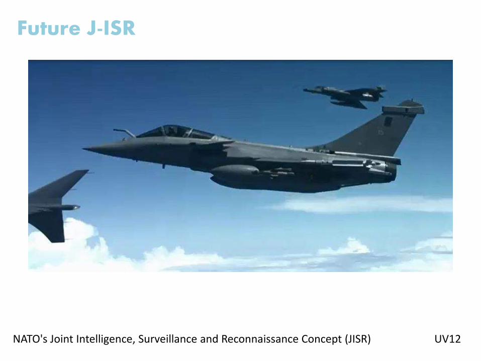
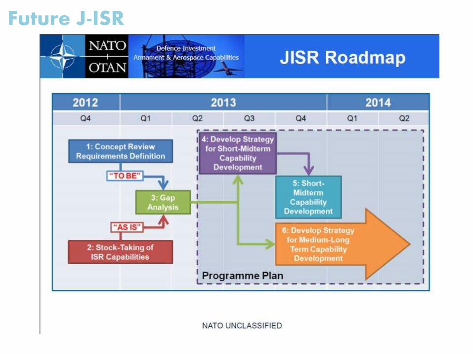
Future J-ISR
Big Data Processing
CASD – Roma 10 Ottobre 2013
Filippo Gemma - GMSPAZIO
Future J-ISR
NATO's Joint Intelligence, Surveillance and Reconnaissance Concept (JISR) UV12
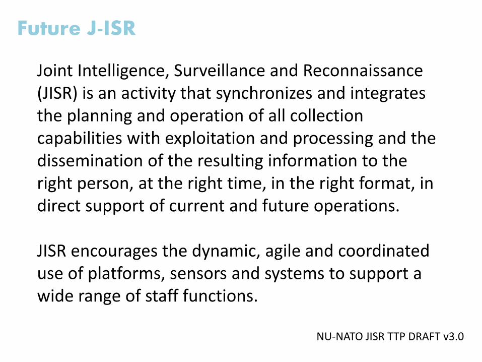
Joint Intelligence, Surveillance and Reconnaissance (JISR) is an activity that synchronizes and integrates the planning and operation of all collection capabilities with exploitation and processing and the dissemination of the resulting information to the right person, at the right time, in the right format, in direct support of current and future operations.
JISR encourages the dynamic, agile and coordinated use of platforms, sensors and systems to support a wide range of staff functions.
Future J-ISR
NU-NATO JISR TTP DRAFT v3.0
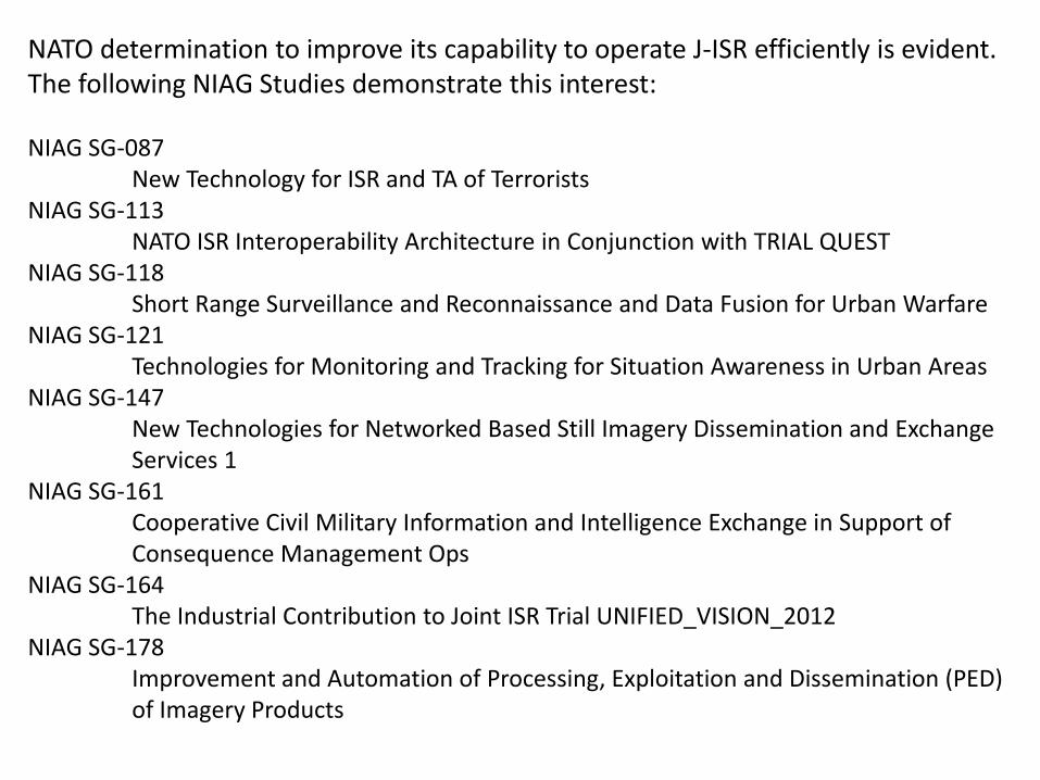
NATO determination to improve its capability to operate J-ISR efficiently is evident.The following NIAG Studies demonstrate this interest:
NIAG SG-087 New Technology for ISR and TA of Terrorists
NIAG SG-113 NATO ISR Interoperability Architecture in Conjunction with TRIAL QUEST
NIAG SG-118 Short Range Surveillance and Reconnaissance and Data Fusion for Urban Warfare
NIAG SG-121 Technologies for Monitoring and Tracking for Situation Awareness in Urban Areas
NIAG SG-147 New Technologies for Networked Based Still Imagery Dissemination and Exchange Services 1
NIAG SG-161 Cooperative Civil Military Information and Intelligence Exchange in Support of Consequence Management Ops
NIAG SG-164The Industrial Contribution to Joint ISR Trial UNIFIED_VISION_2012
NIAG SG-178Improvement and Automation of Processing, Exploitation and Dissemination (PED) of Imagery Products

I am honored to be part of NIAG SG-178
team and once obtained the permission
to share study progresses from the study
Rapporteur Mr. Rob Munday, today’s
conference speaker, I will run also
through them during my presentation.
Future J-ISR
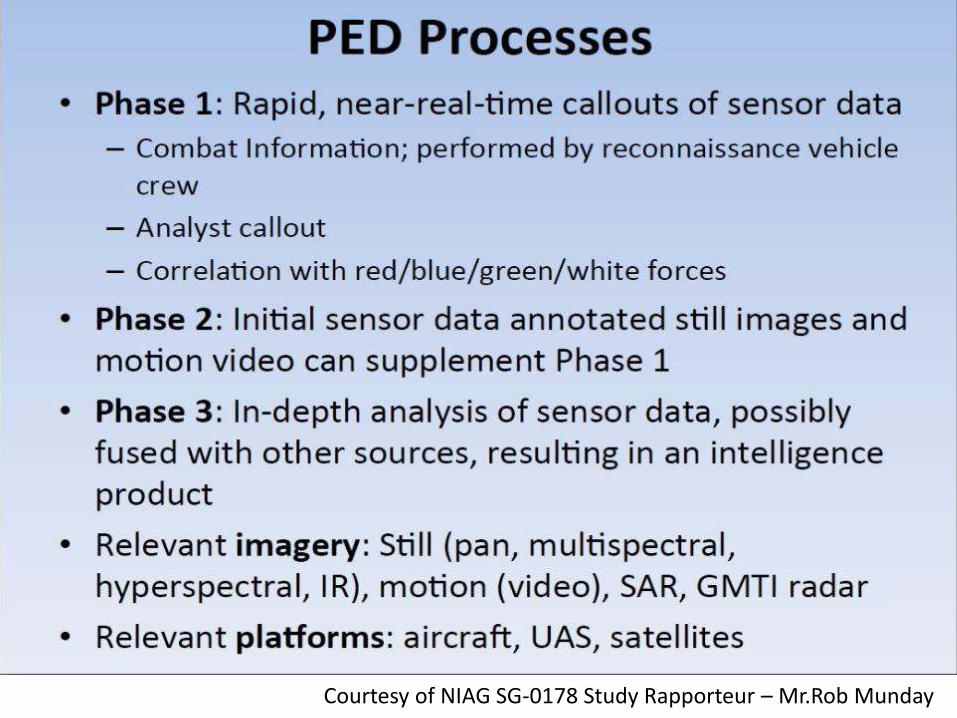
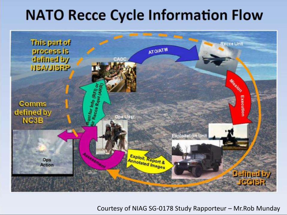
Courtesy of NIAG SG-0178 Study Rapporteur – Mr.Rob Munday
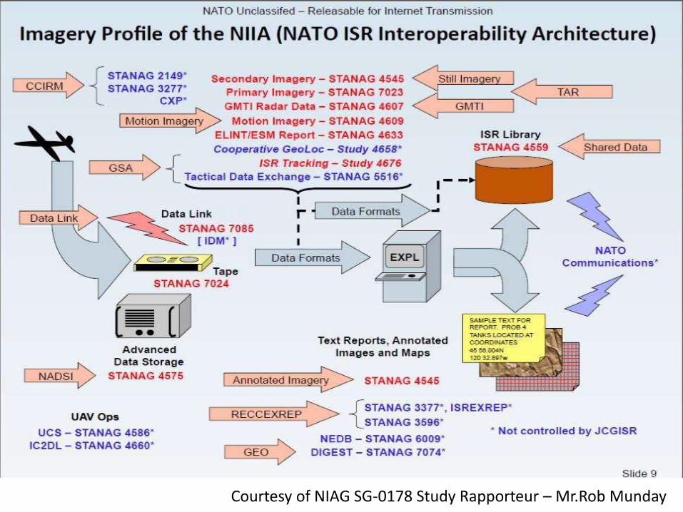
Courtesy of NIAG SG-0178 Study Rapporteur – Mr.Rob Munday
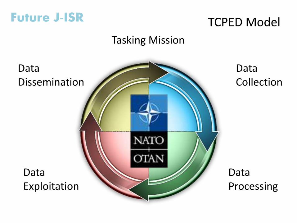
Future J-ISR TCPED Model
Tasking Mission
Data Collection
Data Processing
Data Exploitation
DataDissemination
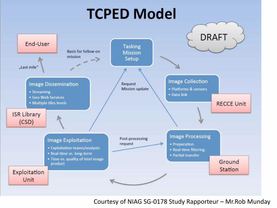
Courtesy of NIAG SG-0178 Study Rapporteur – Mr.Rob Munday
Courtesy of NIAG SG-0178 Study Rapporteur – Mr.Rob Munday
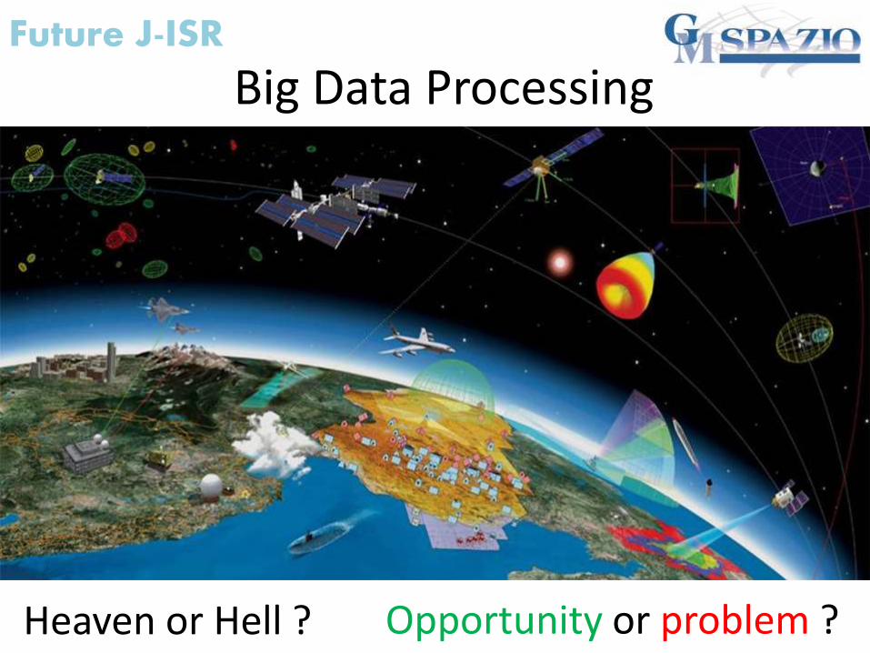
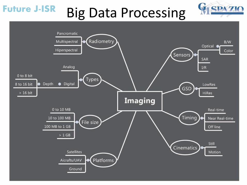
Big Data Processing
Heaven or Hell ? Opportunity or problem ?
Future J-ISR
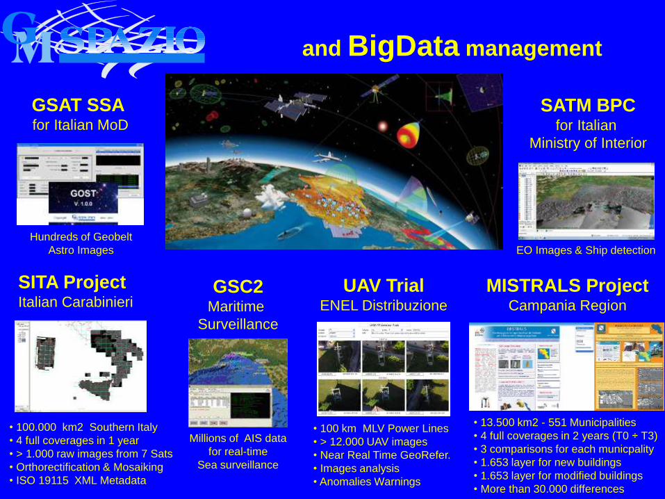
and BigData management
SITA ProjectItalian Carabinieri
• 13.500 km2 - 551 Municipalities
• 4 full coverages in 2 years (T0 ÷ T3)
• 3 comparisons for each municpality
• 1.653 layer for new buildings
• 1.653 layer for modified buildings
• More than 30.000 differences
MISTRALS ProjectCampania Region
GSAT SSA for Italian MoD
• 100.000 km2 Southern Italy
• 4 full coverages in 1 year
• > 1.000 raw images from 7 Sats
• Orthorectification & Mosaiking
• ISO 19115 XML Metadata
UAV TrialENEL Distribuzione
• 100 km MLV Power Lines
• > 12.000 UAV images
• Near Real Time GeoRefer.
• Images analysis
• Anomalies Warnings
GSC2Maritime
Surveillance
Millions of AIS data
for real-time
Sea surveillance
Hundreds of Geobelt
Astro Images
SATM BPCfor Italian
Ministry of Interior
EO Images & Ship detection
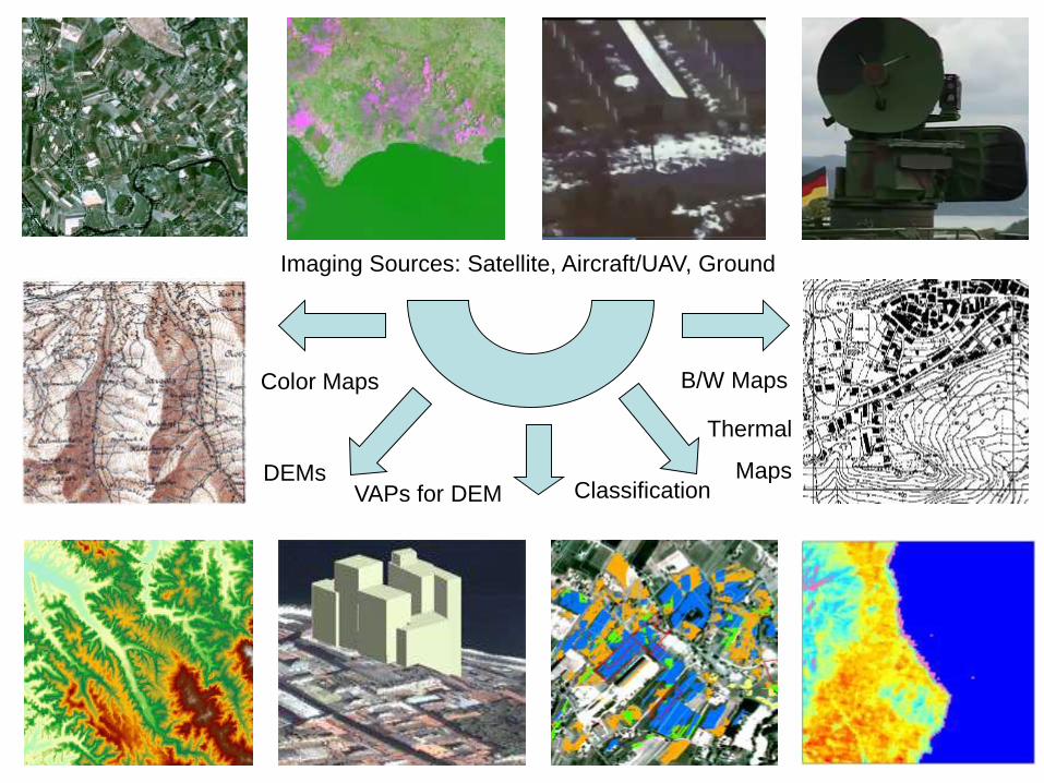
Imaging Sources: Satellite, Aircraft/UAV, Ground
DEMsClassification
Color Maps
Thermal
Maps
B/W Maps
VAPs for DEM
Future J-ISR Big Data Processing
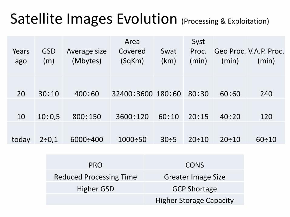
Years ago
GSD(m)
Average size(Mbytes)
Area Covered(SqKm)
Swat(km)
Syst Proc.(min)
Geo Proc.(min)
V.A.P. Proc.(min)
20 30÷10 400÷60 32400÷3600 180÷60 80÷30 60÷60 240
10 10÷0,5 800÷150 3600÷120 60÷10 20÷15 40÷20 120
today 2÷0,1 6000÷400 1000÷50 30÷5 20÷10 20÷10 60÷10
Satellite Images Evolution (Processing & Exploitation)
PRO CONS
Reduced Processing Time Greater Image Size
Higher GSD GCP Shortage
Higher Storage Capacity
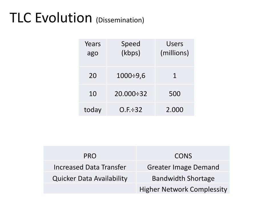
TLC Evolution (Dissemination)
Years ago
Speed(kbps)
Users(millions)
20 1000÷9,6 1
10 20.000÷32 500
today O.F.÷32 2.000
PRO CONS
Increased Data Transfer Greater Image Demand
Quicker Data Availability Bandwidth Shortage
Higher Network Complessity
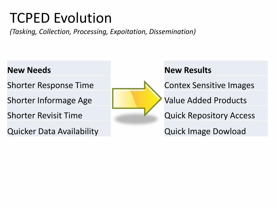
New Needs
Shorter Response Time
Shorter Informage Age
Shorter Revisit Time
Quicker Data Availability
New Results
Contex Sensitive Images
Value Added Products
Quick Repository Access
Quick Image Dowload
TCPED Evolution (Tasking, Collection, Processing, Expoitation, Dissemination)
Future J-ISR
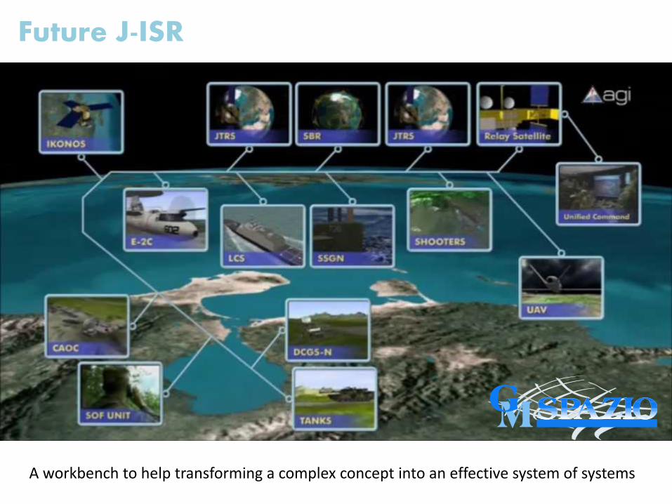
Future J-ISR
A workbench to help transforming a complex concept into an effective system of systems
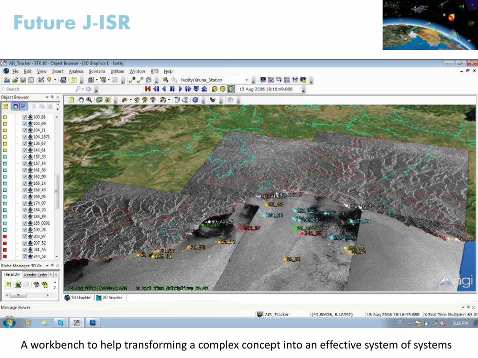
Future J-ISR
A workbench to help transforming a complex concept into an effective system of systems
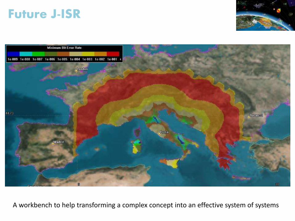
Future J-ISR
A workbench to help transforming a complex concept into an effective system of systems
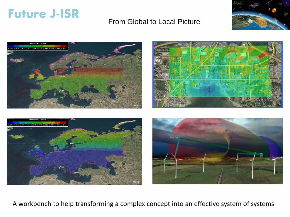
Future J-ISR
A workbench to help transforming a complex concept into an effective system of systems
From Global to Local Picture
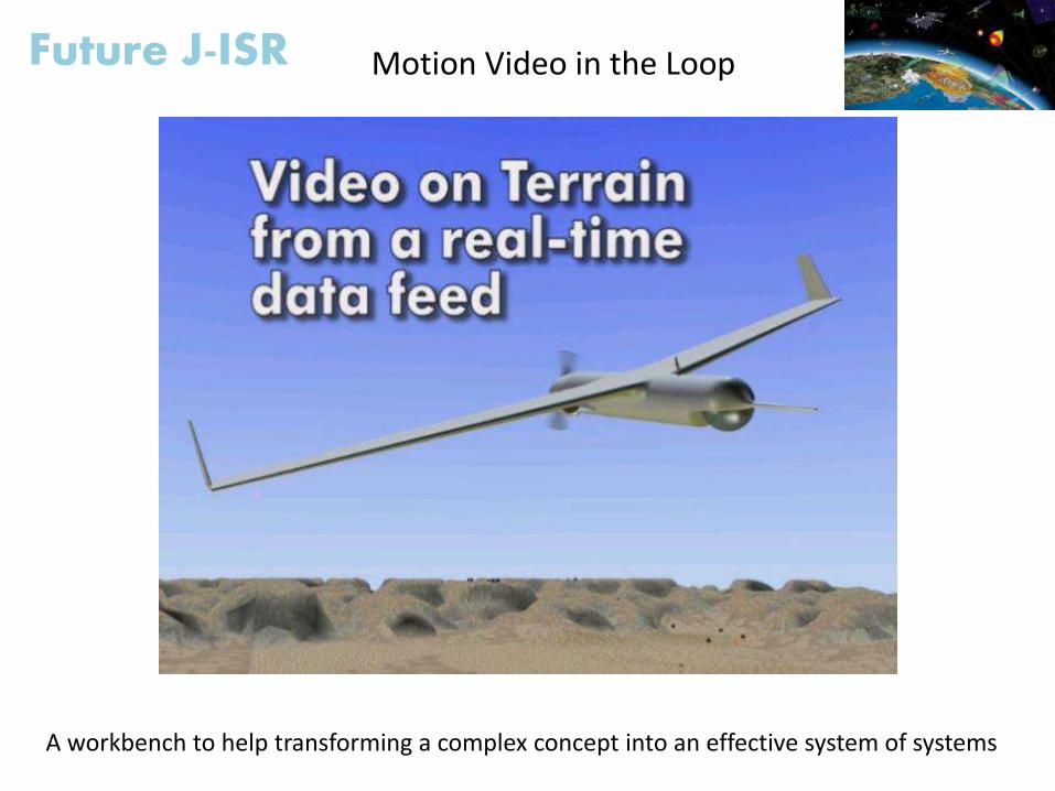
Future J-ISR Motion Video in the Loop
A workbench to help transforming a complex concept into an effective system of systems
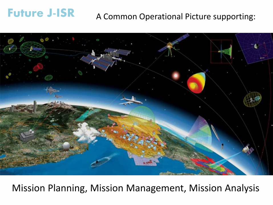
Future J-ISR
Mission Planning, Mission Management, Mission Analysis
A Common Operational Picture supporting:
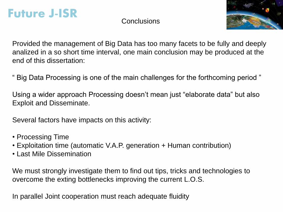
Future J-ISRConclusions
Provided the management of Big Data has too many facets to be fully and deeply
analized in a so short time interval, one main conclusion may be produced at the
end of this dissertation:
“ Big Data Processing is one of the main challenges for the forthcoming period ”
Using a wider approach Processing doesn’t mean just “elaborate data” but also
Exploit and Disseminate.
Several factors have impacts on this activity:
• Processing Time
• Exploitation time (automatic V.A.P. generation + Human contribution)
• Last Mile Dissemination
We must strongly investigate them to find out tips, tricks and technologies to
overcome the exting bottlenecks improving the current L.O.S.
In parallel Joint cooperation must reach adequate fluidity
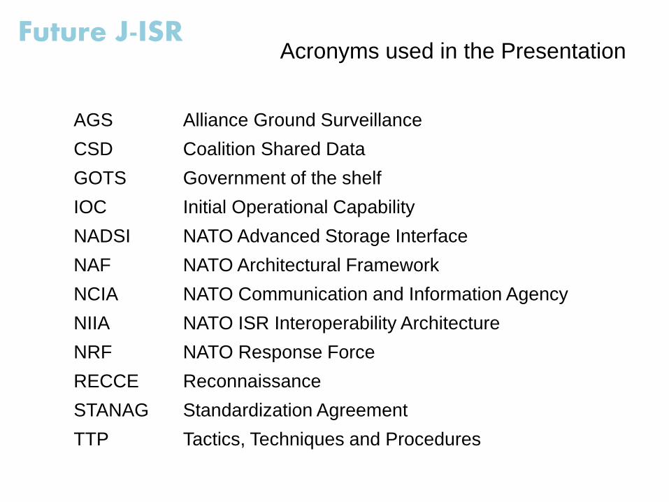
AGS Alliance Ground Surveillance
CSD Coalition Shared Data
GOTS Government of the shelf
IOC Initial Operational Capability
NADSI NATO Advanced Storage Interface
NAF NATO Architectural Framework
NCIA NATO Communication and Information Agency
NIIA NATO ISR Interoperability Architecture
NRF NATO Response Force
RECCE Reconnaissance
STANAG Standardization Agreement
TTP Tactics, Techniques and Procedures
Future J-ISRAcronyms used in the Presentation
Future J-ISR
Thank You
Very much
for
Your kind attention…