Embed Size (px)
Citation preview
Earth Observation Technologies for Crop Monitoring: A GEOGLAM Workshop to Promote Collaborations among JECAM and Asia-RiCE 2018
17-20 September 2018 – Taichung City (Taiwan)
Rice field surveyLessons learned from GeoRice/Asia-Rice
Thuy Le Toan, Hoa Phan, Alexandre BouvetCentre d’Etude Spatiale de la Biosphère (CESBIO),Toulouse, France
Lam Dao Nguyen,VNSC/VAST, Ho Chi Minh City, Vietnam
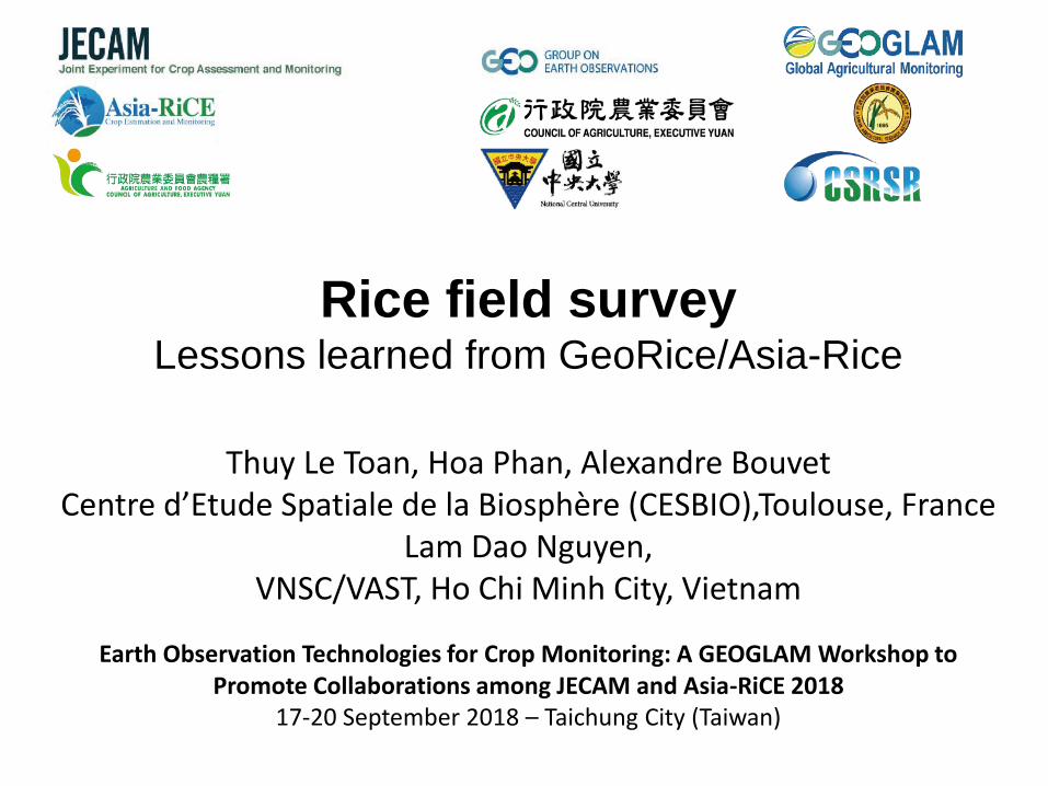
Asia-Rice required Products
General Description
Service&Productdesciption
GEOGLAM-Asia-RICE: Rice crop calendar, Rice Area mapping, Early warning, Damage monitoring, and possibly rice production forecast.
Uses and benefits: GEOGLAM-Asia-RICE: use of the information for monthly outlook of the status of rice growth, for general statistics, early warning, and for farmer intervention in the field.
Product specifications
Spatial scale: Country coverage (and larger)
Minimum cell size (or mapping unit):
20 m x 20 m
Required Information layers:
Rice-non Rice (water, urban, other crops)
Cropping intensity (one, 2 or three crops per year)
Phenology (Sowing date, End of vegetative phase, Harvest period)
Rice parameters (biomass, LAI)
Water management (irrigation scheme)
Indicators of crop production (growth anomaly, drought, insect..)
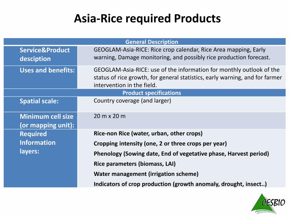
Every 12 days except few gaps
6 days with Setinel-1B since 1 Oct 2016
GEORICE: can we meet the requirements using Sentinel-1 data ?
05 May 2017
VH
VV
Automatically
dowloaded and
preprocessed at
CESBIO
Big Data challenge
10/01/2015
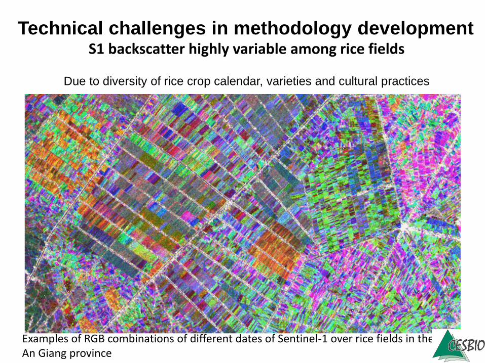
VHExamples of RGB combinations of different dates of Sentinel-1 over rice fields in the An Giang province
Technical challenges in methodology developmentS1 backscatter highly variable among rice fields
Due to diversity of rice crop calendar, varieties and cultural practices
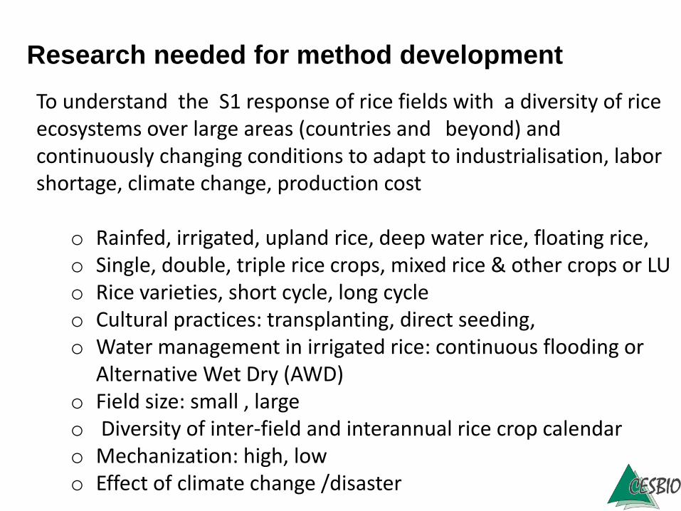
To understand the S1 response of rice fields with a diversity of riceecosystems over large areas (countries and beyond) and continuously changing conditions to adapt to industrialisation, laborshortage, climate change, production cost
o Rainfed, irrigated, upland rice, deep water rice, floating rice, o Single, double, triple rice crops, mixed rice & other crops or LUo Rice varieties, short cycle, long cycleo Cultural practices: transplanting, direct seeding,o Water management in irrigated rice: continuous flooding or
Alternative Wet Dry (AWD)o Field size: small , largeo Diversity of inter-field and interannual rice crop calendaro Mechanization: high, lowo Effect of climate change /disaster
Research needed for method development
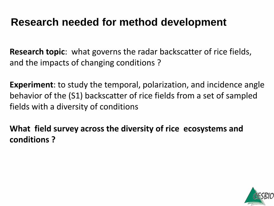
Research topic: what governs the radar backscatter of rice fields, and the impacts of changing conditions ?
Experiment: to study the temporal, polarization, and incidence angle behavior of the (S1) backscatter of rice fields from a set of sampledfields with a diversity of conditions
What field survey across the diversity of rice ecosystems and conditions ?
Research needed for method development
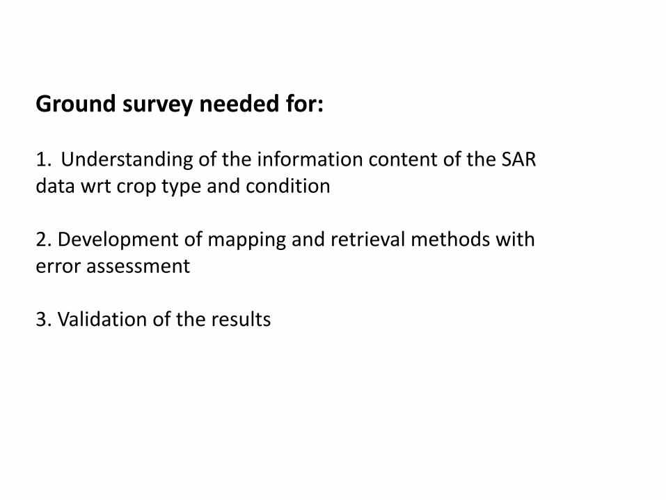
Ground survey needed for:
1. Understanding of the information content of the SAR data wrt crop type and condition
2. Development of mapping and retrieval methods witherror assessment
3. Validation of the results
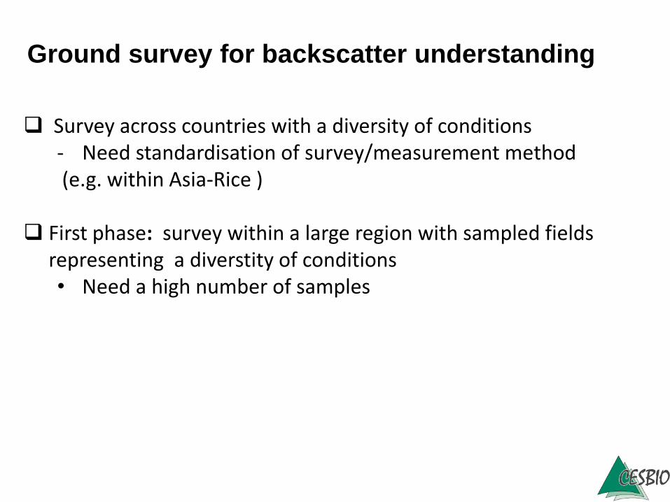
Survey across countries with a diversity of conditions- Need standardisation of survey/measurement method(e.g. within Asia-Rice )
First phase: survey within a large region with sampled fieldsrepresenting a diverstity of conditions• Need a high number of samples
Ground survey for backscatter understanding
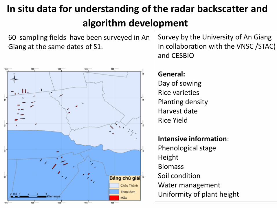
In situ data for understanding of the radar backscatter and
algorithm development 60 sampling fields have been surveyed in An Giang at the same dates of S1.
Survey by the University of An GiangIn collaboration with the VNSC /STAC) and CESBIO
General:Day of sowingRice varietiesPlanting densityHarvest dateRice Yield
Intensive information:Phenological stageHeightBiomassSoil conditionWater managementUniformity of plant height
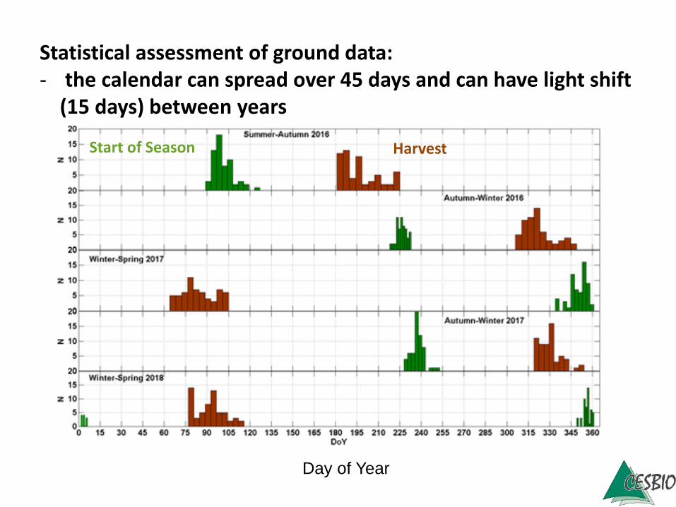
Statistical assessment of ground data: - the calendar can spread over 45 days and can have light shift
(15 days) between years
Start of Season Harvest
Day of Year
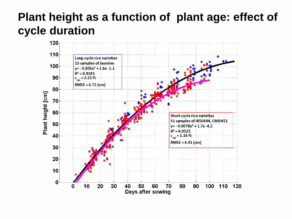
Plant height as a function of plant age: effect of
cycle duration
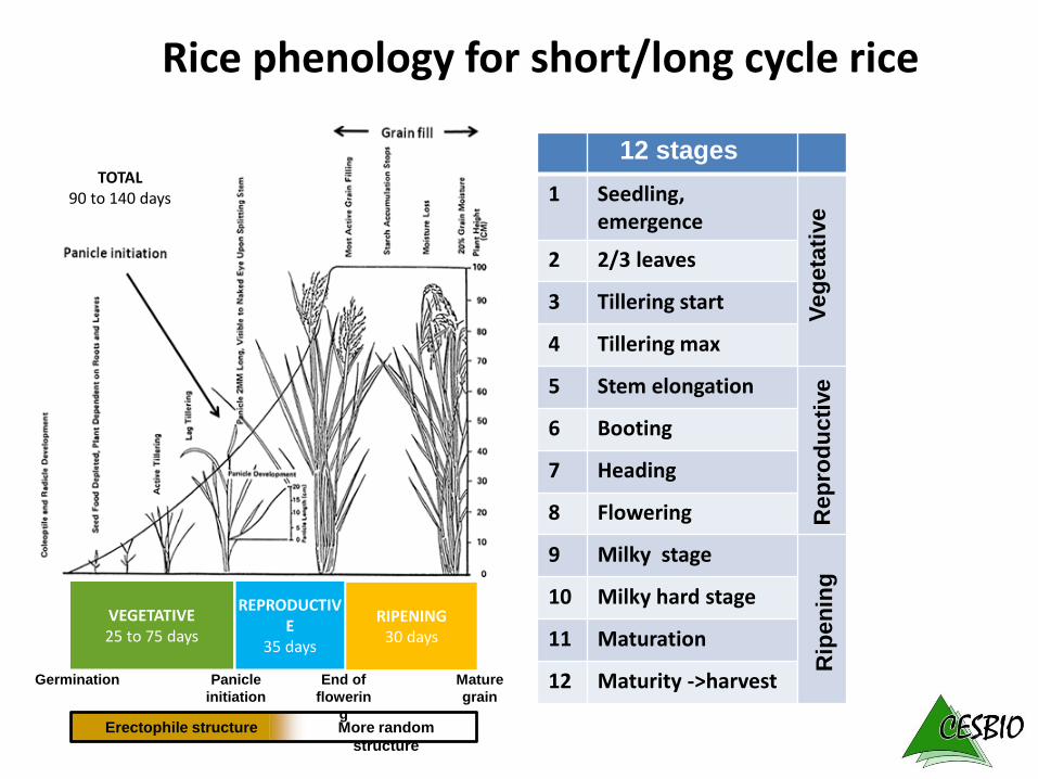
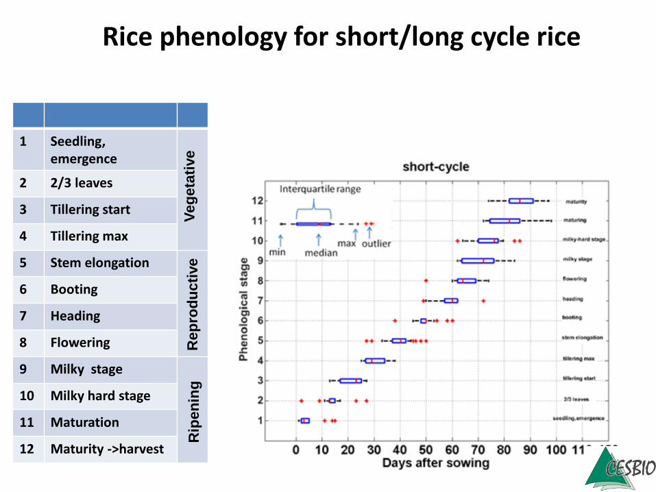
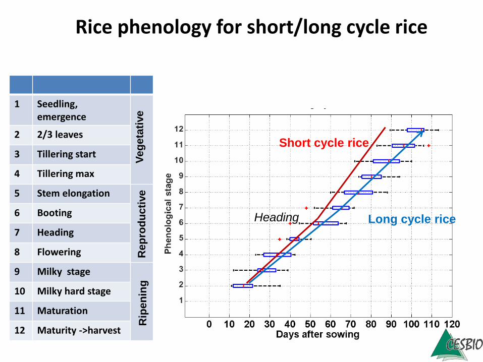
Rice phenology for short/long cycle rice
1 Seedling, emergence
2 2/3 leaves
3 Tillering start
4 Tillering max
5 Stem elongation
6 Booting
7 Heading
8 Flowering
9 Milky stage
10 Milky hard stage
11 Maturation
12 Maturity ->harvest
VEGETATIVE25 to 75 days
REPRODUCTIVE
35 days
RIPENING30 days
TOTAL90 to 140 days
Germination Panicle
initiation
End of
flowerin
g
Mature
grain
Erectophile structure More random
structure
Veg
eta
tive
Rep
rod
ucti
ve
Rip
en
ing
12 stages
1 Seedling, emergence
2 2/3 leaves
3 Tillering start
4 Tillering max
5 Stem elongation
6 Booting
7 Heading
8 Flowering
9 Milky stage
10 Milky hard stage
11 Maturation
12 Maturity ->harvest
Veg
eta
tive
Rep
rod
ucti
ve
Rip
en
ing
Rice phenology for short/long cycle rice
Short cycle rice
Long cycle rice
1 Seedling, emergence
2 2/3 leaves
3 Tillering start
4 Tillering max
5 Stem elongation
6 Booting
7 Heading
8 Flowering
9 Milky stage
10 Milky hard stage
11 Maturation
12 Maturity ->harvest
Veg
eta
tive
Rep
rod
ucti
ve
Rip
en
ing
Heading
Rice phenology for short/long cycle rice
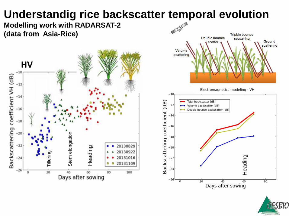
HV
Understandig rice backscatter temporal evolutionModelling work with RADARSAT-2
(data from Asia-Rice)
He
ad
ing
Ste
m e
lon
ga
tio
n
Till
erin
g
He
ad
ing
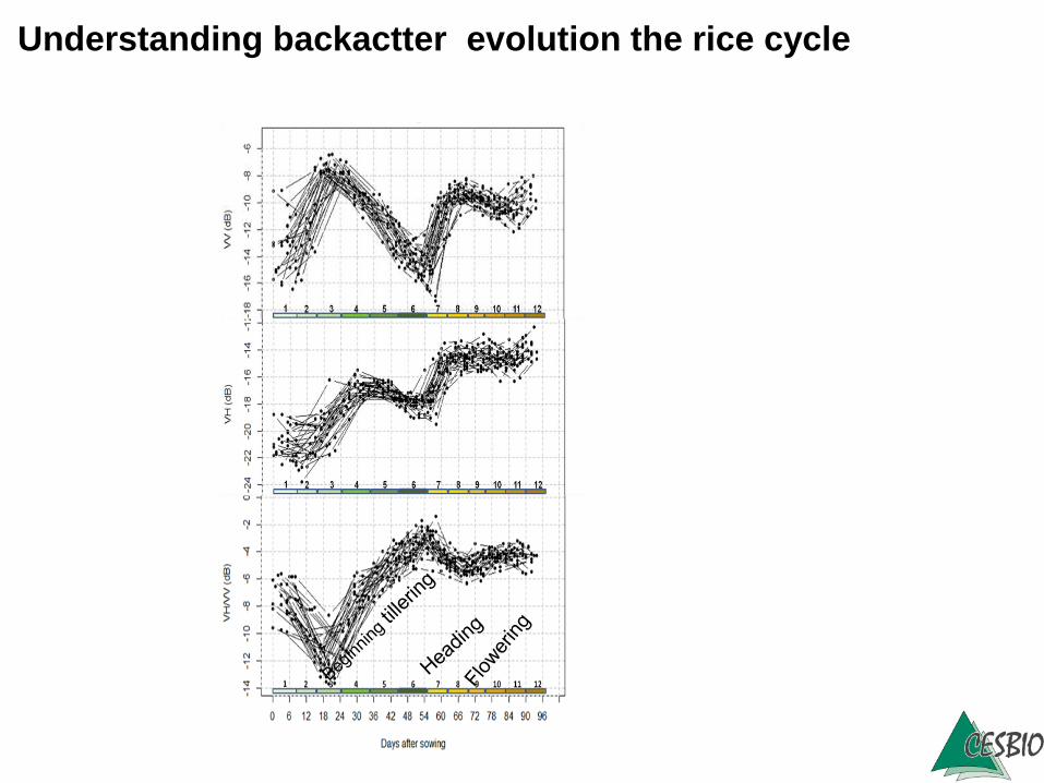
Understanding backactter evolution the rice cycle
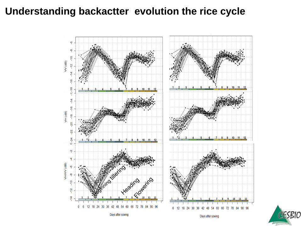
Understanding backactter evolution the rice cycle
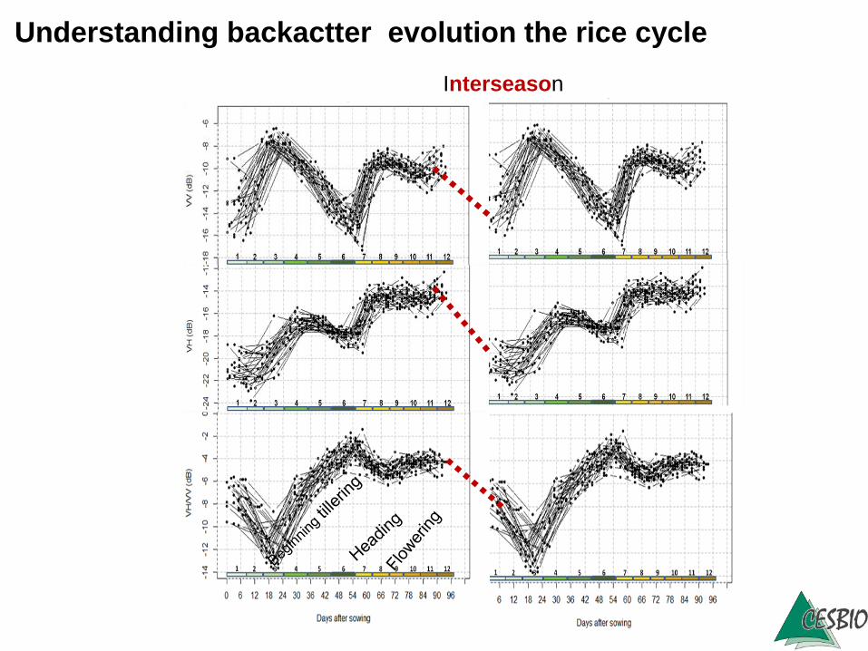
Interseason
Understanding backactter evolution the rice cycle
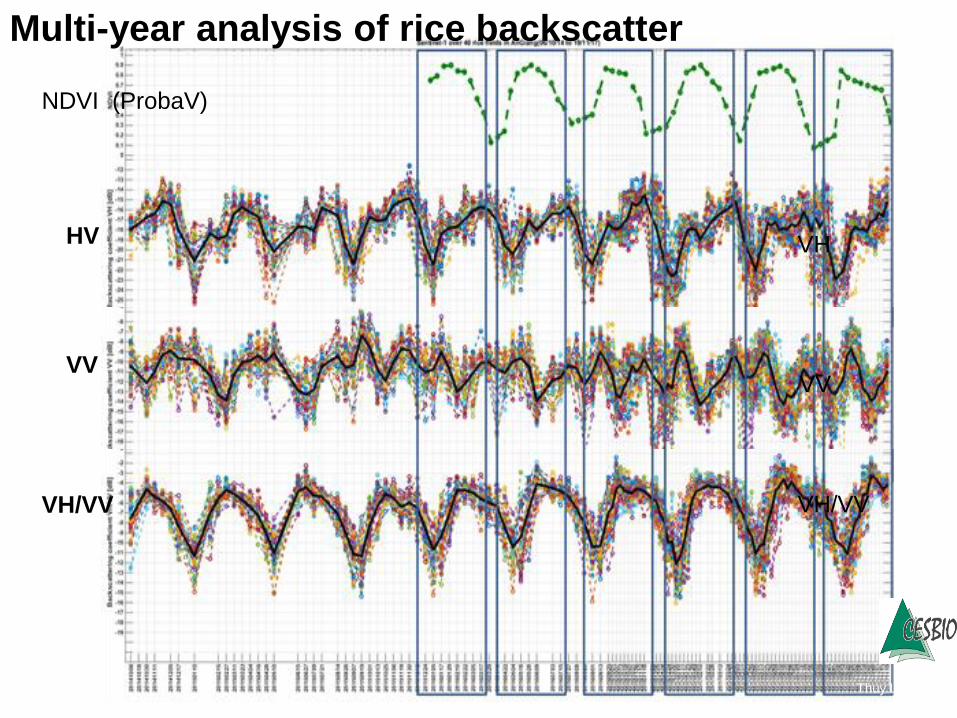
NDVI (ProbaV)
VH
VV
VH/VV
Multi-year analysis of rice backscatter
Thuy Le Toan
HV
VV
VH/VV
VegetativeReproductiveRipening
S2_2017
S1_2017S1_2015
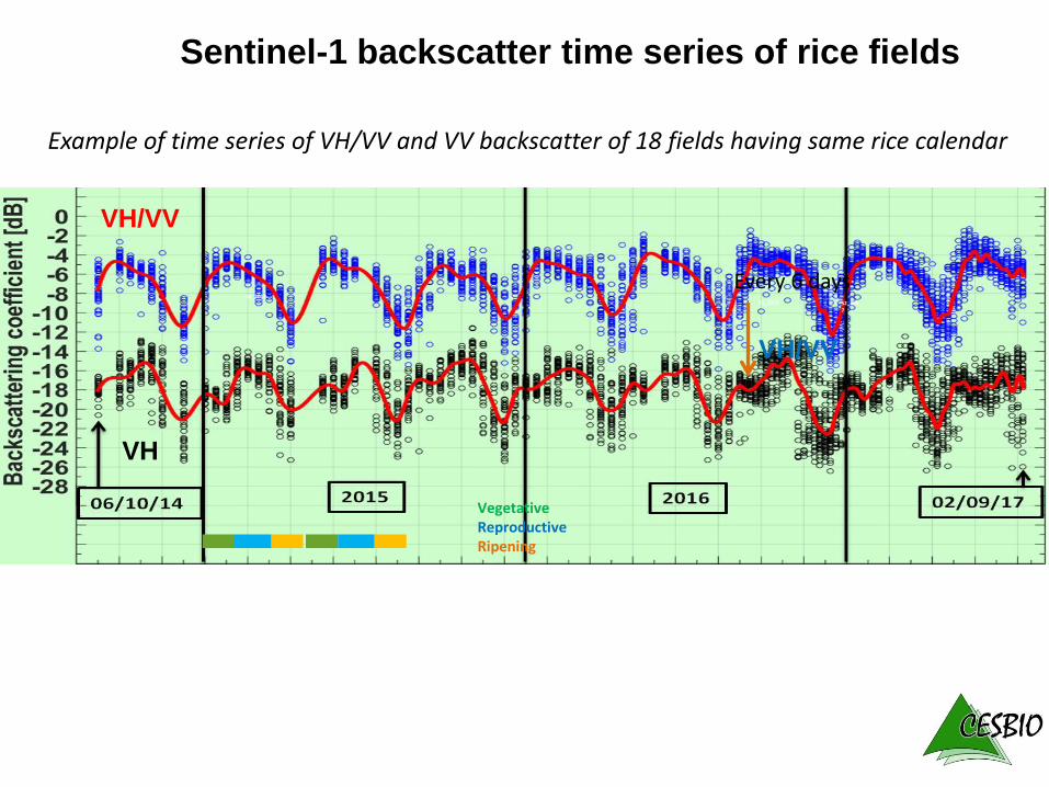
Sentinel-1 backscatter time series of rice fields
VH/VV
VH
Every 6 days
Example of time series of VH/VV and VV backscatter of 18 fields having same rice calendar
VH/VV
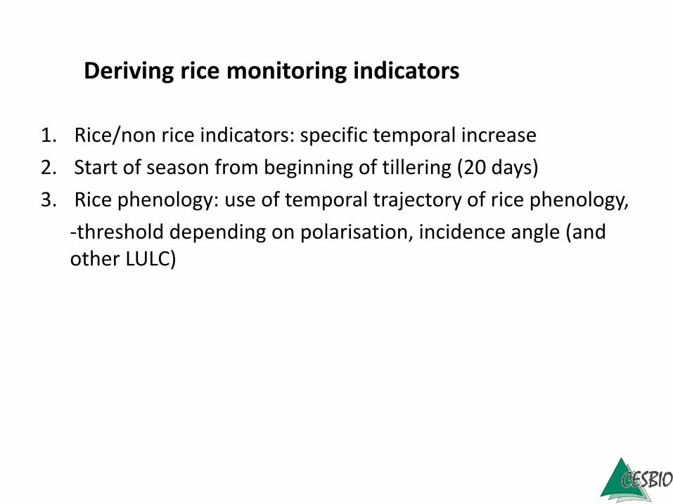
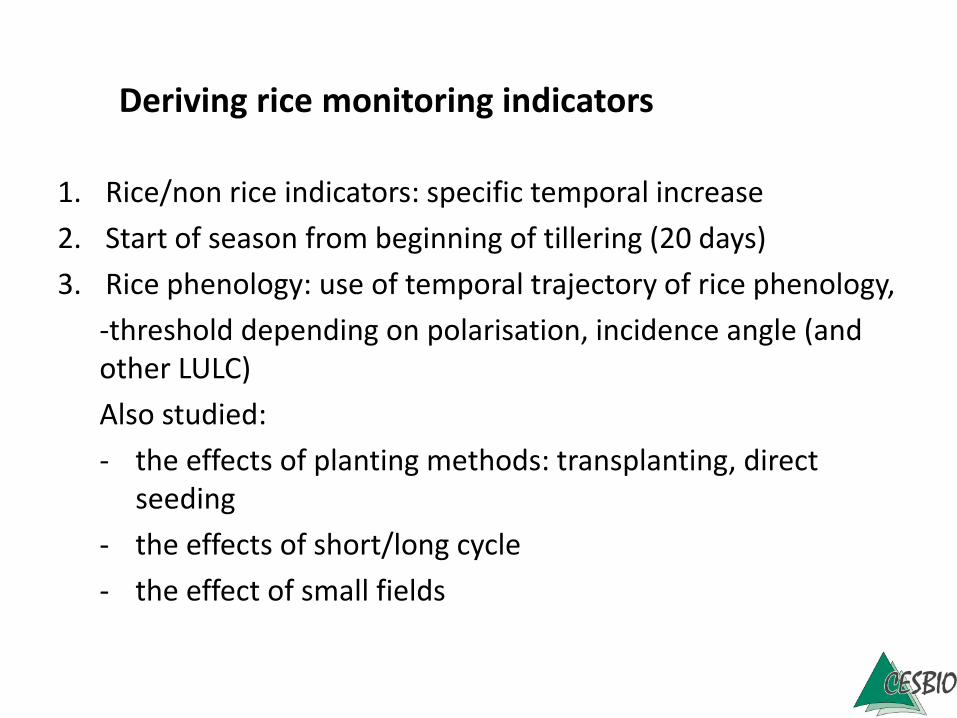
1. Rice/non rice indicators: specific temporal increase
2. Start of season from beginning of tillering (20 days)
3. Rice phenology: use of temporal trajectory of rice phenology,
-threshold depending on polarisation, incidence angle (and other LULC)
Deriving rice monitoring indicators
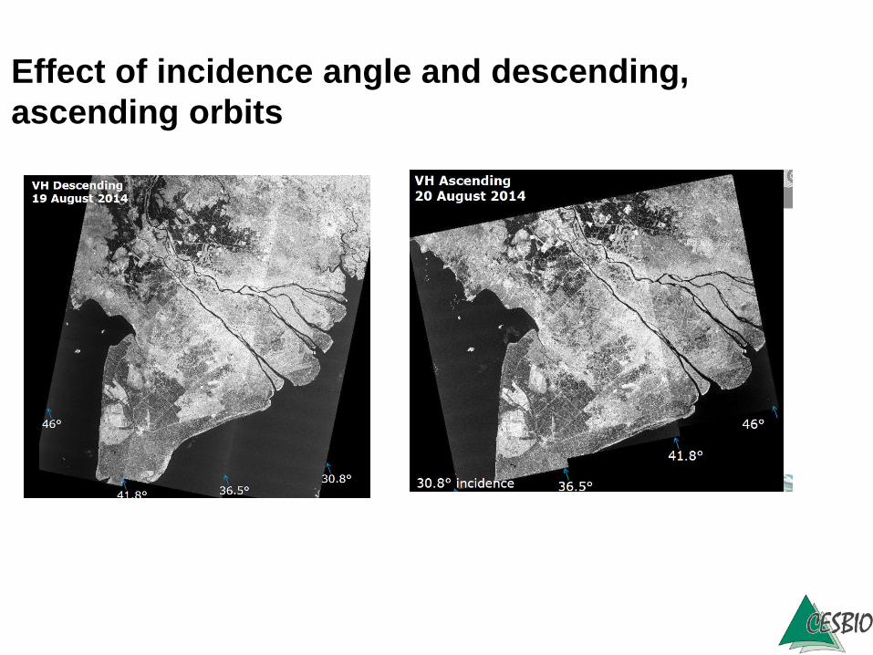
Effect of incidence angle and descending,
ascending orbits
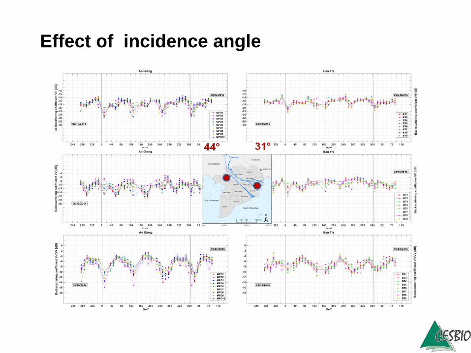
Effect of incidence angle
1. Rice/non rice indicators: specific temporal increase
2. Start of season from beginning of tillering (20 days)
3. Rice phenology: use of temporal trajectory of rice phenology,
-threshold depending on polarisation, incidence angle (and other LULC)
Also studied:
- the effects of planting methods: transplanting, direct seeding
- the effects of short/long cycle
- the effect of small fields
Deriving rice monitoring indicators
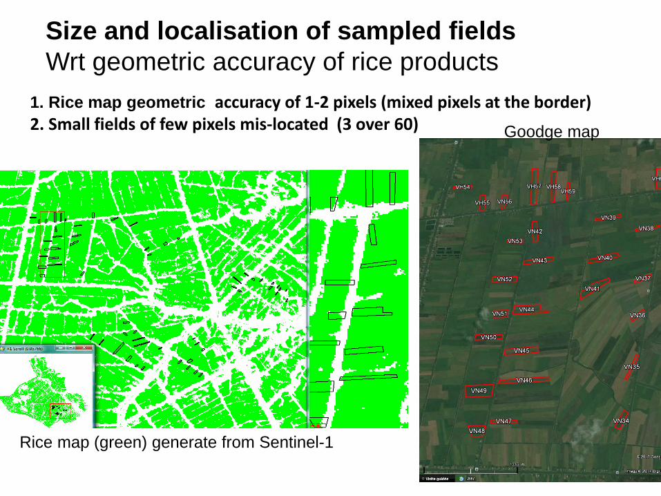
Size and localisation of sampled fields
Wrt geometric accuracy of rice products
1. Rice map geometric accuracy of 1-2 pixels (mixed pixels at the border)2. Small fields of few pixels mis-located (3 over 60)
Rice map (green) generate from Sentinel-1
Goodge map
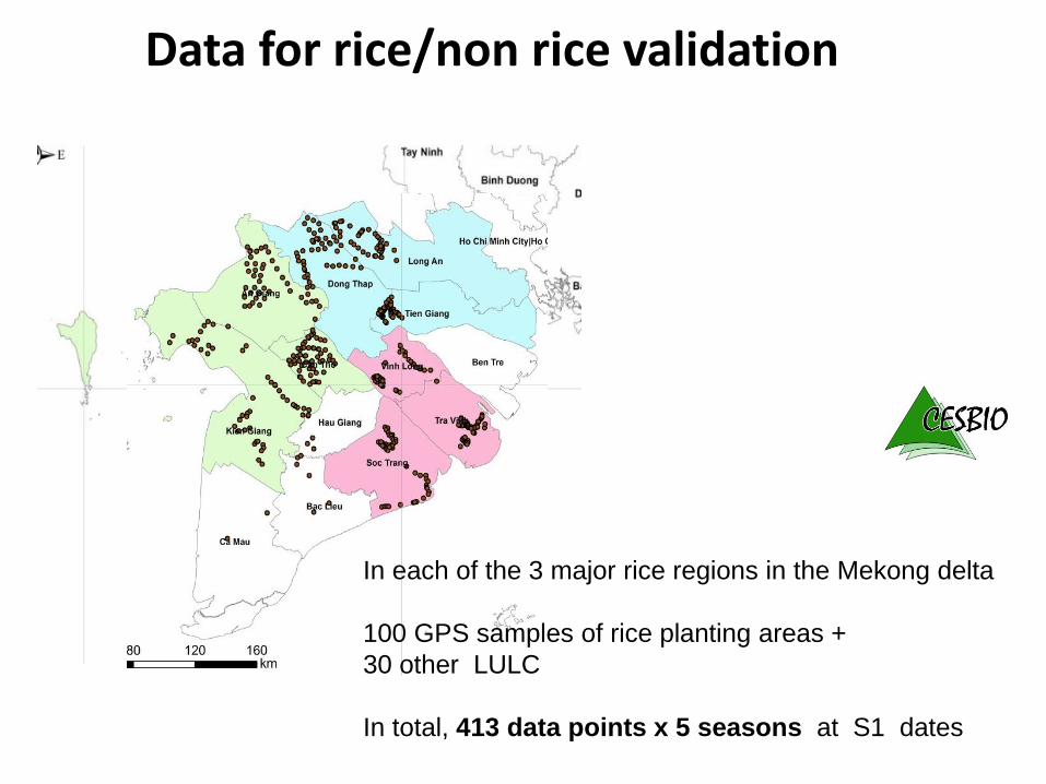
Data for rice/non rice validation
In each of the 3 major rice regions in the Mekong delta
100 GPS samples of rice planting areas +
30 other LULC
In total, 413 data points x 5 seasons at S1 dates
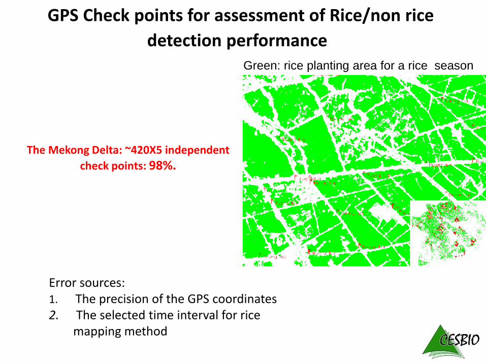
The Mekong Delta: ~420X5 independent
check points: 98%.
Error sources:1. The precision of the GPS coordinates2. The selected time interval for rice
mapping method
GPS Check points for assessment of Rice/non rice
detection performanceGreen: rice planting area for a rice season
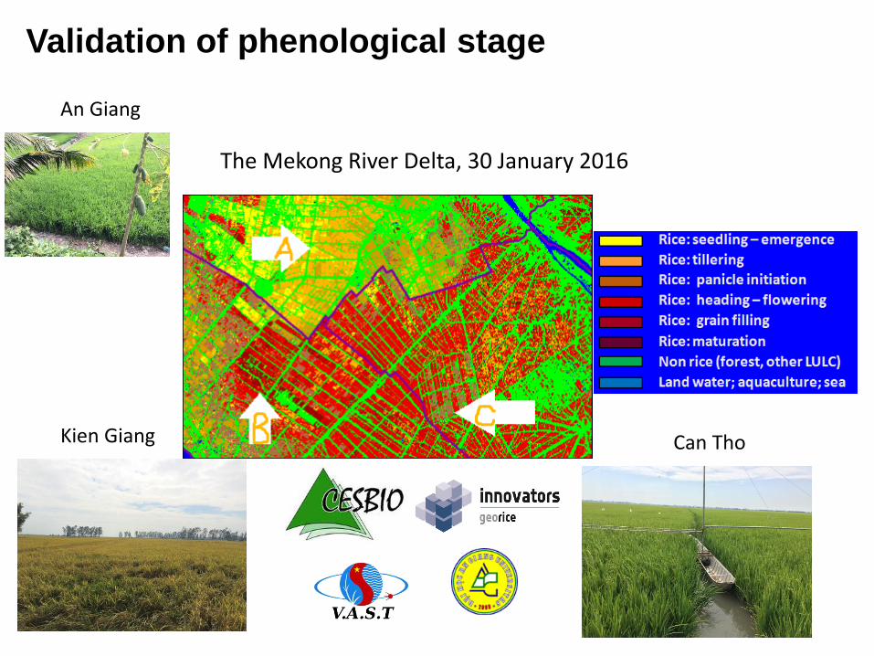
The Mekong River Delta, 30 January 2016
An Giang
Kien Giang Can Tho
Validation of phenological stage
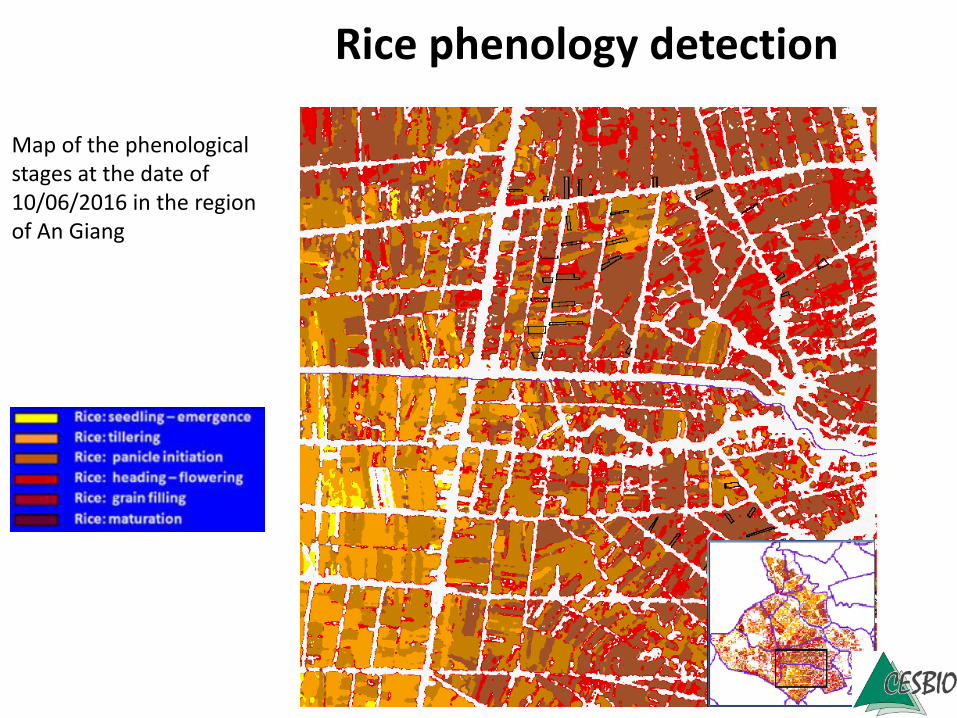
Rice phenology detection
Map of the phenological stages at the date of 10/06/2016 in the region of An Giang
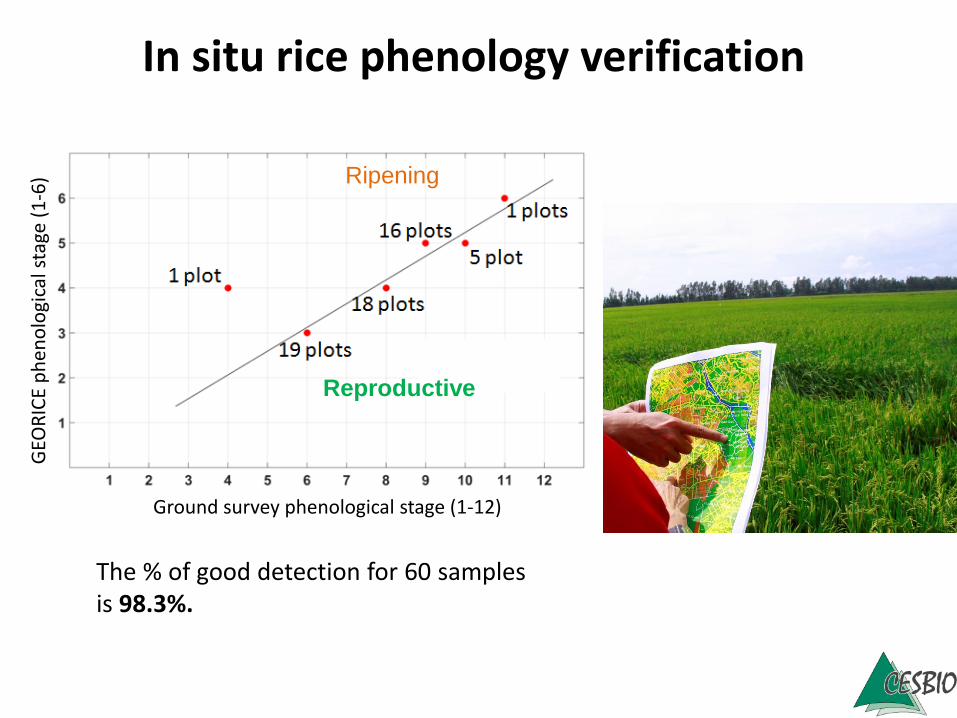
Ground survey phenological stage (1-12)
GEO
RIC
E p
he
no
logi
cals
tage
(1
-6)
The % of good detection for 60 samplesis 98.3%.
In situ rice phenology verification
Ripening
Reproductive
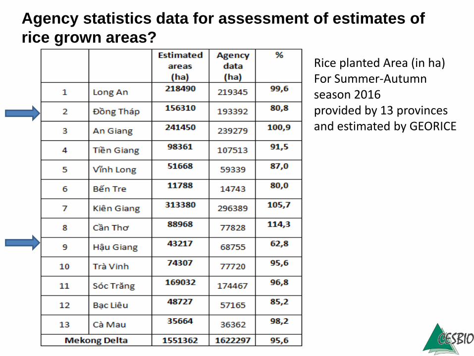
Rice planted Area (in ha)For Summer-Autumn season 2016provided by 13 provinces and estimated by GEORICE
Agency statistics data for assessment of estimates of
rice grown areas?
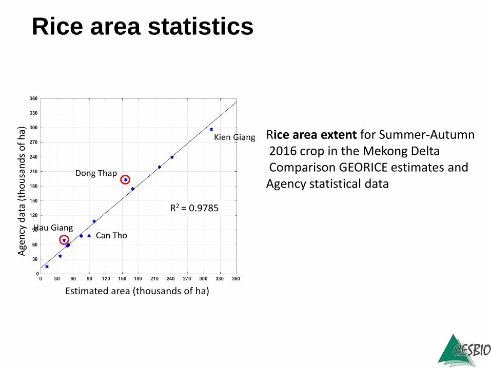
Dong Thap
Kien Giang
Hau GiangCan Tho
R2 = 0.9785
Estimated area (thousands of ha)
Rice area extent for Summer-Autumn2016 crop in the Mekong DeltaComparison GEORICE estimates andAgency statistical data
Rice area statistics
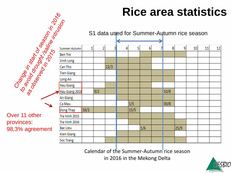
Calendar of the Summer-Autumn rice season in 2016 in the Mekong Delta
Rice area statistics
S1 data used for Summer-Autumn rice season
Over 11 other
provinces:
98,3% agreement
• Field survey needs to be designed to account for a diversity of rice conditions
• Ground data collection practices need to be updated
• Quantitative assessments are still needed to improve the sampling method
• Experiments/validation across a diversity of sites/countries are a necessity.
Lessons learned