Embed Size (px)
Citation preview
ICA NewsNouvelles de I’ACI
Number 37, December 2001 Numéro 37, Dècembre 2001 http://www.icaci.o
ICA Executive Committee
ICA NEWS December 2001
ICA ExecutiveCommitteeBengt RystedtPresidentNational Land SurveySE-801 82 Gavle, SwedenUniversity of GavleSE-801 76 Gavle, [email protected]
Ferjan OrmelingSecretary-GeneralFaculty of Geographical SciencesUtrecht UniversityP.O.Box 801153508 TC UtrechtThe [email protected]
Kirsi VirrantausVice-presidentHelsinki University of TechnologyDepartment of SurveyingP.O.Box 1200FIN-02015 [email protected]
Milan KonecnyVice-presidentDepartment of GeographyFaculty of Science, Masaryk UniversityKotlarska 2611 37 BrnoCzech [email protected]
Li LiVice-presidentNational Geomatics Center of ChinaState Bureau of Surveying and Mapping1 Baishengcun Zi Zhu [email protected]
Elri LiebenbergVice-presidentUniversity of South AfricaDepartment of Geography and EnvironmentalStudiesP.O.Box 392Pretoria 0003South [email protected]
Robert McMasterVice-president Department of GeographyUniversity of Minnesota414 Social Sciences Building267-19th Avenue SouthMineapolis, MN 55455United [email protected]
Takashi MoritaVice-presidentDepartment of Civil EngineeringHosei University3-7-2 Kajinocho, Koganei-shi184-8485 Tokyo [email protected]
Alberta Auringer WoodVice-presidentMemorial University of NewfoundlandSt.John's, NewfoundlandCanada A1B [email protected]
Michael WoodPast-presidentDepartment of GeographyUniversity of AberdeenElphinstone Rd, Aberdeen AB24 3UF, ScotlandUnited [email protected]
ICA Commission ChairsJacqueline M. Anderson Cartography and [email protected]
Roger [email protected]
Eva K.-BlumGender and [email protected]
Christopher BoardHistory of [email protected]
Tim DavisCensus [email protected]
Ron FurnessMarine [email protected]
Lorenz HurniMountain [email protected]
Serge Le BlancMapping from Satellite [email protected]
Alan MacEachrenVisualisation and Virtual [email protected]
Harold MoelleringSpatial Data [email protected]
Ammatzia PeledWG Incremental Updating and [email protected]
Michael PetersonMaps and the [email protected]
Kira ShingarevaPlanetary [email protected]
Sjef van der SteenMap [email protected]
Dr A.F.TathamMaps and Graphics for Blind and VisuallyImpaired [email protected]
Vladimir TikunovEducation and [email protected]
Timothy TrainorNational and Regional [email protected]
Robert [email protected]
Alexander WolodtschenkoTheoretical [email protected]
Please send contributions to:A/Prof Graciela Metternicht, Editor, ICA NewsDepartment of Spatial SciencesCurtin University of TechnologyGPO Box U 1987, Perth 6845Western AustraliaEmail: [email protected]: +61-8-9266 2703Ftp: alpha.cage.curtin.edu.auLogin and pwd: engftp Directory: /graciela/ICA/incoming
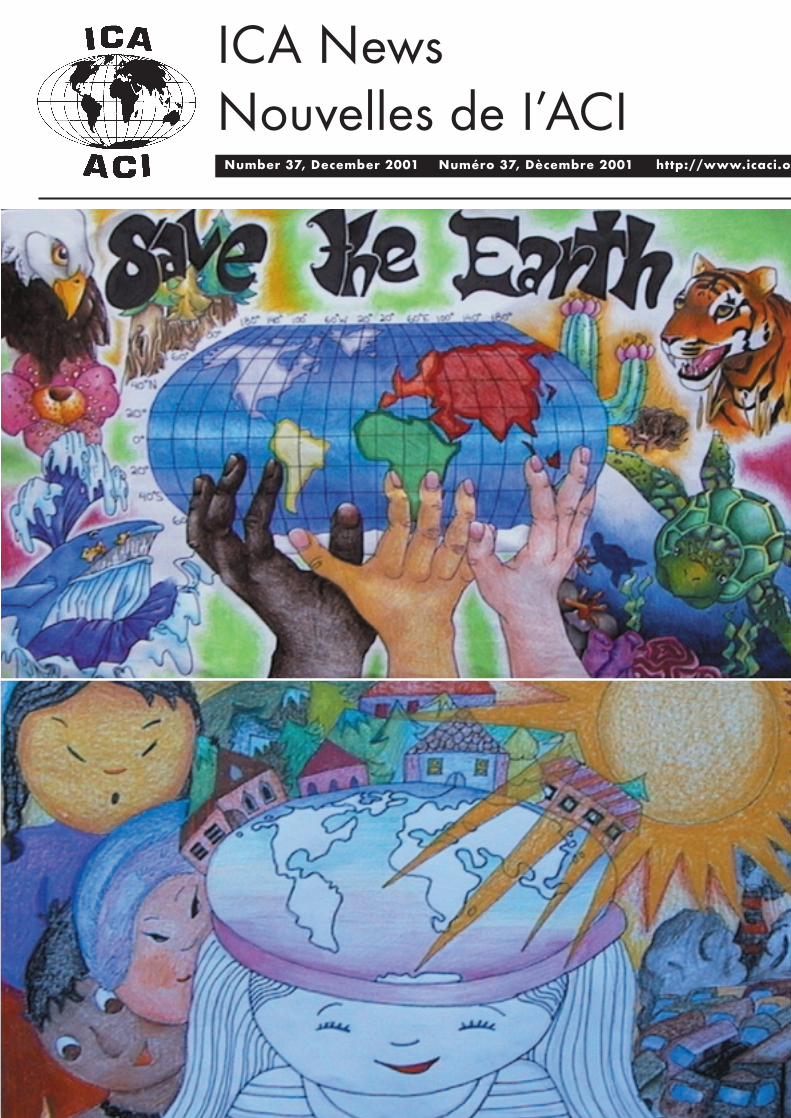
Cover: Save the Earth, Maps by Patricia Lan,Age 12, Canada and Michaela Klimentova, Age12, Slovakia. Two of the eight maps selectedwinners of the 2001 Barbara Bartz PetchenikChildren's Global Map Competition.
Dispatches
Dispatches
ICA NEWS December 2001 1
Editorial
Another successful meeting of theInternational Cartographic Associationis over. With more than 1,000
participants from 57 countries and fourinternational organisations, the 20th ICC washeld in Beijing from the 6 to 11 August.
The Local Organising Committee put agreat effort into the display of the 1,200 mapswhich were entries to the International MapExhibition. They also exhibited 140 Chinesehistorical maps and the 104 maps of the IHOcompetition. Another display was The BarbaraPetchenik Children Map Competition, whichhad 159 entries from 25 countries. This issueannounces the winners of each category.
The conference received ample coveragein the China Daily (the national Englishnewspaper of China). The Vice-Premier ofChina, Wen Jiabao, sent a letter ofcongratulations, which was read during theopening ceremony. 'The conference will playan important role in promoting internationalcollaboration and exchanges in the field ofsurveying and mapping', Wen said.
During the closing ceremony, ICAPresident Bengt Rystedt congratulated theLocal Organising Committee, not only for thequality of the technical and map exhibitions,but also for the number of commercial firmsthat provided support to the conference. Healso noted some minor problems that hadoccurred during the event. 'Although most ofthe sessions went well, there were problemswith some sessions, due to insufficienttechnical support and the non-attendance ofsome contributors. That often happens atinternational conferences and it is difficult toprevent', Bengt said.
This issue of the newsletter contains awide coverage of the main events of theconference including the traditional awards ofthe opening ceremony, the ICA travel awards,the Childrens and International Mapcompetitions, and general statistics of theconference. Alberta Auringer Wood andRussian ICA representatives provideinteresting views of the conference, oral andposter sessions, and commission meetings.Milan Konecny and Elri Liebenberg recentlyheld Symposium on Digital Cities and Historyof Cartography, respectively.The specialfeature section contains an interestingdescription of the National Map Library ofChina, visited by an ICA delegation during theconference.
The addition of 'The Society forCartography and Geographic InformationScience' as a sub-title to the ICA name wasdiscussed during the meeting of the ICAcountry representatives. No better words than
Michael Woods’ speech during the openingceremony can define the need for such amovement. 'The proposed change of the ICAname to ‘Cartography and GeographicInformation Science’may seem a problem forsome cartographers, but it can also beinterpreted as the natural next stage in theevolution of our joint fields. It could have verypositive effects. It may provide opportunities toheal the 40-year-old separation – reconnectingthe GISystem field with its parent discipline,cartography. For others, it will be a recognitionof collaborative ventures which are already inplace. I would hope for new and rich researchopportunities, less duplication of effort and astrengthened geospatial/ geographical scientificcommunity', Michael said.
To keep apace with this ever evolvingdiscipline, and to better recognise thecontributions of ICA's sponsors, the layout ofthe newsletter has changed. A coloured coverhas been designed, with each issue containinga different winning entry of the BarbaraPetchenik Childrens Map Competition. Theback of the cover contains the list of Affiliatessubscribed to the ICA with a minimum of tensubscription units, while the inside backnames International and National Scientificand Technical Organisations subscribed to theICA with a minimum of two subscriptionunits. It is also thought that this publicity mayattract additional sponsors for the Society,which is certainly a need. I hope you willenjoy the new design and the contents of thisissue.
Lastly, I wish you all a Happy Christmasand New Year, and look forward to receivingyour contributions, which are fundamental tothe continuing success of this newsletter.
See you all in Durban, South Africa, in2003 to celebrate 'Cartographic Renaissance:Revival of Developing Nations'.
Graciela MetternichtEditor
ObituaryIn Memoriam Olof W.Hedbom(1920-2001)
On July 4 our good friend OlofW.Hedbom died of a rapidly spreading cancer.The cartographic community will rememberhim as a prominent representative with anoutstanding record of service. On nationallevel Hedbom made a career as cartographicdesigner and atlas editor.He rose from the rankof draughtsman engaged with theLithografiska Anstalt Esselte to generalmanager of the map publishing firm Liber
Kartor. Continually Olof maintained fruitfulrelations with geographers who knew how toappreciate his ability to visualize terrestrialphenomena. At an advanced age he madehimself familiar -reluctantly but with success-with computer mapping. He leaves behind animpressive series of atlases, predominantlyeducational, most of them excelling in clarityand legibility.
In his thirties Olof participated in the so-
called Esselte Conference on Applied
Cartography held in Sweden in 1956 which
laid the foundation of an International
Cartographic Association (ICA) in which he
himself would later play an important role.He
served the Association in the successive
capacities of Vice-President (1972-1976) and
Secretary-Treasurer (1976-1984). During these
years I had the pleasure of visiting many
countries together with Olof to discuss a
diversity of ICA-questions among which
membership and subscription problems,
conference and seminar venues. As certain
countries in those days refused visa to
conference participants for political reasons
sometimes tricky affairs had to be solved. Our
frequent contacts led to good relations
between our families. Repeatedly Olof was a
welcome guest in our home in Holland.
His knowledge of the historical
background and economic situation of the
visited countries facilitated contacts. His
remarks often spiced with humour moved
people to abandon their reservations. He
displayed his faculties on many occasions in a
variety of now and then critical circumstances.
So I remember our first contact with the
Chinese in the 1970's to discuss their possible
ICA-membership when Olof animated a
formal dinner by serving Peking Duck, their
favourite dish, to our hosts. Not to forget our
visit in 1981 to Poland where Martial Law was
proclaimed and where we succeeded to
safeguard the planned conference in Warsaw.
In recognition of his merits the General
Assembly of the ICA presented him in 1989
with the Honorary Membership.
Finally we wish his dear sister Ingegerd
and his children Lars,Ulrika and Ann-Sofie,
who together took care of him until the bitter
end, strength to bear and overcome their loss.
My wife and I will always remember Olof's
warm friendship!
F.J.Ormeling Sen.
ICC Report
ICA NEWS December 20012
ICC Report
General Statistics of ICC 2001 During the closing ceremony, Mr Bai Bo,
Chairman of the Local Organizing Committeereported the following statistics of ICC 2001:1157 persons, from 57 countries and 4international organisations attented theConference. There were 814 delegates, 59students, 519 foreigners, 295 Chinese, 120accompanying persons, 223 exhibitors,amongst which 100 foreigners. Theconference was sponsored by State Bureau ofSurveying and Mapping of China, the ChineseSociety for Photogrammetry, Geodesy andCartography, ESRI and Supersoft. There hadbeen 7 pre-conference workshops, withaltogether 250 participants, 4 plenarymeetings, 65 oral sessions, with 260 papers, 4poster sessions with 80 papers, 20 commissionmeetings, an International Map exhibitionwith 1200 exhibits from 30 foreign countries,an exhibition of Chinese historical maps with140 exhibits, an IHO exhibition with 104exhibits. The Barbara Bartz Petchenikexhibition had 159 exhibits from 25 countries.There were 40,000 visitors to the InternationalMap Exhibition. 43 Companies from 7countries (13 foreign companies) participatedin the technical exhibition, there were 30 000visits. There were 5 technical visits to which324 delegates participated, and 585 personsparticipated in the city tours.
Welcome by the PresidentHonorary guests, delegates and
accompanying persons of the 20thInternational Cartographic Conference - ICC2001. Ladies and gentlemen, on behalf ofICA I wish you most welcome.
Many thanks to Vice Premier Wen Jiabaofor the congratulations and wishes for asuccessful conference. The decision forholding the 20th International CartographicConference in Beijing was taken four yearsago, so it has been a long time forpreparation. I would like to thank all involvedin the organisation for their dedicated work toachieve a good conference. Thanks also toyou, who have prepared presentations andmaterials for the exhibitions. Now we willstart the examination of your work and givethe final grades on Friday.
Working for ICA gives no monetaryprofit. The profit is found in personalsatisfaction of meeting and learning fromcolleagues all over the world. This isespecially valid for the members of theExecutive Committee and the Commissionsand Working Groups. The main work of ICAis done in the commissions and thecommission chairs are real heroes of work.Many commissions have already had preconference meetings in order to completetheir terms of reference and to report on theresult of this period, when we meet inDurban, in two years from now.
To witness our conference we haveinvited representatives from our sistersocieties. From the International Society forPhotogrammetry and Remote Sensing -ISPRS- we have Ammazia Peled from Israel.He is not only treasurer of ISPRS but alsoheavily involved in ICA activities. From theInternational Geographical Union we haveAcademician Changming Liu. He is one ofthe vice presidents of IGU. From the
International Hydrological Organisation -IHO - we have Rear Admiral GuiseppeAngrisano. He is president of the IHO. FromIMTA - the International Map TradeAssociation we have Will Teft. He ispresident-elect. As official guest from theUnited Nations we have Vladimir Bessarabov.He is at the Cartographic Section at UN inNew York. You are all most welcome.
In the dawn of this new millennium theorganisers have chosen the theme Mappingthe 21st Century as conference theme. Thisrefers to mapping for the future, but can alsoin Chinese be understood as mapping for life,and that maps and cartography are needed inall aspects of our life. The theme hasobviously inspired to look ahead and to facenew problems and challenges, wherecartography can contribute to thedevelopment of our society at large and to thecultural and natural environment in particular.
Once again most welcome and with thesewords I declare the conference open.
Bengt Rydstedt, President
A View of the 20th ICC, Beijing Executive and Chairs ofCommissions Meetings
After the lengthy journey of two days anda night due to crossing the International DateLine, we arrived in Beijing on the afternoonof August 3. The events began withregistration and an Executive Committeemeeting on the morning of the 4th. Receivingthe five volume set of proceedings was ashock as altogether they weighed 5 Kg or 11Lbs. In the afternoon, the Commission onChildren and Cartography met to discuss theevents during this meeting. They agreed torequest that the Executive Committee allocate$500 for up to 10 prizes of $50 each for theBarbara Petchenik Children’s MapCompetition and to change the theme for theDurban meeting in 2003 to "Making a BetterWorld for Children." This was later approvedby the Executive Committee.
The Executive Committee met again onSunday morning to discuss, among othertopics, the strategic plan that must be readyfor presentation to the General Assembly in2003 in Durban. An interim meeting withCommission Chairs is contemplated to gettheir suggestions. Considerable discussionensued regarding other aspects of the ICApublications program. A journal is beingcontemplated, while each commission isexpected to do a monograph during a fouryear period. Each commission is to send aproposal by November 15th for one basedupon current work and papers appearing inthe proceedings. The publications proceduresneed to be rewritten and a process forreviewing monographs established. It isexpected that the Publications Working Groupwill be dissolved in Durban and thePublications Committee will be reconstitutedat that time. Some additional discussionoccurred regarding awards and balloting fordelegates and the general public on the mapexhibits. The meeting of Commission Chairstook place in the afternoon, being wellattended with only three commission chairsabsent. The major topics were publications(such as monographs and the proposal for a
journal), archiving (procedures are now inplace to deposit ICA materials with theInstitut Geographique National in France),and terms of office of chairs. Small groupdiscussion brought up other problems such asparticipation of young scholars, difficulties infinding members to do committee work,communication to and from the ExecutiveCommittee, intellectual property rights, anddefinitions. Commission Chairs have untilNovember 15th to submit a proposal inregard to the latter item. Visitors at the end ofthe meeting included Rear Admiral GuiseppeAngrisano, President of the InternationalHydrographic Organization, to talk aboutpossible cooperative efforts. In the evening,members of the Publications Working Groupmet for a short discussion of possibilities.
Opening CeremonyThe official Opening Ceremony for the
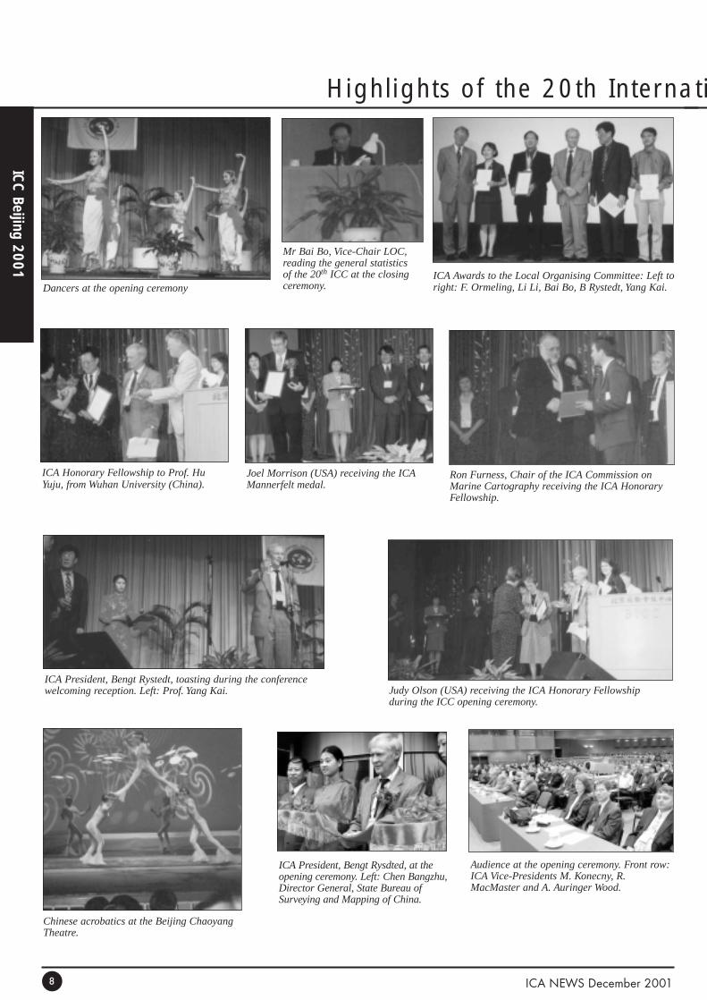
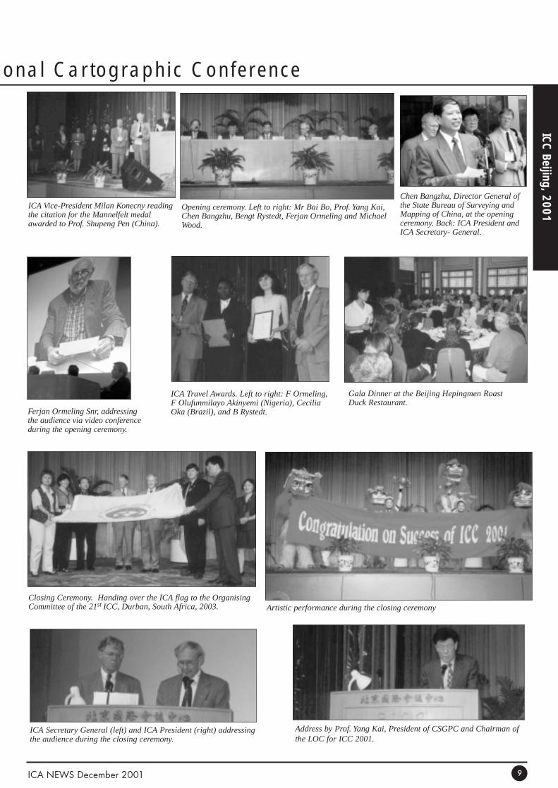
meeting was held on Monday, 6 August, inthe Beijing International Conference Centre.It was chaired by Bai Bo, Vice Chair of theLocal Organizing Committee and ConferenceDirector. Bengt Rystedt, ICA President, gavea short welcoming address to officially openthe conference and introduced the sistersociety representatives. A letter was read byChen Bangzhu, Director General of theSurveying and Mapping Bureau, from theVice Premier of China. Representatives fromsister mapping organizations gave greetingsfrom their respective organizations, includingISPRS (International Society forPhotogrammetry and Remote Sensing), IGU(International Geographical Union), IHO(International Hydrographic Organization),IMTA (International Map Trade Association),UN (United Nations). Mr. Chen also notedthat there were 65 oral sessions, 20 workingmeetings, six technical visits, and five pre- orpost-conference excursions. Video greetingswere presented from Fer Ormeling Sr. formerICA President who had been invited toattend, but was prevented due to healthreasons. Yang Kai, Chair of the LocalOrganizing Committee, indicated that therewere delegates from 54 nations. Memorialmoments of silence were held for JohnKeates, Alexander Liouty, and Olof Hedbom,recently deceased cartographers ofsignificance and ICA participants. BengtRystedt, ICA President, conductedpresentation of awards, assisted by ICA VicePresidents and Judy Olson, Chair of the ICAAwards Committee. There were two of theprestigious Mannerfelt Medals presented, oneto Shupeng Chen of China and the other toJoel Morrison of the USA. In addition, ICAHonorary Fellowships (for specialcontributions to ICA by cartographers ofinternational reputation) were presented toJudy Olson (USA), Hu Yuju (China), KeiKanazawa (Japan), and Ronald Furness(Australia). This was followed by someentertainment including two groups ofdancers, a singer with a very robust voice,and a magician who involved the audience inhis magic. Michael Wood, ICA PastPresident, gave a keynote address on the"21st Century World - No Future WithoutCartography." This is in the proceedings in itsentirety and will probably appear elsewherein some form. His major themes were thescientific and societal challenges facing all of
20th ICC: Sessions & Meetings
ICA NEWS December 2001 3
ICC Report
us and how cartography and cartographers arenecessary for a sustainable future.
SessionsWith these events the meeting really got
underway in general. After a lunch break, thefirst of the oral sessions began. Sessioncomprised map design and production, GISand digital mapping, cartographic theory andmethods, computer generalization of spatialdata, and cartography and the environment.After a break, the afternoon concluded with aplenary session on Global Issues moderatedby ICA Vice President Milan Konecny (CzechRepublic) at which he presented, along withChen Shupeng (China), Gao Jun (China),Vladimir Bessarabov (UN), and Derek Clarke(South Africa). The exhibits, including mapsand technical products, were opened. In theevening, there was a welcoming reception foreveryone which was a buffet of exotic disheswith entertainment by a group of musicians.
On Tuesday, August 7, there werenumerous (20) oral paper sessions, as well astwo poster sessions, technical visits, city andregion tours, and exhibits. Session topicsincluded GIS and digital mapping; mappingon the Internet and the World Wide Web;education and training in cartography; touristmapping and intelligent navigation systems;national and regional atlases; temporal aspectsof cartography; security, pricing and copyrightof cartographic database and digital maps andgeospatial data sharing; history of cartographyand historical maps; spatial data infrastructurepolicies; satellite mapping; cartographictheory and methods; global mapping andmilitary cartography; multimedia cartographyand electronic maps; spatial data visualization;mountain cartography; map design andproduction; computer generalization of spatialdata; and cartography and children and genderin cartography. I visited the Chinese historicalmap exhibit consisting primarily ofreproductions of scroll maps, city and countrymaps and atlases from the first century B.C. tothe early 1900s, including rubbings of stonemaps. It was a bit hard to find this exhibit areadue to the lack of a floor plan of theconference centre in the conference programand confusing signs in the building. Theinternational map exhibit was also visitedwhere we found several Canadian maps onexhibit. Problematic were double-sided mapsof which only one copy had been sent. Theywere laid on tables along with atlases whichmeant finding a particular one to be a verydifficult task, although the Local OrganizingCommittee had prepared an excellent, 365 p.descriptive listing of all maps in all theexhibits. There was also an exhibit of nauticalcharts from many countries.
On Wednesday, there was another plenarysession, on Towards the CartographicResearch Agenda, chaired by ICA PresidentBengt Rystedt (Sweden) featuringpresentations by Dietmar Gruenreich(Germany), Roy Mullen (USA), Liqiu Meng(Germany), and ICA Secretary General FerjanOrmeling (The Netherlands). In addition,there were eight oral presentation sessionsafter it, as well as one poster session,technical tours and city tours. The sessiontopics included GIS and digital mapping,mapping on the Internet and the World WideWeb, map design and production, marine
cartography, spatial data visualization,mountain cartography, education and trainingin cartography, computer generalization ofspatial data, cartography and the environment,satellite mapping, cartographic theory andmethods, global mapping and militarycartography, and national and regional atlases.
On Thursday there were 20 oralpresentation sessions and two poster sessions.The topics included satellite mapping,mapping on the Internet and the World WideWeb, map design and production, national andinternational standards in cartography,cartography and children, cartographic theoryand methods, maps for the handicapped,computer generalization of spatial data, spatialdata visualization, GIS and digital mapping,planet cartography, history of cartography andhistorical maps, geo-spatial data quality andevaluation, national and regional atlases,education and training in cartography,multimedia cartography and electronic maps,and cartography and the environment.
Meeting of ICA CountryRepresentatives
A meeting of 35 representatives from 26ICA member countries and others was heldduring the afternoon. A number of problemswere raised by some of those present. Havingsix parallel sessions with six or seven speakerseach was one complaint, while changes in theorder of presentations from people who didnot show up was another. There wereproblems in understanding some of thespeakers and session chairs, equipment didnot always work, a number of people endedup chairing several sessions, and the problemsof the number of volumes of the proceedingsand getting them back home was raised.Having the poster papers in the proceedingswas appreciated, however. Many supportedhaving registration payments sent with papers,felt that national committees should ensurethat their speakers show up, and that a roomshould be set up where speakers must check-in by a particular time and where a technicalset up could be done in advance. Some briefcommentaries regarding the strategic planwere made. A number of countries supportedthe addition of "The Society for Cartographyand Geographic Information Science" as asub-title to the ICA name. Discussionsregarding the ICA archiving procedures withthe Institut Geographique National in Pariswere held. The procedures are publishedelsewhere or are available upon request. Thissession was followed by another continuationof the Executive Committee meeting. Amongthe highlights were forthcoming conferencebids (three invitations), finances (noproblems), Mongolia will be re-instated as amember, The Turkish Chamber of Engineerswill become an affiliate member, and futureExecutive Committee meetings weretentatively scheduled. In the evening, therewas a "Gala Dinner" requiring another hour-long bus ride to the downtown area to theBeijing Hepingmen Roast Duck Restaurant.While time-consuming, it did give anopportunity to see more of the city which isexperiencing a tremendous amount of growthand building. The dinner featured suchdelicacies as deep-fried scorpions, as well asall the parts of a duck that are edible. Themarch of the cooks with the platters of the
roasted ducks was quite something to see, aswas the carving of them. After dinnerentertainment consisted of toasts by variouspeople and singing by quite a few countrydelegations, including Canada and the USA.
Friday morning, the last day of theconference, began for me with a history ofcartography session including papers onJedediah Hotchkiss and the accuracy of hismaps prepared during the US Civil War in the1860s, historic nautical charts of theMediterranean, digitizing of map archives inSweden, and Daniel Defoe’s 1705 satire "TheConsolidator" about Chinese map makers onthe moon. It was one of five sessions held firstthing in the morning, prior to the ClosingCeremony.
The Closing CeremonyThat ceremony began with a recounting
by Bai Bo of statistics about the conference.There were addresses by ICA President BengtRystedt, the Surveying and Mapping BureauChief Chen Bangzhu, ICA Secretary GeneralFerjan Ormeling and Prof. Yang Kai Presidentof the GSGPC and Chair of the LOC. YangKai noted that the five volumes of theproceedings contained 160 papers, and thatthere were 60 members on the LocalOrganizing Committee. The ICA TravelAwards were presented to Cecilia Maria Oka(Brazil), Richard Olomo (Nigeria), FeliciaOlufunmilayo Akinyemi (Nigeria),and SunXuejuan (Canada), two of whom made it tothe awards session. Appreciation was given tothe keynote speaker and invited speakers.Awards for the nine categories (topographic,nautical, geologic, urban, satellite images ormaps, recreation and orienteering, globes,atlases, and other) of the international mapexhibit were presented. The Children’s MapCompetition winners were announced and arementioned earlier in this report, as well as in aseparate report. Awards for outstandingcontributions to the conference werepresented, including an Honorary Fellowshipin ICA for Bai Bo. The 8th UN Conference onStandardization of Geographic Names wasannounced. There was a performance by anumber of Chinese entertainers followed bythe handover of the ICA flag and the officialclosing of the conference.
All in all, it had been a good conferencewith many experiences of generoushospitality.
Alberta Auringer Wood, ICA Vice-President,Canada
Special recognitionMemorial moments of silence were held
during the opening ceremony for threerecently deceased cartographers ofsignificance and ICA participants. The ICAPresident read the following citations:
John Steven Keatesdied in September1999. John Keates made an outstandingcontribution to international cartographythrough his many students who have madetheir marks in the mapping world and throughhis writings, which included theinternationally- renowned textbookCartographic Design and Productionand hisinsightful critique on modern cartographyUnderstanding Maps. Although he was a quietman who did not seek high office, hecontributed immeasurably to ICA when he
20th ICC: Awards & Recognitions
ICC Report
ICA NEWS December 20014
helped his good friend Carl Mannerfelt inearly discussions about the idea of ICA. Helater made contributions to the Commissionon Cartographic Technology. For hisoutstanding contributions to the field, for thevery special cartographer he was incombining practice and theory, and for hisincredible influence on his students, ICAposthumously bestows Special Recognitionon John S. Keates.
Alexander Liouty died in March thisyear. He was a scientist of national andinternational renown. A familiar face to manyat ICA, he was a long-time participant. He isespecially appreciated for his contribution tothe Commission on Theoretical Cartography.
Olof Hedbom died just a month ago. Hereceived his ICA Honorary Fellowship in1997. He was a well-known contributor tocartographic meetings all over the world formany decades. He was a very active personwith many international contacts andcontributed to international co-operation inthe field of cartography. He served asSecretary General 1976-1984. Olof Hedbomwas always prepared to give his opinion, notseldom controversial and drasticallyformulated.
AwardsICA has two awards. The most
prestigious one is the Carl Mannerfelt GoldMedal. It honours cartographers ofoutstanding merit who have made significantcontributions of an original nature to the fieldof cartography. It is awarded only on rareoccasions to emphasise its distinction. Theother one is the ICA Honorary Fellowship forcartographers of international reputation whohave made special contribution to the ICA.Two Mannerfelt medals and five HonoraryFellowships were delivered during theopening ceremony
The Carl Mannerfelt Gold Medal
Professor Chen Shupengis the honorarydirector of the Institute of Remote SensingApplications of the Chinese Academy ofSciences (CAS). He was the first director ofthe State Key Lab of Resources andEnvironment Information Systems. ProfessorChen initialized in China the research in suchgeo-sciences fields as automated cartography,remote sensing applications and geographicinformation systems (GIS). He accomplishedhis four-volume Probe in Geo-sciences andhas supervised more than 50 graduatestudents at the Ph.D. and MSc levels. He isnow advocating research in geographicinformation science.
He is also the chief expert of the pilotproject Mechanism and Transformation ofRemote Sensing Information (1998) grantedby the National Natural Science Foundation.He has published more than 20 books, atlases,and dictionaries, which have won him 27prizes of various sorts, such as the NationalAward, Distinguished Contribution in China(1991), Special Golden Award forEnvironmental Science (1993), Geo-scienceAward, Liang-He li Foundation of Hong Kong(1996), and the Miller Cartographic Award,The American Geographic Society (1998).
Professor Chen held the full membershipof the Committee of Geographic DataAcquisition of the International Geographic
Union (1984-1991) and was a full member ofthe Committee on Geographic Modelling(1996-2000). As an academician of theChinese Academy of Sciences (1980-), theThird World Academy of Sciences (1992-)and International Eurasian Academy ofSciences (1995-), and a member of editorialboards of three international GIS journals, hesignificantly strengthened internationalacademic cooperation and exchange betweenChina and the world.
For his national leadership, his years ofdistinguished service, and his outstandingcontributions to cartography, Professor ChenShupeng is awarded the Carl Mannerfelt GoldMedal.
Dr. Joel Morrison is currently Professorof Geography and Director of the Center forMapping at Ohio State University. He earnedhis Ph.D. from the University of Wisconsin,Madison, WI, in 1968, his M.Sc. from theUniversity of Wisconsin, Madison, WI, inl964, and his B.A. from Miami University,Oxford, OH, in 1962.
He served as an ICA Vice-President for anumber of years and as ICA President from1984-1987, continuing on the ICA Executiveas Past President for four years, as well. Hewas the recipient of an ICA HonoraryFellowship in 1991, was a member of theBoard of Directors of the International Unionof Surveying and Mapping, a U.S.representative to the ICA Commission onCartographic Communication, Chair of theUnited States Board of Geographic Names,and President of the American Congress onSurveying and Mapping and chair of itsCartography Division, which he wasinstrumental in changing to the AmericanCartographic Association (now Cartographyand Geographic Information Society). He wasone of the organizers of the CartographySpecialty Group of the Association ofAmerican Geographers (AAG) and recentlywas the AAG Treasurer. In 1999, he wasawarded the Anderson Medal, the highesthonour of the AAG Applied GeographySpecialty Group which was bestowed inrecognition of highly distinguished service tothe profession of geography.
His distinguished employment careerincludes service in major governmentagencies, including Assistant Division Chieffor Research in the National MappingDivision of the United States GeologicalSurvey, and Chief of the Geography Divisionof the U.S. Census Bureau. In addition, hetaught for many years at the University ofWisconsin--Madison, where he educated andinspired numerous cartography andgeography students and served as chair ofDepartment of Geography.
Dr. Morrison is the one of the long-timeco-authors of Elements of Cartography, theclassic English-language resource incartography. It provides a solid conceptualfoundation in the basic principles ofcartography while introducing thetechnological advances, which have greatlyaltered modern cartographic techniques. Hehas been associate editor and seniorconsultant to Goode's World Atlas, and hisinnovative and stimulating articles haveappeared in professional journals worldwide,and his thought-provoking presentations arealways on the forefront of developments inthe field.
For his leadership in cartography, for hispositive influence on mapping and relatedprograms in the United States and othercountries, and for his outstandingcommitment to the profession of cartography,Dr. Joel L. Morrison is awarded CarlMannerfelt Gold Medal.
ICA Honorary Fellowships Dr. Judy Olson is professor of geography
at the Michigan State University at EastLansing. Dr. Olson received her B.A., M.A.and Ph.D. from the University of Wisconsin.After graduating from Wisconsin, she hasheld academic positions at the University ofGeorgia, Boston University, and morerecently Michigan State University.
Dr. Olson's seminal research has focusedon cartographic communication, design andsymbolization. Her early projects included theimprovement of dot mapping techniques, anda focus on the cognitive aspects ofcartography. More recently, Dr. Olson'sresearch has looked at colour theory and useon maps, including the design of maps forpersons who are colour blind. At all of herteaching positions, she has educated some ofthe very best and brightest graduated students.
Dr. Olson's professional service to theprofession of cartography has been nothingshort of exceptional. She has served asAssociate Editor and Editor of the journal TheAmerican Cartographer, now Cartographyand Geographic Information Science,President of the Association of AmericanGeographers, Chair of the AAG's CartographySpecialty Group, and Chair of the GeographyDepartment at Michigan State University. Formany years she served as chair of the USNational committee for ICA. She served asVice President of the InternationalCartographic Association (1992-1999). Shetook over this position at short notice after theunfortunate premature death of BarbaraPetchenik. As Vice President she had manyproactive contributions and involvement inrunning the EC business and played a leadingrole in organising commission chair andnational delegates meetings. In thecommission on theory of cartography shecontributed to the redefinition of cartography.
Prof. Hu Yuju is a professor incartography in Wuhan University. He is wellknown in cartography in China and haspublished over ten books on cartography,especially on map projections. He was amember of the first delegation of the ChineseSociety for Geodesy, Photogrammetry andCartography to the ICA, that is to the 6th ICAGeneral Assembly in Tokyo in 1980 whenChina joined ICA as a national member. Hewas ICA Vice President for 2 terms in theperiod of 1984-1991. Prof. Hu Yuju hasactively participated in the organization of theSeminar on Computer-aided Cartography inWuhan in 1981 and the Seminar on AdvancedCartographic Education and Training inWuhan in 1986. He was the organizer of theICA Executive Committee meeting in Wuhanin 1990, including many other ICA activitiesin the last 20 years.
Mr. Kei Kanazawa has been a fullmember of the ICA Commission onEducation and Training (CET) since 1964. Hehas participated in the writing and editing ofthe ICA publication "Basic Cartography" andthe accompanying Exercise Manual. He has
20th ICC: Awards & Recognitions
20th Aw
ards
ICA NEWS December 2001 5
lectured at the Seminars of the CET in Wuhan,China in 1986; in Prague, Czech in 1987; inBangkok, Thailand in 1991 and 1994; and inat least seven additional locations in the1990s.
Ron Furnessis internationally known forhis work in hydrographic cartography, and hasmade an outstanding contribution to ICA asChair of the Commission on Marine Mapping.He successfully convened the CoastGIS seriesand has been an active participant in manyICA functions.
International MapExhibition Awards
The jury for the official CommitteeAwards consisted of:
Mrs Li Li, Prof Ferjan Ormeling, Mr FanYi, Prof Vladimir Tikunov, Mr Sjef van derSteen, Prof Alexander Wolodtschenko, ProfRobert Weibel, Mr Fan Jingsheng, MrTimothy Trainor, Mr Ron Furness, Prof EvaK.Blum, and Prof Menno-Jan Kraak. The following categories were discerned:1. Topographic maps2. Nautical charts and bathymetric maps3. Geological maps4. Urban maps5. Satellite images and satellite image maps6. Recreation and orienteering maps7. Atlases8. Globes9. Other cartographic material
The jury picked a winner for each of thesecategories:
Topographic maps:sheet 15, Antwerpen,of the new digitally produced topographic mapseries 1: 1:50 000 of Belgium, NGI (CatalogueBE06)
Nautical Charts and bathymetric maps:Bathymetry of Lake Ontario, NOAA, USA(US25)
Geological maps:Geological map ofRussia and adjacent areas. Russia (CatalogueRU16)
Urban maps: Top Swiss ErlebniskarteSt.Moritz. Switzerland (Catalogue CH05)
Satellite images and satellite imagemaps: Landscape map of the KarkonoszeNational Park, Poland (PL17)
Recreation and orienteering maps:Mapa Excursionista Gavarnie-Ordesa. Spain(Catalogue ES26)
Atlases :The National Physical Atlas ofChina. China cartographic Publishing House(Catalogue CN03)
Globes: Illuminated Political Globe (inChinese and English-language versions),China Cartographic publishing house andBoom Cart.Prod.Co., Ltd (Catalogue CN94)
Other cartographic material: NationalGeographic ‘Millennium in maps’ mapsupplements (esp. Biodiversity) (CatalogueUS38)
IHO Map Exhibition AwardThe Jury of the IHO map exhibition award
was composed by: Radm Giuseppe Angrisano,IHB President (Chairman), and Ron Furness,Chairman of the ICA Commission on MarineCartography; Prof.Harold Moellering,Chairman, ICA Commission on Spatial DataStandards; Mr Wang Jinfu, Depity-Director,Maritime Safety Administration, China; Ing en
chef Michel Huet, IHB Professional Assistantfor Cartography.
The winner was the Maritime SafetyAdministration, China
ICA Travel AwardsThe jury of the Travel Awards consisted of
Prof Bengt Rystedt, Prof Ferjan Ormeling andMrs Li Li. They had selected the followingwinning entries:
– Richard Olomo for his paper The impactof human factors on the retrieval ofinformation presented with cultural symbolson Nigerian Topographic maps;
– Cecilia Oka for her paper Theproduction and use of tactile maps in SaoPaulo, Brazil. An overview and perspectives;
– Felicia Akinyemi for her paperGeographic targeting for poverty alleviation inNigeria: a GIS approach;
– Xuejuan Sun for her paperBalancingtourism and conservation in the Tianmu Shanbiosphere reserve, China.
Awards of OutstandingContributions to the 20th ICC
Profs. Chen Bangzhu, Yang Kai, BengtRystedt, Ferjan Ormeling, Mrs Li Li and MrWang Qian provided all of the volunteers whohad contributed, manned the desks, lookedafter the equipment, etc, with honorarydiplomas.
After that ICA president Bengt Rystedtpossessed himself of the microphone andasked Mr Bai Bo to come forward in order tohand him an honorary fellowship of theInternational Cartographic Association, for hisservices to cartography in his capacity asConference Director for the 20th ICC. He thenawarded to Mrs Li Li, Prof Yang Kai and MrWang Qian diplomas for their outstandingservices.
Ferjan Ormeling ICA Secretary General
2001 Barbara PetchenicChildren’s World Map Award – Winners
25 countries entered with 116 officialmaps displayed. There were also an additional24 maps displayed from five of the countries.Eight Awards were made by the AwardsCommittee. These best represented the themeof "Save the Earth" or "Préservons la terre."The judges were:
Alberta Auringer Wood (ICA VicePresident, Canada, Chair, Judging Committee)
Jacqueline Anderson (Chair of Childrenand Cartography Commission, Canada)
Reinhard Herzig (Member, Children andCartography Commission, Germany)
Elri Liebenberg (ICA Vice President,South Africa)
Xu Gencai (Local Organizing CommitteeRepresentative, China)
The judges focused on three criteria: 1) arecognizable message, 2) cartographic content,and 3) quality of execution. Peter van derKrogt (The Netherlands) prepared the CD-ROM from which images of the awardwinners were displayed. The countries weregrouped accordingly:1. North America (2 countries) - one award
(Ms. Wood and Ms. Anderson abstained)2. South America (3 countries) - one award
3. Africa, Australia and New Zealand - oneaward (Ms. Liebenberg abstained)
4. Asia (China, Japan and India) - one award(Mr. Xu abstained)
5. Middle East (Israel, Iran) - one award6. Europe (11 countries) - three awards (Mr.
Herzig abstained)
Brazil (BR02)Title: Sauver la Terre: preserver l’environmentaujourd’hui c’est assurer la vie demainAuthor: Jacqueline C. Camargo, Age: 11School: Travessa Jacob Budel, 36, Bocaiuva do Sul
Canada (CA01)Title: Save the EarthAuthor: Patricia Lan, Age: 12School: Glenlyon-Norfolk School, Junior GirlsCampus, 801 Bank St., Victoria, B.C.
Greece (GR02)Title: [In Greek]Author: Stelios Petrakis, Age: 15School: Trilofos Thessaloniki
Hungary (HU06)Title: Wake up, Man! Perhaps It is Not Too Late!Author: Kristof Barsony, Age: 8School: Catholic Elementary and Secondary School,2072 Zsambek, Zichy ter 3
India (IN03)Title: Save the EarthAuthor: Ankita Lamba, Age: 11School: Convent of Jesus and Mary, 16 ConventRd., Dehra Dun, Uttaranchal
Iran (IR03)Title: Save the EarthAuthor: Saba Sameti, Age: 11School: Edalat Secondary School, IsfahanUniversity Campus, 81744 Isfahan
Slovakia (SK01)Title: [Not given]Author: Michaela Klimentova, Age: 12School: Zakladna skola, ul. Frana Krala 838, 966 81Zarnovica
South Africa (ZA02)Title: Save the EarthAuthor: Bonnie Ras, Age: 14School: Hoerskool Menlopark, PretoriaThe public attending the exhibit also voted. Therewere 495 ballots received. The top three choices asfavourites were:
Iran (IR03): 77 votesTitle: Save the EarthAuthor: Saba Sameti, Age: 11School: Edalat Secondary School, IsfahanUniversity Campus, 81744 Isfahan(This map was also selected, as noted above, by thejudging committee).
Hungary (HU02): 53 votesTitle: ContinentsAuthor: Virag Kelle, Age: 15School: Bethlen Gabor Secondary School, 1115Budapest, Bartok Bela ut 141
Canada (CA01) 52 votesTitle: Save the EarthAuthor: Patricia Lan, Age: 12School: Glenlyon-Norfolk School, Junior GirlsCampus, 801 Bank St., Victoria, B.C.(This map was also selected, as noted above, by thejudging committee).
Jacqueline Anderson and Alberta AuringerWood
2001 Barbara Petchenic Winners
Children Map Com
petition
ICA NEWS December 20016
Jacqueline C. Camargo, Age: 11, Brazil.
Patricia Lan, Age 12, Canada.Stelios Petrakis, Age 15, Greece.
Ankita Lamba, Age 11, India.
Saba Sameti, Age 11, Iran.
Michaela Klimentova, Age 12, Slovakia.
Bonnie Ras,Age 14, South Africa.
Kristof Barsony, Age 8, Hungary.
Mapping in the Century
Reports
A View from RussiaThe 20th International Cartographic
Conference of ICA being the first one inpresent century has taken place under the motto" Mapping in the XXI century " in Beijing.Before the beginning of the Conference,seminars and meetings of ICA commissionshave been passed from July 30 till August 5.The seminar of the commission on the Nationaland Regional Atlases chaired by TimothyTrainor (USA) was held at the Institute ofGeographical Science and Research of NaturalResource of the Chinese Academy of Science.
The large interest of the participants of thisseminar was stimulated by the exhibition of theChinese atlases, on which 132 atlases and seriesof maps issued in traditional printing and onCD-ROM's during last years were represented.There were three volumes of the National Atlasof China (physical-geographical, economic,agricultural), atlases of the population, history,climatic, woods, vegetation, soils, powerresource, natural disasters, protection of nature,transport, provinces, cities, tourist, old mapsand many others.Such broad spectrum issued inChina scientific - reference, thematic and touristmaps and atlases characterizes the promptdevelopment of cartography in this country andalso proper scientific researches in variousbranches of knowledge. The Chinesecartography is doubtlessly at the first line ofmodern cartography in the world on variety ofsubjects of the atlases and depth of their study.
The analysis of the papers submitted on theConference, and exhibits of the exhibitionsshows that today the main directions ofdevelopment of modern cartography andgeoinformatics are global mapping, applicationof satellite technologies and communicationchannels for obtaining, processing andtransmitting of the spatial data, creation ofelectronic maps. Besides this it is noticeable theincreased attention to the most different aspectsof cartographic education, theoreticalcartography, and planetary cartography. On allthese directions the cooperation is intensifyingbetween national cartographic organizations.The partnership of research organizations, higheducational establishments, state and privatecartographic enterprises is getting stronger andcloser.
Global mapping and the volume of materialdevoted to it claims the main role in moderncartography and geoinformatics. First of all it isdiscussed the creation of the Digital Earth,though it is possible already to speak both aboutthe Digital Universe and about digital countries,cities etc. Its essence consists of construction ofunified geoinformatic space on the Earth globeand construction of a unified geoinformaticstructure. A number of the most developedcountries create the national geoinformaticstructures. The Digital Earth is sometimesconsidered as " new information era ". Spacesurvey of our planet with high resolutionimages, computer processing of the spatial dataand use of telecommunication technologiesforms its basis.
The USA and China are especially active inthis field. The Digital Earth is understood astopographical three-dimensional representationof a planet, in raster and vector form, withvariable resolution (up to 1 m), permitting toaccumulate huge volumes of the thematicinformation at different scales. Corresponding
to planetary cartography development the nextstep in this direction should become thecreation of similar models for other bodies ofthe Solar system.
The Russian point of view was representedby the Institute of Problems of ComputerScience of the Russian Academy of Science.There were six papers reflecting the scientificparadigm of the Electronic Earth as a complexsystem of the digital description of our realplanet and its virtual portrait with use ofnational information and computing resources,methods and technologies for the processing ofvolumes of multi-thematic information aboutthe Earth. The papers also covered systems forelectronic mapping of the Earth; fundamentalsof spatial and temporal data integration of thelithosphere, hydrosphere, atmosphere andbiosphere; the creation of object-relationalknowledge bases about the Earth; highintellectual technologies; telecommunicationnetworks; expert cartographic systems with anartificial intelligence and GIS; and statestandards of electronic maps.
The theoretical problems of cartographyremain one of the important directions ofresearch of scientists - cartographers in differentcountries of the world. Map language was oneof the known theoretical problems ofcartography discussed during the conference,which speaks about its increasing role inmodern cartography. Language of a map in thepapers submitted by scientists from Canada,Poland, Russia, Germany was considered fromthe different perspectives: syntax (local syntaxof a map language, syntax components of thecartographic sentence), pragmatics, typology ofsigns and evolution, and also capability ofsemantic search in digital geolibraries.
All aspects of cartography were discussedin a number of sessions devoted to educationand training. Besides this, it was pleasant tonote that the problems of education haveattracted attention of the representatives ofalmost all the delegations, including such smallcountries as Papua New Guinea.
Regarding the so called "papers of a newwave " we noticed the presentation of D.Taylor(Canada) on the teaching cyber-cartography (itis connected with the representation of theworld multidimensionality in variousmultimedia submissions). Alarge interest shown byresearchers working ondistance education.
In the field on planetarycartography the large interestwas called by thepresentation of RandolphKirk (chair of ISPRS WG onExtraterrestrial Mapping)about the activities of theUSGS USA on geodesy andmapping of Solar systembodies including satellites ofgiant-planets and asteroids.The research headed by EgonDorrer (Institute forPhotogrammetry andCartography, MunichBundeswehr University,Germany) on reliefrepresentation of the surfaceof Mars by combination ofdigital elevation model andshape from shading also
received special attention. Likewise, the papersdevoted to the history of the Chinesecartography were received with particularinterest. Due to several reasons, this field hasremained poorly known to cartographers ofother countries for a long time, in comparison,for example, with European or Americancartography.
Representatives of Russia head the activityof two commissions, namely on education andtraining and on planetary cartography. Duringthe conference, the ICA commission onEducation and Training chaired by VladimirTikunov has considered the state of theactivities related to the creation of aninternational Internet-Course on Cartography.This Commission (http: //www.geogr.msu.su/cet) should ensure aneducational and scientific level of the course.The fundamental problem resides in creating acertain standard for such courses onCartography, which all people interested incartography and cartographic education coulduse as a guide. The structure of a prospectivecourse will consist of various directions ofmodern cartography investigated on selection.The technical and legal aspects of such coursestill require discussions and adaptations, but, asthough "in an ideal world", the ICACommission would like to see the coursecharge-free, with a capability to freely copyinteresting materials.
The commission on Planetary Cartographychaired by Kira Shingareva considered theresults of activities undertaken in currentprojects (http://www.nasm.edu/ceps/ica). Firstof all, the creation of a series of multilingualmaps of planets and their satellites, and alsocreation of a multilingual glossary on planetarycartography. Mars Map and Venus Mapsbelonged to the series were presented. Theprinted preliminary version of the glossary wasdiscussed too. Besides, the discussion of thenew project, namely creation of a cartographicdatabase on planetary cartography, has takenplace.
Lastly, we would be very glad to organizethe next ICA Congress in Russia in 2007.N. Komedchikov, A. Martinenko, K.Shingareva and V. Tikunov
ICA NEWS December 2001 7
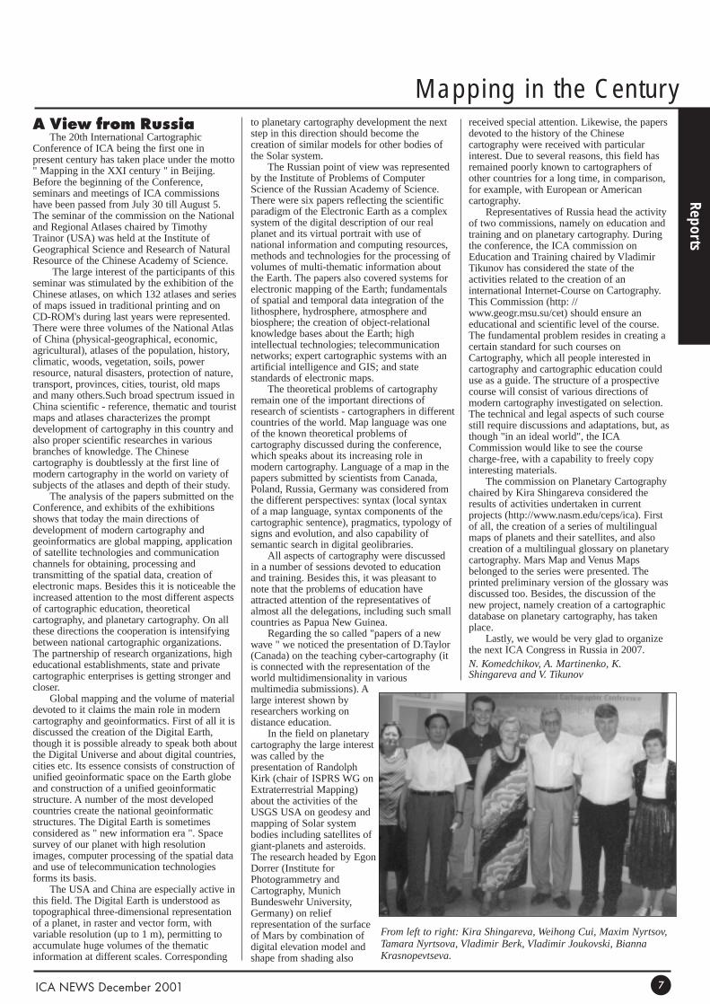
From left to right: Kira Shingareva, Weihong Cui, Maxim Nyrtsov,Tamara Nyrtsova, Vladimir Berk, Vladimir Joukovski, BiannaKrasnopevtseva.
Highlights of the 20th Internati
ICC Beijing 2001
ICA NEWS December 20018
Dancers at the opening ceremonyICA Awards to the Local Organising Committee: Left toright: F. Ormeling, Li Li, Bai Bo, B Rystedt, Yang Kai.
ICA Honorary Fellowship to Prof. HuYuju, from Wuhan University (China).
Judy Olson (USA) receiving the ICA Honorary Fellowshipduring the ICC opening ceremony.
Joel Morrison (USA) receiving the ICAMannerfelt medal.
ICA President, Bengt Rysdted, at theopening ceremony. Left: Chen Bangzhu,Director General, State Bureau ofSurveying and Mapping of China.
Chinese acrobatics at the Beijing ChaoyangTheatre.
Audience at the opening ceremony. Front row:ICA Vice-Presidents M. Konecny, R.MacMaster and A. Auringer Wood.
ICA President, Bengt Rystedt, toasting during the conferencewelcoming reception. Left: Prof. Yang Kai.
Mr Bai Bo, Vice-Chair LOC,reading the general statisticsof the 20th ICC at the closingceremony.
Ron Furness, Chair of the ICA Commission onMarine Cartography receiving the ICA HonoraryFellowship.
ICC Beijing, 2001
ICA NEWS December 2001 9
ional Cartographic Conference
Closing Ceremony. Handing over the ICA flag to the OrganisingCommittee of the 21st ICC, Durban, South Africa, 2003.
ICA Vice-President Milan Konecny readingthe citation for the Mannelfelt medalawarded to Prof. Shupeng Pen (China).
Opening ceremony. Left to right: Mr Bai Bo, Prof. Yang Kai,Chen Bangzhu, Bengt Rystedt, Ferjan Ormeling and MichaelWood.
ICA Secretary General (left) and ICA President (right) addressingthe audience during the closing ceremony.
ICA Travel Awards. Left to right: F Ormeling,F Olufunmilayo Akinyemi (Nigeria), CeciliaOka (Brazil), and B Rystedt.
Chen Bangzhu, Director General ofthe State Bureau of Surveying andMapping of China, at the openingceremony. Back: ICA President andICA Secretary- General.
Ferjan Ormeling Snr, addressingthe audience via video conferenceduring the opening ceremony.
Gala Dinner at the Beijing Hepingmen RoastDuck Restaurant.
Address by Prof. Yang Kai, President of CSGPC and Chairman ofthe LOC for ICC 2001.
Artistic performance during the closing ceremony
ICC 2005
Reports
ICA NEWS December 200110
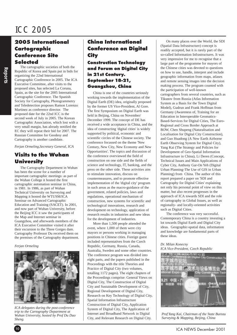
China InternationalConference on DigitalCityConstruction Technologyand Forum on Digital Cityin 21st Century.September 18-21,Guangzhou, China
China is one of the countries seriouslyworking towards the implementation of theDigital Earth (DE) idea, originally proposedby the former US Vice-President, Al Gore.The first Symposium on Digital Earth washeld in Beijing, China on November/December 1999. The concept of DE hasreceived a wide acceptance in China, and theidea of constructing 'digital cities' is widelysupported by political, economic andscientific circles of the Chinese society. Theconference focussed on the theme 'NewCentury, New City, New Economy and NewOpportunities'. The topics and discussion ofthe conference overviewed the field ofconstruction on one side and the fields ofscience and technology, IT, banking, and thepress on the other side. These activities aimto stimulate innovation, discuss oncountermeasures, and to promote effectiveimplementation of the 'digital city' programin such areas as the macro-guidance of thegovernment, related policies, laws andregulations, operational mechanism ofconstruction, new systems for scientific andtechnological innovations, research anddevelopment on technology, application ofresearch results in industries and new ideasfor the development of industries.
More than 1,500 people attended theevent, where 1,000 of them were citymayors or persons working in managingpositions in Chinese cities. Foreign guestincluded representatives from the CzechRepublic, Germany, Russia, Canada,Australia, Sweden and some other countries.The conference program was divided intoeight parts, and the papers published in theProceedings with the title Theories andPractice of Digital City (two volumes,totalling 1172 pages). The eight chapters ofthe Proceedings comprise: General Views onDigital City, The Construction of DigitalCity and Sustainable Development of City,Regional Development of Digital City,Research on Key Technology of Digital City,Spatial Information InfrastructureConstruction of Digital City, ApplicationSystem of Digital City, The Application ofInternet and Broadband Network in DigitalCity, and Relevant Research on Digital City.
On many places over the World, the SDI(Spatial Data Infrastructure) concept isreadily accepted, but it is rarely part of theso-called Information Infrastructures. It wasvery impressive for me to recognise that alarge part of the programme for mayors ofthe Chinese cities was devoted to questionson how to use, handle, interpret and includegeographic information from maps, atlasesand remote sensing images into the decisionmaking process. The program counted withthe participation of well-knowncartographers from several countries, such asTikunov from Russia (Atlas InformationSystem as a Basis for the Town DigitalModel), Gudrun and Frank Hoffman fromGermany (Awareness of, Training for anEducation in Interoperable Geomatics-Based-Services for Digital Cities, The Euro-Regional and Cross Border Approach atBOW, Chen Shupeng (Naturalisation andLocalisation for Digital City Construction),and Guo Huadong (A New Earth AirborneEarth Observing System for Digital City),Yang Kai (The Strategy and Policies forDevelopment of Geo-Spatial InformationInfrastructure in China), Li Deren (Concept,Technical Issues and Main Applications ofCyber City, Anthony Gar-On Yeh (DigitalUrban Planning-The Use of GIS in UrbanPlanning) from China. The author of thisreport prepared a paper on 'SDI andCartography for Digital Cities' explainingnot only his personal point of view on thismatter, but also recent progresses in theapproach of ICA towards SDI and the roleof cartography in Global Issues, as well asregionally- and locally-oriented activitiessuch as Digital Cities.
The conference was very successful.Contemporary China is a country investing alot towards Digital Earth and Digital Cityideas. Geographic-spatial data, informationand knowledge are fundamental parts ofthese ideas.
Dr. Milan KonecnyICA Vice-President, Czech Republic
2005 InternationalCartographicConference SiteSelected
The cartographic societies of both theRepublic of Korea and Spain put in bids fororganizing the 22nd InternationalCartographic Conference in 2005. The ICAExecutive Committee, after visits to theproposed sites, has selected La Coruna,Spain, as the site for the 2005 InternationalCartographic Conference. The SpanishSociety for Cartography, Photogrammetryand Teledetection proposes Ramon LorenzoMartinez as conference director. Theproposed date for the 22nd ICC is thesecond week of July in 2005. The KoreanCartographic Association, which lost with avery small margin, has already notified theEC they will repeat their bid for 2007. TheRussian Committee for Geodesy andCartography is another candidate.
Ferjan Ormeling,Secretary General, ICA
Visits to the WuhanUniversity
The Cartography Department in Wuhanhas been the scene for a number ofimportant cartographic meetings: as part ofthe Wuhan College it hosted the firstcartographic automation seminar in China,in 1981. In 1986, as part of WuhanTechnical University on Surveying andMapping it hosted the WTUSM/ICASeminar on Advanced CartographicEducation and Training (SACET). In 2001,and now part of Wuhan University, beforethe Beijing ICC it saw the participants ofthe Map and Internet seminar inGuangzhou, and afterwards members of theICA Executive Committee visited it aftertheir excursion to the Three Gorges dam.Cartography Professor Du received them onthe premises of the Cartography department.
Ferjan Ormeling
ICA delegates during the post-conferencetrip to the Cartography Department atWuhan University, hosted by Prof Du DaoSheng.
Prof Yang Kai, Chairman of the State BureauSurveying & Mapping, Beijing, China
Conference Reports
Reports
ICA NEWS December 2001 11
19th InternationalConference on theHistory of Cartography
The 19th International Conference on theHistory of Cartography was hosted by theNational Library of Spain in Madrid from 1to 7 July 2001. The Conference was organisedby the National Library of Spain, the SpanishNaval Museum, the Complutense Universityand Imago Mundi Ltd. The main theme of theconference was the Cartography of Spain andIberoamerica, but papers on other aspects ofthe history of cartography were also presented.Approximately 175 participants registered forthe conference of which 55 presented papers.24 poster papers were exhibited.
The International Society of Curators ofEarly Maps (ICSEM) held a meeting onSaturday 30 June, debating the security aspectsof rare map collections. This was followed bya meeting of the Commission on the History ofCartography of the ICA. During this meetingthe Secretary-General of the ICA, FerjanOrmeling, discussed the work done jointly bythe Commissions on Education and Training,and the History of Cartography, on Teachingthe History of Cartography. In the absence ofthe commission chair, Christopher Board, ElriLiebenberg highlighted the ICA Commission’sterms of reference and the progress made withthe Carto-Bibliography on the History ofNational MappingAgencies.
During the conference, a number ofexcellent cartographic exhibitions were ondisplay. The most important was Treasures ofSpanish Cartography, presented by theNational Library of Spain. The ComplutenseUniversity staged an exhibition on GeographyBooks in the University: from Antiquity to the18th Century, whereas the development of theSpanish capital could be traced in aninteresting exhibition called Madrid seenthrough its maps: 1622-2001, presented at thePlaza Mayor.
One of the most memorable highlights ofthe conference was a visit to the RealMonasterio de El Escorial where lunch wasserved and where one of the sessions of theconference dealing with the mapping of Spaintook place. Everybody agreed that themagnificent monastery was the ideal venue fora discussion of matters historical.
Elri LiebenbergICA Vice-President, South Africa
The second symposium onDigital Earth
The Digital Earth (DE) program, firstannounced by the former US Vice President AlGore two years ago, sounded futuristic, butsome elements of this vision might soonappear as real products. In fact, the DE
initiative is the second step of very successfulspatial data infrastructures activities in manycountries of the World, especially USA,Australia, and Canada. This is also one of theglobal spatial data oriented projects which arecontemporarily developed over the World(GSDI, Global Map, UN GDB, and also theGlobal Disaster Information Network, GDIN).
The series of symposia on DE started onNovember/December 1999 in Beijing, China(see ICA News, June 2000, p. 9). TheFredericton symposium was held under thepresidency of the Prof. Dave Coleman, andcounted with strong support from industrialand scientific/research groups of Canada.Under the umbrella several importantconferences and meetings were held. TheNational Conference on Geomatics and theCanadian Institute of Geomatics AnnualGeneral Meeting, the Geomatics Atlantic 2001Conference, TExpo 2001, and the AnnualWorkshop of the Committee for EarthObservation Satellites Working Group onInformation Systems and Services were heldunder the umbrella of the Second InternationalSymposium on Digital Earth. Co-hosted by theCanadian Institute of Geomatics/NewBrunswick Branch and the Greater FrederictonEconomic Development Corporation, inpartnership with Geomatics Atlantic andTEXPO Technical Exposition, Digital Earth2001 was a showcase of some of the world'smost exciting innovations in the managementand dissemination of geographic data.Additional support was provided fromconference sponsors NASA, Natural ResourceCanada, CARIS, New Brunswick andUniversity of New Brunswick.
Digital Earth addresses the cultural,institutional, scientific and technicalchallenges that allow citizens, scientists,planners and policy makers to visualise theEarth, and all places within it, to accessinformation about it and to understand andinfluence the social, economic andenvironmental issues that affect their lives intheir neighbourhoods, their countries and theEarth. The concept is expected to eventuallyencompass all the geological, geographical anddemographic information collected aboutEarth and its inhabitants. That would enablescientists, teachers, policy-makers or anyoneelse to develop detailed analyses of featuresand phenomena as small as one meter in size.
However, Digital Earth is more than just amapping application. The program has thepotential to become a framework for anenormous range of information that can bepinpointed to a single geographic point onEarth, including cultural and scientific data.By layering this information over thegeographic framework, proponents say, DigitalEarth could lead to a much broaderunderstanding of events that affect peoplearound the world, from natural phenomena tocultural and political issues.
Every day of the Fredericton conferencestarted with a keynote speech. These speecheswere one of the most successful idea of thesymposium. Among the speakers were: JackPellicci, Group Vice President, GlobalBusiness Development, Oracle Corporation;Klaus Barwinski, Direktor desLandesvermessungsamtes Nordrhein-Westfalen; Timothy Foresman, Director of theDivision of Early Warning and Assessment,UN Environment Program, Nairobi, Kenya;and Bill Stoehr, National Geographic Maps.
The program of the conferenceconcentrated mainly on remote sensing andGIS topics. All speakers mentioned theimportance of maps, and at least two keynotespeeches gave a very strong signal thatcartography is here and in certain situations itis the only discipline able to provide answersfor new questions and create solutions for newtasks. The first keynote speaker, Jack Pellicci,said: "Location and spatially aware enterprisesare the thing of the future". Several times hehighlighted that GIS is still growing butmapping, especially in connection withmobile communication tools, has beendeveloping progressively faster in last months.The presentation by Mr. Stoehr discussed theinformation richness of maps, and hownecessary they are to support, in combinationwith remote sensing, GPS and other tools,decisions on Global Issues. Later this year,ICA also devoted one of the two PlenarySessions of the 20th International CartographicConference to Global Issues and the role ofcartographers in it.
The author of this report is also member ofthe Steering Committee of the DE which ischaired by Lu Yongxiang as the President andGuo Huadong as Secretary General. TheCommittee's discussion focussed on whetherto join DE and GSDI as a spatial data orientedactivity or to keep them separately. It is alsovisible the emergence of two branches of theDE development: the original U.S., orientedmore for technological aspects of the DE, andChina Europe, Japan and others looking forDE from wider perspective, mainly enhancingsustainable development and informationsociety aspects. The place of next symposiumwill be decided later in 2001. The CzechRepublic has presented a written candidacy.
DE it is today not only spatial data andinformation. It means also e-government, e-education and life long learning, e-commerce,telemedicine and many new "e" which will bedeveloped. Other programs are following thebasic idea of DE, such as very strong and fastdevelopment of the Digital Cities in China orDigital Europe in member states of EuropeanUnion. In all these activities cartographers andas well as spatial data specialists are necessary.The question of SDI and cartographicinterpretation and visualisation are hot topicsat many places of our World.
Dr. Milan KonecnyICA Vice-President, Czech Republic
Commissions’ Reports
Reports
ICA NEWS December 200112
ICA Commission onMountainCartography
The International CartographicAssociation Commission on MountainCartography will be holding its 2002Mountain Cartography Workshop at 6,000feet/1,829 meters above sea level on thevolcanic slopes of Mt. Hood, Oregon. Theworkshop is held biannually and covers alltopics related to mountain mapping,including avalanche mapping, geo-visualization, relief presentation,photogrammetry, remote sensing,multimedia, software development, touristmapping, GPS, and much more.
The 2000 Mountain CartographyWorkshop at Rudolfshütte, Austria attractedparticipants from 8 nations. In May 2002,we invite you to join us at TimberlineLodge, the first ICA Mountain CartographyWorkshop to be held in North America forthree days of applied cartography andprofessional interaction in an informalmountain setting. The call for papers is nowout. Details can be found at: http://www.nps.gov/carto/hood/mt/index.htmlDate: May 15-19, 2002Venue: Timberline Lodge,Mt. Hood, Oregon, USAContacts:Tom Patterson ([email protected])Karel Kriz ([email protected])Lorenz Hurni ([email protected])
Lorenz HurniChair, ICA Commission on MountainCartography
TheoreticalCartography Meetingin Beijing
The Commission on TheoreticalCartography (CTC) held its second Meetingin Beijing, China on Wednesday, August 8,2001 during the 20th ICA Conference.Seventeen members of the Commission andfriends of theoretical cartography met in themorning in Meeting Room 3058 of theBeijing International Cartographic Center.The topics of Meeting were:• Chair's report related on the Commission
activities for 1999-2001(A.Wolodtschenko)
• Commission poster for 20th ICC(T.Morita and A.Wolodtschenko)
• Presentation of the CommissionProceedings of a Seminar "The SelectedProblems of Theoretical Cartography
2000", Dresden, Germany, October 14-15, 2000 (A.Wolodtschenko)
• Cartosemiotic project (H.Schlichtmann)• Terminological project (T.Morita)• Translation of the Book "Cartosemiotic
and prehistoric maps" (T.Kanakubo)• New German Cartographic
Encyclopaedia (W.G.Koch, presented byA.Wolodtschenko)
• Next Seminar in Gdansk 2002, Poland(P.Neytchev, presented byA.Wolodtschenko)
• Next Commission Meeting in Durban,South Africa, during the 21th ICAConfernce 2003 (A.Wolodtschenko)
• Miscellanea and discussion. Our Commission is a new commission
that was established at the 1999 ICAconference in Ottawa. By now the CTCincludes 25 members from 17 countries andfour continents. The key themes for theperiod 1999-2003 are: cartosemiotics, maplanguage, mapping as a cognitive processand terminology. As a rule, the CTCmembers research individually, sometimes ina small groups projects. The CTC willconcentrate on the next main events: GdanskSeminar "The Selected Problems ofTheoretical Cartography 2002" and theDurban ICA Conference 2003.
Alexander WolodtschenkoChair, ICA Commission on TheoreticalCartography
ICA Commission onMap Production Compendium of cartographictechniques
During the meeting held in Beijing,there was a discussion about the format ofthe Compendium. At present it is thought asa ‘book’. However, the time it takes to getall the text means that some material is datedby the time it is published. One suggestionwas to publish it on the web as the materialbecomes available and then considerpublishing as a single book when ready.There needs to be further discussion aboutthis matter. The manuscript will becompleted by the end of 2001, after whichJarl and Sjef will make the final editing.
CMP WebsiteS. Iversen reviewed the website and
discussed how it should evolve. It wassuggested that all of the CMP projectsshould be available on the site. There wasconsiderable discussion about how to makethe site better.
SeminarsCuba 2000: The program went well. The
commission wants to be able to present thistype of program on-demand.
Barcelona 2000: As a result of the goodevaluations, there was a suggestion from theBarcelona and Cuba seminar that CMPshould hold workshops with otherCommissions.
Next Meeting:Cuba in February 2002.There is to be a seminar.
Presentations• S. Iversen presented a review of
Norwegian maps with samples.• J.R. Larsen presented an overview of the
activities (specifically computer software)at the Cartography & Surveying Sectionat the Vitris Bering Centre for HigherEducation in Denmark.
• E. Mathias reviewed recent developmentsin city mapping activities in Germany.
• N.G. Grant reviewed the new NaturalResources Canada, AeroD website andshowed samples of some of the products,which are in PDF format. As well theCanadian, National Quality Instituteawarded Aeronautical and TechnicalServices the Canada Award forExcellence 2000.
• P. Gran Lopez presented a newmultimedia CD map teaching tool. Itspurpose is to teach people how to readtopographic maps in Chile. The CD wasproduced using Macromedia Director.This was an excellent endeavour andthere is interest in commercialising theproduct. As well there was a presentationof a Digital Atlas of Chile for children.
• The Chair was asked to hold furtherdiscussions on a (re)orientation withinthe commission, due to the unclearnaming of the Commission.
• There were suggestions that theCommission should includedissemination of products and that thescope should be broadened to include themanagement of production.
• W. Tefft of the IMTA (International MapTraders Association) suggested that therewere opportunities for collaborationbetween CMP and IMTA.
Sjef van der SteenChair, ICA Commission on Map Production
Commissions’ Reports
Reports
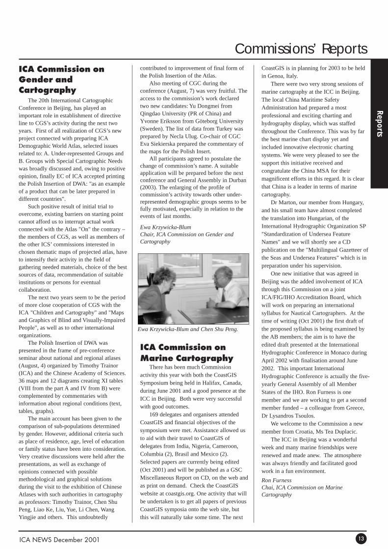
ICA Commission onGender andCartography
The 20th International CartographicConference in Beijing, has played animportant role in establishment of directiveline to CGS’s activity during the next twoyears. First of all realization of CGS’s newproject connected with preparing ICADemographic World Atlas, selected issuesrelated to: A. Under-represented Groups andB. Groups with Special Cartographic Needswas broadly discussed and, owing to positiveopinion, finally EC of ICA accepted printingthe Polish Insertion of DWA: "as an exampleof a product that can be later prepared indifferent countries".
Such positive result of initial trial toovercome, existing barriers on starting pointcannot afford us to interrupt actual workconnected with the Atlas "On" the contrary –the members of CGS, as well as members ofthe other ICS’ commissions interested inchosen thematic maps of projected atlas, haveto intensify their activity in the field ofgathering needed materials, choice of the bestsources of data, recommendation of suitableinstitutions or persons for eventualcollaboration.
The next two years seem to be the periodof more close cooperation of CGS with theICA "Children and Cartography" and "Mapsand Graphics of Blind and Visually-ImpairedPeople", as well as to other internationalorganizations.
The Polish Insertion of DWA waspresented in the frame of pre-conferenceseminar about national and regional atlases(August, 4) organized by Timothy Trainor(ICA) and the Chinese Academy of Sciences.36 maps and 12 diagrams creating XI tables(VIII from the part A and IV from B) werecomplemented by commentaries withinformation about regional conditions (text,tables, graphs).
The main account has been given to thecomparison of sub-populations determinedby gender. However, additional criteria suchas place of residence, age, level of educationor family status have been into consideration.Very creative discussions were held after thepresentations, as well as exchange ofopinions connected with possiblemethodological and graphical solutionsduring the visit to the exhibition of ChineseAtlases with such authorities in cartographyas professors: Timothy Trainor, Chen ShuPeng, Liao Ke, Liu, Yue, Li Chen, WangYingjie and others. This undoubtedly
contributed to improvement of final form ofthe Polish Insertion of the Atlas.
Also meeting of CGC during theconference (August, 7) was very fruitful. Theaccess to the commission’s work declaredtwo new candidates: Yu Dongmei fromQingdao University (PR of China) andYvonne Eriksson from Göteborg University(Sweden). The list of data from Turkey wasprepared by Necla Ulug. Co-chair of CGCEva Siekierska prepared the commentary ofthe maps for the Polish Insert.
All participants agreed to postulate thechange of commission’s name. A suitableapplication will be prepared before the nextconference and General Assembly in Durban(2003). The enlarging of the profile ofcommission’s activity towards other under-represented demographic groups seems to befully motivated, especially in relation to theevents of last months.
Ewa Krzywicka-BlumChair, ICA Commission on Gender andCartography
ICA Commission onMarine Cartography
There has been much Commissionactivity this year with both the CoastGISSymposium being held in Halifax, Canada,during June 2001 and a good presence at theICC in Beijing. Both were very successfulwith good outcomes.
169 delegates and organisers attendedCoastGIS and financial objectives of thesymposium were met. Assistance allowed usto aid with their travel to CoastGIS ofdelegates from India, Nigeria, Cameroon,Columbia (2), Brasil and Mexico (2).Selected papers are currently being edited(Oct 2001) and will be published as a GSCMiscellaneous Report on CD, on the web andas print on demand. Check the CoastGISwebsite at coastgis.org. One activity that willbe undertaken is to get all papers of previousCoastGIS symposia onto the web site, butthis will naturally take some time. The next
CoastGIS is in planning for 2003 to be heldin Genoa, Italy.
There were two very strong sessions ofmarine cartography at the ICC in Beijing.The local China Maritime SafetyAdministration had prepared a mostprofessional and exciting charting andhydrography display, which was staffedthroughout the Conference. This was by farthe best marine chart display yet andincluded innovative electronic chartingsystems. We were very pleased to see thesupport this initiative received andcongratulate the China MSA for theirmagnificent efforts in this regard. It is clearthat China is a leader in terms of marinecartography.
Dr Marton, our member from Hungary,and his small team have almost completedthe translation into Hungarian, of theInternational Hydrographic Organization SP"Standardization of Undersea FeatureNames" and we will shortly see a CDpublication on the "Multilingual Gazetteer ofthe Seas and Undersea Features" which is inpreparation under his supervision.
One new initiative that was agreed inBeijing was the added involvement of ICAthrough this Commission on a jointICA/FIG/IHO Accreditation Board, whichwill work on preparing an internationalsyllabus for Nautical Cartographers. At thetime of writing (Oct 2001) the first draft ofthe proposed syllabus is being examined bythe AB members; the aim is to have theedited draft presented at the InternationalHydrographic Conference in Monaco duringApril 2002 with finalisation around June2002. This important InternationalHydrographic Conference is actually the five-yearly General Assembly of all MemberStates of the IHO. Ron Furness is onemember and we are working to get a secondmember funded – a colleague from Greece,Dr Lysandros Tsoulos.
We welcome to the Commission a newmember from Croatia, Ms Tea Duplacic.
The ICC in Beijing was a wonderfulweek and many marine friendships wererenewed and made anew. The atmospherewas always friendly and facilitated goodwork in a fun environment.
Ron FurnessChai, ICA Commission on MarineCartography
ICA NEWS December 2001 13
Ewa Krzywicka-Blum and Chen Shu Peng.
Special Features
Special Features
National Library ofChina and Maps
Several people who attended theInternational Cartographic Associationconference in Beijing were given a specialtour of the National Library of China that wasarranged by Ms. Li Li, ICA Vice Presidentfrom China. We were met and taken aroundby Mr. Sun Guoqing who had been herclassmate at Nanjing University and was oneof the people working with maps in thelibrary.
Beijing Library is China's national library,a comprehensive research library, and nationalaggregate stack room. The library uses thename "The National Library of China" ininternational contracts. Beijing Library has along standing history in collectingcartographic materials. As early as 1909,when the Beijing Library's predecessor JingShi Library was established, the Qing Dynastygovernment decided to transfer all its royalmap collection to the library. In February1929, the Beijing Library specially establishedthe Yu Tu Bu (Map Department) to collect,process, store, and view maps. The director ofthe Map Unit was the famous cartographyexpert Mr. Wang Yong. In 1948, the libraryreorganized, and the Map Unit was renamedYu Tu Zu (Map Team). In 1952, BeijingLibrary established Shan Ben Te Cang Bu(Rare Book Special Collection Department),which included the Map Team. In 1988, theRare Book Special Collection Departmentmoved into the new Beijing Library (built in1986) at Bai Shi Qiao Road, and added aBook Reservation and Reading Team to be incharge of collections and service. The MapTeam focuses on map collecting, cataloguing,and reference. For the 60 years since the MapUnit was established, map collecting hasalways been one of the ultimate goals of theteam. They collect domestic and internationalmaps extensively via broad channels.
The foreign maps are not catalogued, butthe Chinese maps are on their OPAC. Theyhave a legal deposit system for maps andatlases and are supposed to receive threecopies of each publication. Mr. Sun noted thatmore than 80% of companies participate.Most of the topographic maps are stored inthe Bureau of Surveying and Mapping. Mapsat the scale of 1:50 000 or larger areconsidered secret in China. There is an ArcChina product at a scale of l:1 000 000,however. There is not much of a touristwalking society in China, but city maps are
getting more popular. Some of the holdingsinformation given to us was that by the end of1991, they had a collection of 23,500 titlesand 98,000 volumes or sheets of which 14,000titles (70,000 volumes or sheets) were inChinese and 9,500 titles (28,000 sheets orvolumes) were in foreign languages(organized in 100 categories). In terms oftopographic maps, we were told that there are24,000 sheets at a scale of 1:50 000, 816sheets at 1:250 000 and 77 sheets at l:1 000000. The oldest item was a stone carved mapfrom the Song Dynasty. Among the other rareitems are China's earliest extant atlas GuangYu Tu of the Ming Dynasty; the Kang XiHuang Yu Quan Lan Tu which was the firstmap drawn based on longitude and latitudemeasurements in China; also Ming Dynasty'sShaanxi Yu Tuand Qing Dynasty's Huang HeTu (Yellow River). The early Qing Dynastycolor drawing, Fujian Yu Tu, is about sevenmeters in width and length with a yellow silkdragon edge, and is really one of a kind.These rare maps provide not only theimportant information for the study ofchanges in China's geographical environment,as well as, political and economicdevelopments, but also provide valuableinformation for the historical study of China'scartographic development.
This handout also described the collectionpolicy: As part of the national library, the MapTeam can receive free maps published bydomestic publishers. The Map Team alsocollects large amounts of Chinese and foreignlanguage maps through provincial, municipal,and autonomous regions departments, orthrough Zhongguo Tu Shu Jin Chu Kou ZongGong Si (China Book Import and Export Co.).The basic policy of Map Team is to collect allmaps openly published in China; activelycollect internal reference maps published bycentral and regional governments; fill gaps inthe collection for publications prior to 1949,including ancient maps; for maps publishedby foreign countries to select the generalatlases, subject atlases, large scale seriesmaps, and maps of major ports/citiespublished by major map publishers.
To provide good service to their users, theMap Team catalogued all maps on cardswhich were included in the catalogue in theRare Book Special Collection Department.They were catalogued by region, subject, titleand author. Because of the limitation ofconditions and specialities of map collection,in recent years the collection has only beenopen to special researchers with letters of
introduction or recommendation. According totheir statistics, in 1990 they served 600researchers who used 8000 maps; and in 1991,they served 700 users with 7000 items.
In 1991 or 1992, there were eightprofessionals working on the Map Team, fiveof them with degrees in geography orcartography, and three in high-level positions.At the time of our visit, we were told thatthere five people taking care of the maps. Inaddition to daily routine works, team memberswork hard to improve professionally,especially research related to history ofcartography and atlases in order to provideexcellent service to the users. The web pagesto reach the National Library of China start athttp://www.nlc.gov.cn
Prepared by Alberta Auringer Wood withnotes from the visit and from a descriptivehandout in Chinese translated by Yurong"Jade" Atwill, Asian Studies Librarian atUniversity Libraries, The Pennsylvania StateUniversity.
For your DiaryI N T E R C A R T O - 8
INTERCARTO-8 InternationalConference, to be held in St. Petersburg,Russia, on May 30 - June 1, 2002, is intendedas an important step forward to reach the goalof sound nature management. It will be thesixth, after INTERCARTO-3, conferencesupported by the International CartographicAssociation and the International GeographicUnion, which theme is close to problems ofsustainable development. The main purpose ofthe Conference is to assess the present state ofdevelopment of GIS-technology, digitalmapping and GIS-projects for variousterritories. It is supposed to discuss pure andapplied aspects of GIS working out,experience of leading scientists and experts inelaboration of environmental GIS. A specialattention will be paid to GIS usage for solvingof problems of sustainable development ofdifferent territories - rural and urban, local,regional and national ones. The conferencetopics include: GIS for Solving of Problemsof Sustainable Development of Territories;GIS Theory and Methodology; GIS-Technology for Land Management; DigitalEarth, Country, City; MultidimentianalCartography; Education and Internet; Practicalaspects of distant education; Mapping forExtraterrestrial Geography, etc.The conference is organized by theInternational Cartographic Association, the
ICA NEWS December 200114
For Your Diary
For Your Diary
International Geographic Union, GeographicInformation Sciences Commission, M.V.Lomonosov Moscow State University, theRussian Geographical Society and theFederal Service of Geodesy andCartography of Russia
The Chairman of the Local OrganizingCommittee is Dr. Yuri P.Seliverstov,President of the Russian GeographicalSociety and co-chairmans are: Prof. FerjanOrmeling, Department of Geography,Utrecht, and Prof. Vladimir S. Tikunov,Moscow State University. For moreinformation concerning the Commission’smeetings, please, contact:Vladimir S.Tikunov, chair of Education andTraining Commission, e-mail:[email protected] B.Shingareva, chair of PlanetaryCartography Commission, e-mail:[email protected]
Call for Papers
Authors are invited to submit papers in
English or Russian to the Organizing
Committee of the Conference as soon as possible and not later than 15 April 2002.
Important dates and deadlines
15 April 2002 Submission of papers
1 May 2002 Sending invitations
29 May 2002 Welcoming of participants
30 May 2002 Opening of the Conference
ForthcomingconferencesMap India 2002New Delhi, IndiaFrom 06-08 FebruaryEnquiries to: Map IndiaSecretariat, CSDMS, G-4, Sector – 39Noida-201 301, UP India, Web-site: www.MapIndia.org
2002 Annual Conference of the ProfessionalLand Surveyors of OhioQuaker Square Crowne PlazaHotel Hotel, Akron. Ohio, USAFrom 07-09 FebruaryEnquiries to Jeffrey M Mallison,PS, 2049 Braewick Dr., Akron, Ohio 44313-6241 USATele: 330 643 8128Fax: 330 836 5979Email: [email protected]
Geomatica 2002Palacio de las Convenciones de La
Habana, Ciudad de La Habana, Cuba
From 18-23 February.
Enquiries to: GEOMATICA 2002
Ing. Tatiana Degado Fernandez,
Calle 6 No 301 Esq 3ra Miramar
La Habana, 11300, Cuba
Tel: 53 (7) 22 1794
Fax: 53 (7) 24 2869
Email: [email protected]
GEOTec Event
Toronto, Ontario, Canada
From 08-11 April 2002
Enquiries to: Matt Ball, TEOTec
Media, Tel: 1 (303) 544 0594,
Email: [email protected]
29th International Symposium on RS of
Environment
Buenos Aires, Argentina,
From 8-12 April 2002
Enquiries to: Chiyo Yamashita-Gill,
University of Arizona, office of Arid Lands
Studies
1955 E. Sixth St, Suite 205, Tucson, AZ
85719
USA Tel 1 (520) 621 8567
Fax 1 (520) 621 3816
Email: [email protected]@conae.gov.ar
GEO 2002
5th Middle East Geosciences Conferences
and Exhibition
Bahrain
From 15-17 April 2002
Enquiries to Susan Hudson, GEO 2002
PO Box 14 B-1390 Grezdoiceau, Belgium
Tel: +32 (0) 10 84 56 77
Fax: +32(0) 1084 1965
Email: [email protected]
ACSM-ASPRS in Conjunction with FIG
2002
Marriott Wardman Park Hotel, Washington
DC, USA
From 19-26 April
Enquires to: Nadine George, 6220,
Montrose Road, Rockville, MD
20852 USA
Tel: 1 (301) 984 9450 ext 11
Fax: 1 (301) 984 9441Email: [email protected]
The Mapping Sciences Institute of Australia12-15 May 2002Melbourne, AustraliaOrganiser: AustraliaEnquiries <[email protected]> Tel: +61-3-9595-0259Fax: +61-3-9596-2538
GISDECO Conference, 6th Seminar on GISand Developing CountriesInternational Institute for Aerospace Surveyand Earth Sciences (ITC) Enschede, TheNetherlandsFrom: 15-18 May 2002Enquiries to: Mireille Meester,Email: [email protected]: www.itc.nl
3rd International Symposium on RemoteSensing of Urban AreasIstanbul, turkeyFrom 11-13 June 2002Enquiries to Assoc Professor Filiz SunarErbek Symposium Secretariat, IstanbulTechnical University, Civil EngineeringFaculty, Remote Sensing Division, Maslak,80626 Istanbul Turkey, Tel: 90 (212 285 3801Fax: 90(212) 573 7027Email: [email protected] site: www.itu.edu.tr/rsurban3
ISPRS Symposium of Commission IVOttawa, Canada From 09-12 July 2002Enquiries to: Tom HerbertTel: 1 (613) 224 9851Fax: 1 (613) 224 9577Email: [email protected]
IEEE/IGARSS 200224-28 June 2002Toronto, CanadaInformation: Tammy Stein (tel 281-251-6067Fax: 1-281-251-6068Email: [email protected]
11th Australasian Remote Sensing andPhotogrammetry Conference2-6 September 2002Brisbane, AustraliaEnquiries:[email protected]: +61-2-6257-3299Fax: +61-2-6257-3256Web site www.ausconvservics.com.au
ICA NEWS December 2001 15
For Your Diary
Tail Pieces
ISPRS Symposium of Commission VGraz, Austria,From 09-13 September 2002Enquiries to: Prof. Dr FranzLeberl, Tel: 43 (316) 873 5011Fax: 43 (316) 873 5050Email: [email protected]
IPRS Symposium of Commission VIRio de Janeiro, BrazilFrom 17-19 September 2002Enquiries to Dr Tania Maria SausenTel: 55 (12) 345 6862Fax: 55 (12) 345 6870Email: [email protected]
VII International Congress on Earth SciencesInstituto Geografico Militar de ChileDate : 21 – 25 October 2002Venue : Diego Portales convention Center,Santiago, ChileEmail : [email protected]://www.igm.cl
ISPRS Symposium of Commission IAdam’s Mark Hotel, Denver, COUSA from 11-15 November 2002Enquiries to Amy BudgeTel: 1 (505) 277 3622 ext 231Fax; 1 (505) 277 3614Email: [email protected]
ISPRS Symposium of Commission VIIHyderabad, IndiaFrom: November/December 2002Enquiries to: Dr RangnathNavagundTel: 91 (79) 676 8862Fax: 91 (79) 676 2735Email: [email protected]
International Symposium on " Resource andEnvironmental Monitoring"From 3-6 December 2002Enquiries to RangnathNavagund, President, Technical CommissionVII, 200-2004 and Director National RemoteSensing Agency Dept of Space, Govt ofIndia, Balanagar, Hyderbad – 500 037 India, Web site www.commission7.isprs.org
XXth ISPRS CongressDate: 13 – 24 July 2004Venue: Istanbul Convention and Exhibitioncentre (ICEC)Contact: Congress Secretariat, MagisterTours Inc.Email: [email protected]://www.magister.com.tr
ICA Commission on theHistory of Cartography
This commission recently established its ownWeb site at http://www.stub.unibe.ch/ica-chc/For more information contact Markus Oherly([email protected])
2003 InternationalCartographic Conference inDurban, South Africa
During the closing ceremony of the 20th
ICC in Beijin, Derek Clarke, head of the
organizing committee for the 21st
International Cartographic Conference in
2003 in Durban, South Africa, noted that it
would be held from August 10-16, under the
theme of Cartographic Renaissance; Revival
of Developing Nations. He gave some
enticing information about Durban, such as
its 320 days of sun per year, low prices, and
low crime rate. He noted that abstracts are
due by October 30, 2002, with papers by
April 2003.
Alberta Auringer Wood, ICA Vice-President, Canada
ICA NEWS June 200116
ContributionsPlease send contributions to:Graciela Metternicht, Editor ICA NewsSchool of Spatial SciencesCurtin University of TechnologyGPO Box U 1987, Perth 6845Western AustraliaEmail: [email protected]: +61-8-9266 2703Ftp: alpha.cage.curtin.edu.auLogin and pwd: anonymousDirectory: /graciela/ICA/incoming
© Published by the International Cartographic Association. President: Bengt Rystedt, National Land Survey, Sweden.Secretary General: Ferjan Ormeling, Faculty of Geographical Sciences, Utrecht University, The Netherlands.Editor: Graciela Metternicht, Departmentl of Spatial Sciences, Curtin University of Technology, Perth, Australia.
Editorial 1
Obituary 1
ICC Report 2
20th ICC: Opening Ceremony
and Meetings 3
20th ICC: Sessions 4
20th ICC: Awards &
Recognitions 5
2001 Barbara Petchenic Winners 6
Mapping in the Century 7
Highlights of the 20th
International Cartographic
Conference 8-9
ICC 2005 10
Conference Reports 11
Commissions’ Reports 12
Special Features 14
ICA NEWS December 2001
The following Organizations support theInternational CartographicAssociation:
Centro Argentino de Cartografiaph +54 1 576 5545fax +54 1 502 6799Av. Cabildo 3811426 BUENOS AIRESARGENTINE
Institut Cartografic de Catalunyaph +34 93 425 29 00fx +34 93 426 74 42Parc de MontjuicE - 08038 BARCELONASPAIN
United States Geological Surveyph +1 703 648 4639fax +1 703 648 5542National Mapping Division519 National CenterPRESTON Virginia 22092USA
Institut Géographique Nationalph +33 1 43 98 82 95fx +33 1 43 98 84 00136 bis rue de Grenelle75700 PARIS 07 SPFRANCE
Naval Hydrographic OfficeP.O. Box 75DEHRA DUN - 248001INDIA
Geographical Survey Instituteph +81 298 64 1111fax +81 298 64 1804Kitasato 1Tsukuba-shiIBARAKI-KEN 305JAPAN
Heritage Manuscripts & DocumentsCenterph +965 532 900fax +965 532 0902P.O. Box 3904Safat13040 KUWAITKUWAIT
ITCph +31 53 487 44 44fax +31 53 487 44 00Hengelosestraat 99P.O. Box 67500 AA ENSCHEDETHE NETHERLANDS
Elsevier Science Ltdph +44 1865 843327fax +44 1865 843960Earth & Environmental SciencesThe Boulevard - Langford Lane -KidlingtonOXFORD OX5 1GBUNITED KINGDOM
Moscow State University for Geodesyand Cartographyph +7 095 261 3152fax +7 095 267 46814 Gorokhovsky by-streetMOSCOW 103064RUSSIAN FEDERATION
The International Cartographic
Association welcomes new affiliate
members.
For further information contact: The
ICA Secretary General: Ferjan
Ormeling, Faculty of Geographical
Sciences, Utrecht University, P.O.Box
80115, 3508 TC Utrecht, The
Netherlands. Email:
23435-12-01
The following organizations support theInternational Cartographic Association:
Intergraph:www.intergraph.com Barco Graphics:www.barco.com
Aero-Sensing RadarsystemsGmbh:www.aerosensing.de Tokyo Inshokan Printing Co:www.inshokan.com.jp

![Trisrapides - h4.tourniaire.org · Vieuxtris Triàbulles Triparsélection Triparinsertion deftri_a_bulle(li): n= len(li) foriinrange(n 1): forjinrange(n i 1): ifli[j]>li[j+1]: li[j],li[j+1]=li[j+1],li[j]](https://img.pdfslide.fr/doc/110x75/5f428d610df1944eaf318d35/trisrapides-h4-vieuxtris-tribulles-triparslection-triparinsertion-deftriabulleli.jpg)
![MODERN TECHNIQUES OF LANDS AND CONSTRUCTIONS …revcad.uab.ro/upload/36_450_Paper23_RevCAD17_2014.pdfsignificantly improved geometric levelling operational performances. [1] In surveying,](https://img.pdfslide.fr/doc/110x75/5e7a6711bcb1c62a463c1f46/modern-techniques-of-lands-and-constructions-significantly-improved-geometric-levelling.jpg)