Embed Size (px)
Citation preview
2-4
2-8
2-5
2-16
2-12
2-13
2-14
2-15
VICTORIA
SidneyDuncan
Port Renfrew
Jordan River
Bamfield
Ucluelet
Tofino
Ladysmith
NANAIMOPORT ALBERNI
COURTENAY
CAMPBELL RIVER
ComoxGold River
Tahsis
Sayward
Port McNeill
Port Hardy
Port Alice
Parksville
Squamish
GibsonsSecheltQualicum
Beach
PowellRiver
VANCOUVER
NORTHVANCOUVER
Sooke
STRAIT
JUANDE
FUCA
KYUQUOT SOUND
NOOTKA SOUND
CLAYOQUOT SOUND
BARKLEY SOUND
Great Central L
TlupanaInlet
Loughborough Inlet Holberg
Inlet
KingcomeInlet
SeymourInlet
BondSd
Muchalat
Inlet
PowellLake
AlberniInlet
Gabriola Island
Denman Island
QuadraIsland
SonoraIsland
GilfordIsland
NootkaIsland
BrooksPeninsu
la
CapeCook
CapeScott
HornbyIsland
Texada Island
Galiano Island
Saltspring Island
NitinatL
KennedyL
Taseko Lakes
Lake
UpperCampbellL
ButtleL
VictoriaL
Pack L
NimpkishL Bonanza
L
Cowichan L
HOWESOUND
JERVISINLET
SALMONINLET
TOBAINLET
BUTEINLET
CHILKO
LAKE
KNIGHTINLET
INLET
San Juan R
Gord
on
R
Nanaimo R
Nitin
at
R
Leech R
Jord
a n R
Muir Cr
Taylor R
Kenn
edy
R
Chemainus R
Oyster R
Puntledge R
Moy
eha R
Bedw
ell R
Adam R
Tsitika R
Nimpkish
River
R
Zeba
llos
R
QUEEN
CHARLOTTESTRAIT
Klin
aklin
i
Homathko
R
Mo o R
Bishop R
Toba R
Southgate
R
Big
Cr
Squa mish
R
Elaho R
Ashlu Cr
Lillooet R
Cowichan R 1-4
1-3
1-51-7
1-8
1-6
1-9
1-101-11
1-12
1-13
1-15
1-14
1-2 1-1
5-4
5-55-7
4
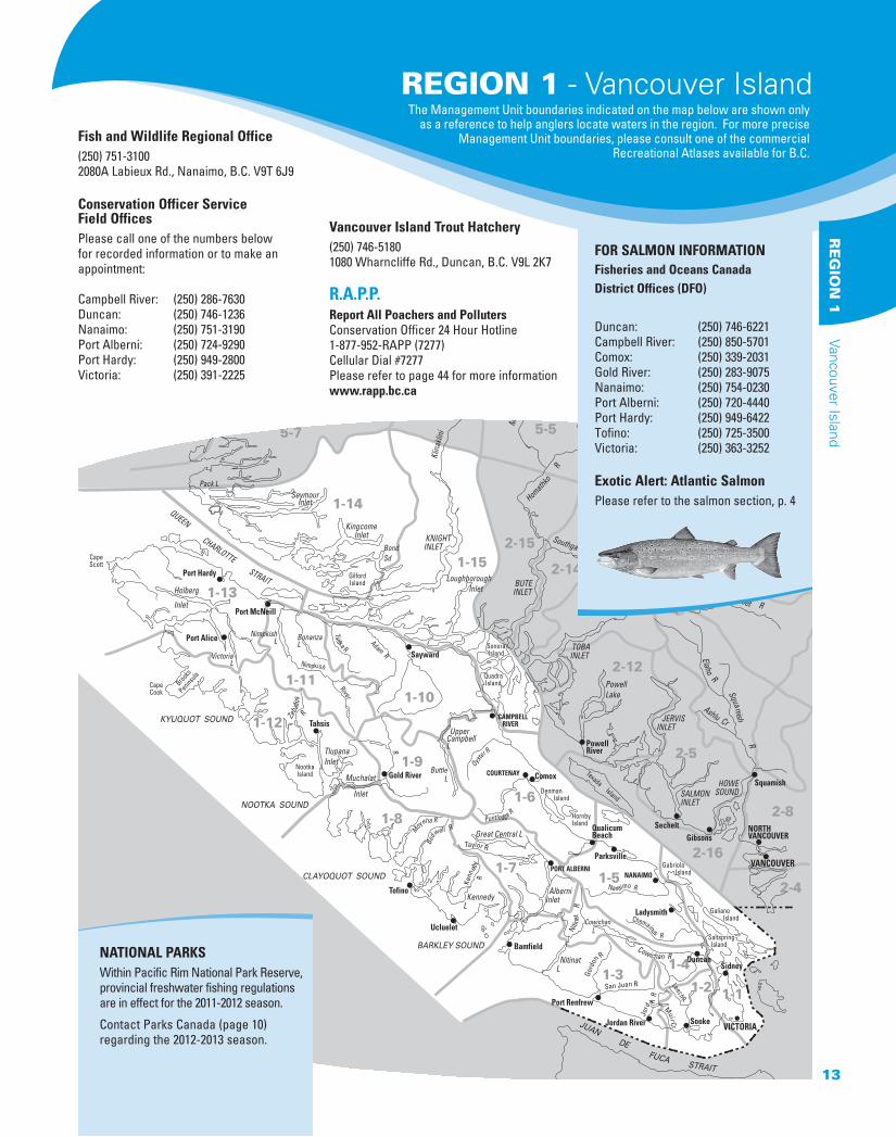
Fish and Wildlife Regional Office(250) 751-3100 2080A Labieux Rd., Nanaimo, B.C. V9T 6J9
Conservation Officer Service Field OfficesPlease call one of the numbers below for recorded information or to make an appointment:
Campbell River: (250) 286-7630Duncan: (250) 746-1236Nanaimo: (250) 751-3190 Port Alberni: (250) 724-9290Port Hardy: (250) 949-2800Victoria: (250) 391-2225
Vancouver Island Trout Hatchery(250) 746-51801080 Wharncliffe Rd., Duncan, B.C. V9L 2K7
R.A.P.P. Report All Poachers and PollutersConservation Officer 24 Hour Hotline1-877-952-RAPP (7277)Cellular Dial #7277Please refer to page 44 for more informationwww.rapp.bc.ca
FOR SALMON INFORMATION
Fisheries and Oceans Canada District Offices (DFO)
Duncan: (250) 746-6221Campbell River: (250) 850-5701Comox: (250) 339-2031Gold River: (250) 283-9075Nanaimo: (250) 754-0230Port Alberni: (250) 720-4440Port Hardy: (250) 949-6422Tofino: (250) 725-3500Victoria: (250) 363-3252
Exotic Alert: Atlantic SalmonPlease refer to the salmon section, p. 4
NATIONAL PARKSWithin Pacific Rim National Park Reserve, provincial freshwater fishing regulations are in effect for the 2011-2012 season.
Contact Parks Canada (page 10) regarding the 2012-2013 season.
REGION 1 - Vancouver IslandThe Management Unit boundaries indicated on the map below are shown only
as a reference to help anglers locate waters in the region. For more precise Management Unit boundaries, please consult one of the commercial
Recreational Atlases available for B.C.
13
RE
GIO
N 1
Vancouver Island
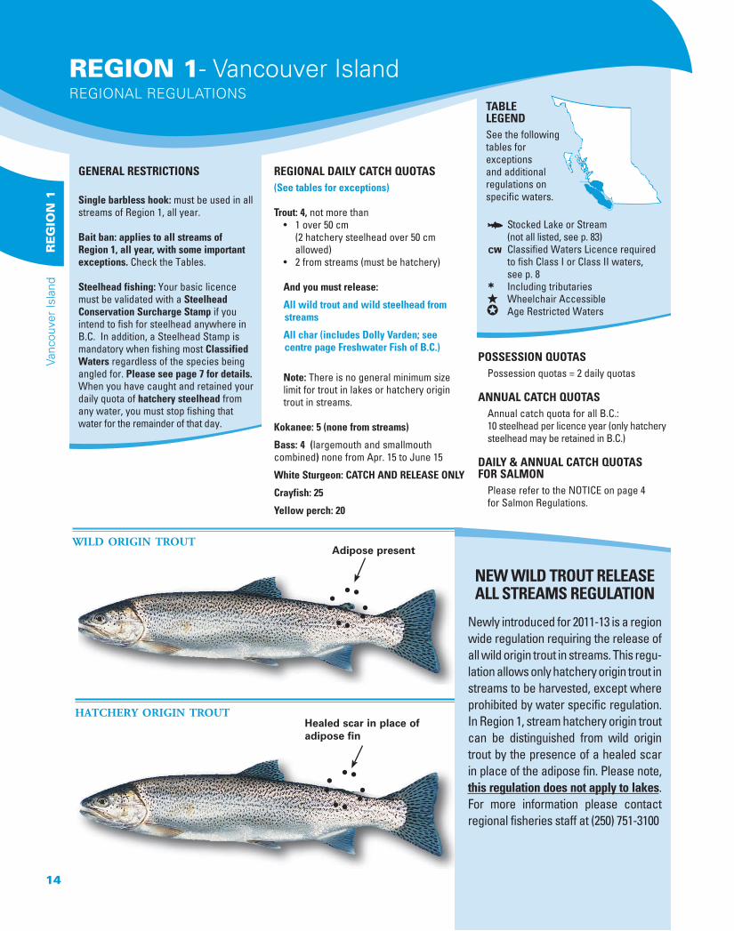
Healed scar in place of adipose fin
Adipose presentWILD ORIGIN TROUT
HATCHERY ORIGIN TROUT
REGIONAL DAILY CATCH QUOTAS(See tables for exceptions)
Trout: 4, not more than • 1 over 50 cm (2 hatchery steelhead over 50 cm allowed) • 2 from streams (must be hatchery)
And you must release:
All wild trout and wild steelhead from streams
All char (includes Dolly Varden; see centre page Freshwater Fish of B.C.)
Note: There is no general minimum size limit for trout in lakes or hatchery origin trout in streams.
Kokanee: 5 (none from streams)
Bass: 4 (largemouth and smallmouth combined) none from Apr. 15 to June 15
White Sturgeon: CATCH AND RELEASE ONLY
Crayfish: 25
Yellow perch: 20
POSSESSION QUOTAS Possession quotas = 2 daily quotas
ANNUAL CATCH QUOTAS Annual catch quota for all B.C.: 10 steelhead per licence year (only hatchery steelhead may be retained in B.C.)
DAILY & ANNUAL CATCH QUOTAS FOR SALMON Please refer to the NOTICE on page 4 for Salmon Regulations.
GENERAL RESTRICTIONS
Single barbless hook: must be used in all streams of Region 1, all year.
Bait ban: applies to all streams ofRegion 1, all year, with some important exceptions. Check the Tables.
Steelhead fishing: Your basic licence must be validated with a Steelhead Conservation Surcharge Stamp if you intend to fish for steelhead anywhere in B.C. In addition, a Steelhead Stamp is mandatory when fishing most Classified Waters regardless of the species being angled for. Please see page 7 for details. When you have caught and retained your daily quota of hatchery steelhead from any water, you must stop fishing that water for the remainder of that day.
TABLE LEGENDSee the following tables for exceptions and additional regulations on specific waters.
π Stocked Lake or Stream (not all listed, see p. 83)∏ Classified Waters Licence required to fish Class I or Class II waters, see p. 8∑ Including tributaries∞ Wheelchair Accessible∂ Age Restricted Waters
NEW WILD TROUT RELEASEALL STREAMS REGULATION
Newly introduced for 2011-13 is a region wide regulation requiring the release of all wild origin trout in streams. This regu-lation allows only hatchery origin trout in streams to be harvested, except where prohibited by water specific regulation. In Region 1, stream hatchery origin trout can be distinguished from wild origin trout by the presence of a healed scar in place of the adipose fin. Please note, this regulation does not apply to lakes. For more information please contact regional fisheries staff at (250) 751-3100
REGION 1- Vancouver IslandREGIONAL REGULATIONS
14
Vanc
ouve
r Is
land
RE
GIO
N 1
MANAGEMENT UNIT (NOT ALL SHOWN - SEE PAGE 5) EXCEPTIONS TO THE REGIONAL REGULATIONS
ADAM RIVER (EXCEPT Eve River)∑ 1-10 Artificial fly only above Eve River, to Highway 19 bridgeAHNUHATI RIVER∑ ∏ 1-15 Class II water Apr 1 - Oct 31; Steelhead Stamp mandatory Apr 1-June 30ALICE LAKE 1-13 No trout over 50 cm; bait ban, single barbless hookAMOR LAKE 1-10 Trout daily quota = 2AMOR DE COSMOS CREEK 1-10 Closed all year from upper falls downstream 1 km to (Bear River) logging road bridge 3 km from tidewater
No Fishing from mouth to falls about 4 km upstream, Dec 1-May 31“ANDERSON” LAKE (in the Walbran Creek watershed)
1-3 Artificial fly only, bait ban, single barbless hookTrout and kokanee release∑Unnamed lake approx. 7 km W/SW of Mt. Walbran
ANTLER LAKE π 1-9 No powered boatsARTLISH RIVER∑ 1-12 No fishing above the boundary signs at the bridge crossing approximately 10 km from the mouth, Nov 1-Apr 30 ASH RIVER 1-7 No fishing from Dickson Lake to signs 200 m below Lanternman Falls, Dec 1-Apr 30
Closed all year from Dickson Falls downstream 30 m to signs Closed all year from Elsie Lake to Dickson Lake
BAINBRIDGE LAKE 1-7 No angling from boats; ∂ age restriction (see page 5)BEAR LAKE 1-4 See Cowichan LakeBEAR RIVER 1-10 See Amor de Cosmos CreekBEAVER LAKE π 1-1 Engine power restriction - 7.5 Kw (10 hp)BENSON RIVER∑ 1-13 Fly fishing only “BIG QUALICUM” RIVER 1-6 See Qualicum RiverBINGS CREEK 1-4 ∂ age restriction (see page 5)BLACK CREEK∑ 1-6 No fishing Dec 1-May 31BLACKBURN LAKE 1-1 No powered boatsBLACKWATER LAKE 1-10 Trout daily quota = 2BONANZA LAKE 1-11 No trout over 50 cm; bait ban, single barbless hookBOOT LAKE π 1-10 Trout daily quota = 2; bait ban, single barbless hookBRANNEN LAKE π 1-5 Speed restriction on parts (60 km/h)BROWNS RIVER 1-6 See Puntledge River∑BUTTLE LAKE’S TRIBUTARIES 1-9 Fly fishing only; Except Thellwood Creek is closed all year(Lower) CAMPBELL LAKE’S TRIBUTARIES
1-6 No fishing Feb 1-July 15 including Campbell River between Strathcona Dam and (Lower) Campbell Lake
CAMPBELL RIVER 1-10 Closed all year between Elk Falls and John Hart Dam Power StationClosed all year from Strathcona Dam downstream 100 m No fishing in any tributaries (except Quinsam River), Dec 1-May 31From John Hart Dam Power Station to power line crossing approximately 200 m upstream of Quinsam River confluence: fly fishing only year-round and trout/char release Dec 1-May 31Artificial fly only downstream of power line crossing located approx 200 m above Quinsam River confluence: both Dec 1-May 31No vessels between Elk Falls and John Hart Dam Power Station
CARNATION CREEK∑ 1-3 Closed all yearCATHERINE CREEK 1-10 Closed all yearCAYCUSE RIVER 1-3 Fly fishing only above and including Hatton CreekCHASE RIVER 1-5 ∂age restriction (see page 5)CHEMAINUS RIVER 1-5 Closed all year from Copper Canyon Falls downstream 100 m to signs
No fishing upstream of Bannon Creek∑, Dec 1-June 30CHICADEE LAKE π 1-6 Electric motors onlyCLAUD ELLIOTT CREEK 1-10 Closed all yearCLAUD ELLIOTT LAKE 1-10 No trout over 50 cm; bait ban; single barbless hookCLEAR LAKE (Quadra Island) 1-15 Electric motors onlyCLUXEWE RIVER ∑ π 1-13 No fishing above the West Main logging road bridge (about 7.5 km upstream of the
Highway 19 bridge), Dec 1-May 31COLQUITZ RIVER∑ 1-1 Closed all yearCOMOX LAKE 1-6 No trout over 50 cm, Nov 1-Apr 30
Bait ban and single barbless hook, Nov 1-Apr 30CONSORT CREEK∑ 1-10 Closed all yearCOURTENAY RIVER 1-6 ONLY OPEN Oct 1-Nov 30
Speed restriction on part (8 km/h)COUS CREEK 1-7 No fishing Nov 1 - Apr 30COWICHAN LAKE (including Bear Lake)
1-4 Cutthroat trout daily quota = 2 (none over 50 cm)Bait ban and single barbless hook, Nov 15-Apr 15Speed restriction on parts (8 km/h), plus overall 10 km/h speed restriction within 60 m of shore
NOTE: If a lake or stream is NOT listed here, then only the Provincial Regulations (pages 9-11) and the Regional Regulations (page 14) apply. New restrictions are highlighted in blue. Check for any in-season changes at: www.env.gov.bc.ca/fw/fish
REGION 1WATER-SPECIFIC REGULATIONS
15
RE
GIO
N 1
Vancouver Island
NOTE: If a lake or stream is NOT listed here, then only the Provincial Regulations (pages 9 through 11) and the Regional Regulations (page 14) apply. New restrictions are highlighted in blue. Check for any in-season changes at: www.env.gov.bc.ca/fw/fish
MANAGEMENT UNIT (NOT ALL SHOWN - SEE PAGE 5) EXCEPTIONS TO THE REGIONAL REGULATIONS
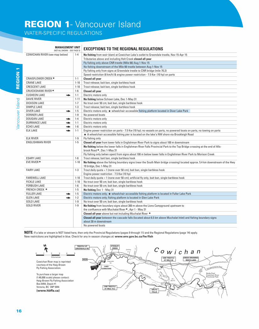
COWICHAN RIVER (see map below) 1-4 No fishing from weir (dam) at Cowichan Lake’s outlet to Greendale trestle, Nov 15-Apr 15Tributaries above and including Holt Creek closed all yearFly fishing only above CNR trestle (Mile 66) Aug 1-Nov 15No fishing downstream of the Mile 66 trestle between Aug 1-Nov 15Fly fishing only from signs at Greendale trestle to CNR bridge (mile 70.2)Speed restriction (8 km/h) & engine power restriction - 7.5 Kw (10 hp) on parts
CRAIGFLOWER CREEK∑ 1-1 Closed all yearCRANE LAKE 1-10 Trout release; bait ban, single barbless hookCRESCENT LAKE 1-10 Trout release; bait ban, single barbless hookCRUICKSHANK RIVER∑ 1-6 Closed all yearCUSHEON LAKE π 1-1 Electric motors onlyDAVIE RIVER 1-11 No fishing below Schoen Lake, Dec 1-May 31DICKSON LAKE 1-7 No trout over 50 cm; bait ban, single barbless hook DIMPLE LAKE 1-3 Trout release; bait ban, single barbless hookDIVER LAKE π 1-5 Electric motors only; ∞ wheelchair accessible fishing platform located in Diver Lake ParkDONNER LAKE 1-9 No powered boatsDOUGAN LAKE π 1-4 Electric motors onlyDURRANCE LAKE π 1-1 Electric motors onlyECHO LAKE π 1-6 Electric motors onlyELK LAKE π 1-1 Engine power restriction on parts - 7.5 Kw (10 hp); no vessels on parts, no powered boats on parts, no towing on parts
∞ A wheelchair accessible fishing pier is located on the lake’s NW shore via Brookleigh RoadELK RIVER 1-9 Fly fishing onlyENGLISHMAN RIVER 1-5 Closed all year from lower falls in Englishman River Park to signs about 100 m downstream
No fishing below the lower falls in Englishman River Falls Provincial Park to the Top Bridge crossing at the end of Alls-brook Road∑, Dec 1-May 31 Fly fishing only (when open) from signs about 100 m below lower falls in Englishman River Park to Morison Creek
ESARY LAKE 1-6 Trout release; bait ban, single barbless hookEVE RIVER∑ 1-10 No fishing above the fishing boundary signs (near the South Main bridge crossing) located approx. 5.4 km downstream of the Hwy
19 bridge, Dec 1-May 31FAIRY LAKE 1-3 Trout daily quota = 1 (none over 50 cm); bait ban, single barbless hook
Engine power restriction - 7.5 Kw (10 hp)FAREWELL LAKE 1-10 Trout daily quota = 1 (none over 50 cm); artificial fly only, bait ban, single barbless hook FICKLE LAKE 1-10 No trout over 50 cm; bait ban, single barbless hookFORBUSH LAKE 1-6 No trout over 50 cm; bait ban, single barbless hookFRENCH CREEK ∑ 1-5 No fishing Dec 1 - May 31FULLER LAKE π 1-5 Electric motors only; ∞ wheelchair accessible fishing platform is located in Fuller Lake ParkGLEN LAKE π 1-2 Electric motors only; fishing platform is located in Glen Lake ParkGOLD LAKE 1-9 No trout over 50 cm; bait ban, single barbless hookGOLD RIVER 1-9 No fishing from boundary signs about 300 m above the Lions Campground upstream to
the confluence with Muchalat River∑, Apr 1 - May 31Closed all year above but not including Muchalat River ∑Closed all year between the cascade falls (located about 6.5 km above Muchalat Inlet) and fishing boundary signs about 30 m downstreamNo powered boats
Old Lake Cowichan Road
Golding
Cr
Mayo L
Skutz
Falls
Cowichan
Lake
Oliver Cr
Sta
nle
y C
r
Josi
ah
Cr
Skutz Cr
Fairservice
C
r
Joe
Ginder
Cr
Bea
r C
r
Pow
er
Stol
tz
Marie Canyon
Former CN Railway
Former EN Railway
Rd
Stoltz PoolCowichan RiverProvincial Park
IR 7SKUTZ
LAKECOWICHAN
WEIR
STANLEYCREEK
TRESTLE ATGREENDALE RD
GreendaleRd
18
1 2 3
Kilometres
4 50
CNR TRESTLEAT MILE 70.2
CNR TRESTLEAT MILE 66
CREEK DRAININGMAYO LAKE
SKUTZFALLS
Line
C o w i c h a n Cowichan River map is reprinted courtesy of the Haig-Brown Fly Fishing Association.
To purchase a larger map (1:40,000 scale) please contact:Haig-Brown Fly Fishing AssociationBox 6454, Depot #1Victoria, BC V8P 5M4(www.hbffa.ca)
REGION 1- Vancouver IslandWATER-SPECIFIC REGULATIONS
16
Vanc
ouve
r Is
land
RE
GIO
N 1
MANAGEMENT UNIT (NOT ALL SHOWN - SEE PAGE 5) EXCEPTIONS TO THE REGIONAL REGULATIONS
GOLDSTREAM RIVER∑ 1-2 No fishing Dec 1 - May 31GORDON RIVER∑ 1-3 No fishing above Bugaboo Creek, Dec 1 - Apr 30GRACIE LAKE π 1-7 Electric motors only GRAHAM LAKE 1-6 Electric motors onlyGREAT CENTRAL LAKE 1-7 No wild rainbow trout over 60 cmGREEN LAKE π 1-5 Electric motors onlyGREENSTONE CREEK∑ 1-10 Closed all yearGUNFLINT LAKE 1-15 Trout release; bait ban, single barbless hook; electric motors onlyHAGUE LAKE 1-15 Electric motors onlyHARRIS CREEK∑ 1-3 Closed all year above and including Hemmingsen Creek ∑HAREWOOD (Extension) LAKE 1-5 Trout daily quota = 2HASLAM CREEK 1-5 Closed all yearHEALY (Panther) LAKE 1-5 Trout release; fly fishing only, bait ban, single barbless hookHEALY LAKE’S OUTLET STREAM 1-5 Closed all yearHEBER RIVER 1-9 Closed all year below top of the lower canyon, located approximately 1.3 km upstream of the Gold River confluence
No fishing above top of the lower canyon, Dec 1 - Apr 30Fly fishing only below Saunders Creek to the top of the lower canyon, May 1 - Nov 30
HEMMINGSEN CREEK∑ 1-3 Closed all yearHENRY LAKE 1-5 Trout release; artificial fly only, bait ban, single barbless hookHIGGENS LAKE 1-10 Trout release; bait ban, single barbless hookHOLLAND LAKE 1-5 No powered boatsIDA LAKE 1-11 No trout over 50 cm; bait ban, single barbless hookILLUSION LAKES 1-6 No powered boatsJASPER LAKE 1-10 Trout release; bait ban, single barbless hookJOHN HART LAKE’S TRIBUTARIES 1-10 No fishing Apr 15-July 15 (includes channel below Ladore Dam)JUNE LAKE 1-7 Trout daily quota = 2KAKWEIKEN LAKE 1-15 Trout release; bait ban, single barbless hookKAKWEIKEN RIVER∑ ∏ 1-15 Class II water Apr 1 - Oct 31; Steelhead Stamp mandatory Apr 1-June 30KEMP LAKE π 1-2 No powered boatsKEOGH RIVER 1-13 Closed all year below lower fish counting fence near tidewater
Release all steelheadNo fishing in all parts ∑, Dec 1-May 31
KINGCOME RIVER∑ ∏ 1-14 Class II water Apr 1 - Oct 31; Steelhead Stamp mandatory Apr 1-June 30KOKISH RIVER 1-11 No fishing from signs in lower canyon to Ida Lake, Nov 1-Apr 30KOKSILAH RIVER∑ 1-4 No fishing Dec 1-May 31LAKE WESTON (“Weston Lake”) 1-1 Trout daily quota = 1 (none over 50 cm); bait ban, single barbless hook; electric motors onlyLANGFORD LAKE π 1-2 Electric motors only; fishing platforms are available off Leigh Road and the Nixon Trail“LINK” RIVER 1-13 See Marble RiverLITTLE MAIN LAKE (Quadra Island) 1-15 Bait ban and single barbless hook, Nov 1-Apr 30
Electric motors only
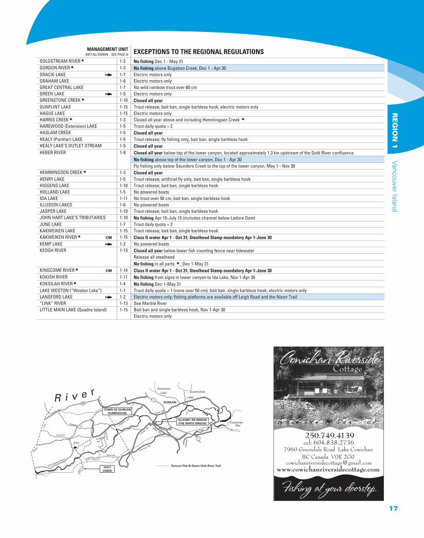
250.749.4139cel: 604.838.2736
Currie Cr
Hol
t Cr
Inwood Cr
WakeL
Cowichan Bay
Trunk Rd
Gibbins Rd
Indian Rd
Glenora Rd
Miller Rd
Allenby
Kok
sila
h
River
Quamichan
Lake
Rd
Cambrai
Vim
y R
d
Vaux Rd
Riverbottom Road
Line
Pow
er
Rd
Robertson Rd
DUNCAN181
1
Somenos
Lake
TOWN OF DUNCANPUMPHOUSE
ALLENBY RD BRIDGE(THE WHITE BRIDGE)
Duncan Fish & Game Club River TrailHOLTCREEK
R i v e r
17
Vancouver Island R
EG
ION
1
MANAGEMENT UNIT (NOT ALL SHOWN - SEE PAGE 5) EXCEPTIONS TO THE REGIONAL REGULATIONS
LITTLE QUALICUM RIVER 1-6 No fishing from the falls in Little Qualicum Falls Provincial Park downstream to the hatchery fence, Dec 1-May 31 All tributaries below the falls in Little Qualicum Falls Provincial Park closed all yearThe standard 100 m closure around a fish rearing facility has been reduced to a no fishing area from the hatchery fence to signs approx. 35 m downstreamFly fishing only, Sept 1-Nov 30 (where open, including tributaries)
LIZARD LAKE π 1-3 Electric motors onlyLIZARD POND 1-7 Trout daily quota = 1; artificial fly only, bait ban, single barbless hookLOIS LAKE π 1-4 Trout daily quota = 1; release all brown trout
Artificial fly only, bait ban, single barbless hookLONG LAKE (Nanaimo) π 1-5 Speed restriction on parts (60 km/h); ∞ wheelchair accessible fishing platform is located in Loudon ParkLOON LAKE π 1-7 Electric motors onlyMACKTUSH CREEK 1-7 Closed all yearMAHATTA RIVER 1-13 No fishing Nov 1-Apr 30MAIN LAKE (Quadra Island) 1-15 Bait ban and single barbless hook, Nov 1-Apr 30
Engine power restriction - 7.5 Kw (10 hp)MAPLE LAKE π 1-6 Electric motors onlyMARBLE (“Link”) RIVER (only between Victoria and Alice lakes)
1-13 Fly fishing only ∑
MARTHA LAKE π 1-10 Trout daily quota = 2; bait ban, single barbless hookMATHESON LAKE π 1-2 Electric motors only“MAXWELL LAKE” (Lake Maxwell) 1-1 Electric motors onlyMAYO LAKE π 1-4 ∂ Age restriction (see page 5)MCKENZIE LAKE 1-2 No powered boatsMCNAIR LAKE 1-10 Trout release; bait ban, single barbless hookMEGIN LAKE 1-8 No trout over 50 cm; bait ban, single barbless hookMICHAEL LAKE 1-54 No powered boatsMILLER CREEK∑ 1-6 Closed all yearMILLSTONE RIVER 1-5 ∂ Age restriction (see page 5), Brannan Lake to Pearson BridgeMINE LAKE 1-15 Engine power restriction - 7.5 Kw (10 hp)MISTY LAKE 1-13 Closed all year (located in an Ecological Reserve)MOHUN CREEK∑ 1-10 No fishing Dec 1-May 31
Closed all year from Menzies Bay logging mainline bridge crossing to Morton LakeMORTE LAKE 1-15 Electric motors onlyMUCHALAT RIVER∑ 1-12 No fishing Dec 1 - May 31NAHMINT LAKE 1-7 No trout over 50 cm; bait ban, single barbless hook; engine power restriction 7.5 Kw (10 hp)
Free Shipping In CanadaFree Shipping In Canada
*wall tents *aluminum frames
*diesel heaters *wood stoves
*cots *tarps *bedrolls
(250) 704-2534
DELUXE WALL TENTSDELUXE WALL TENTS
*with some restrictions*
Charts & Maps
Nautical Charts
Tide Tables
Boating Guides
Parks Guides
Backroad Mapbooks
Topographical Maps
Forest Recreation Maps
www.crownpub.bc.ca
563 Superior St.Victoria, BC
250 387-64091 800 663-6105
Island Serenity
Angling to Exceedyour Expectations
Fly Fishing Guide ServiceVancouver Island B.C.250-248-8881
NOTE: If a lake or stream is NOT listed here, then only the Provincial Regulations (pages 9 through 11) and the Regional Regulations (page 14) apply. New restrictions are highlighted in blue. Check for any in-season changes at: www.env.gov.bc.ca/fw/fish
REGION 1- Vancouver IslandWATER-SPECIFIC REGULATIONS
18
Vanc
ouve
r Is
land
RE
GIO
N 1
MANAGEMENT UNIT (NOT ALL SHOWN - SEE PAGE 5) EXCEPTIONS TO THE REGIONAL REGULATIONS
NAHMINT RIVER 1-7 No fishing below Nahmint Lake, Dec 1 - Apr 30Fly fishing only above Nahmint Lake
NANAIMO RIVER 1-5 Closed all year from power line crossing at “Bore Hole” upstream to fishing boundary signs at the mouth of Boulder CreekNo fishing from the Cedar Road bridge upstream approx. 400 m to the white square boundary signs near the Hwy 19 bridge, Sept 15-Oct 30No fishing upstream of the Hwy 1 bridge∑, Dec 1-May 31Artificial fly only upstream of the westernmost of the two Nanaimo Lakes, known locally as “Second” Lake, including tributariesEngine power restriction on parts - 7.5 Kw (10 hp)
NIMPKISH RIVER∑ 1-11 No fishing above Davie River, Dec 1-May 31NITINAT LAKE 1-3 Note: Nitinat Lake is tidal water; tidal regulations apply and a (federal) Tidal Waters Sport Fishing Licence is requiredNITINAT RIVER∑ 1-4 Closed all year above Parker Creek
No fishing between boundary signs approx. 100 m upstream of & downstream of “Red Rock Pool,”approx. 2 km (by road) south of the Nitinat R. bridge, Aug 25-Dec 31No fishing in “Glory Hole Slough,” approx. 1.5 km upstream of the Nitinat R. mouth, & that part of the river located upstream & down-stream of the entrance to the slough, as marked by boundary signs on opposite banks of the river, Aug 25-Dec 31 No fishing between boundary signs approx. 50 m upstream of and downstream of the Nitinat River bridge, Aug 25-Dec 31
O’CONNELL LAKE 1-13 No trout over 50 cm; bait ban, single barbless hookOYSTER RIVER π 1-6 No fishing upstream of the confluence with Little Oyster River ∑, Dec 1-June 30PANTHER LAKE 1-5 See Healy LakePERRY LAKE 1-12 Trout daily quota = 1 (none over 50 cm); bait ban, single barbless hook“PETE’S POND” 1-3 Trout release; artificial fly only, bait ban, single barbless hook
Unnamed lake at the head of San Juan RiverPRIOR LAKE π 1-2 No powered boatsPROSPECT LAKE π 1-2 Speed restriction on parts (8 & 60 km/h)PROVOST DAM 1-5 No powered boatsPUNTLEDGE RIVER 1-6 Closed all year downstream of the BC Hydro diversion dam (about 3.5 km downstream of Comox Lake) to the base of Stoltan Falls
(about 450 m below the Duncan Bay Mainline logging road bridge)Closed all year between signs approx. 100 m upstream & downstream of the confluence with Morrison CreekClosed all year from signs at hatchery counting fence to signs approx. 75 m downstream of fenceAll tributaries downstream of the BC Hydro diversion dam (about 3.5 km downstream of Comox Lake) closed all yearFly fishing only above the BC Hydro diversion dam (about 3.5 km downstream of Comox Lake), including tributaries
QUALICUM RIVER 1-6 No fishing downstream of the E&N Railway bridge, Dec 1- June 15No fishing from hatchery counting fence to the Hwy 19A bridge, Aug 10-Oct 15No fishing in any tributary below the Horne Lake dam, Dec 1- June 15Artificial fly only from the Horne Lake dam downstream to the E&N Railway bridge, Dec 1- May 31Fly fishing only ∑, Sept 1-Oct 15∞ wheelchair accessible fishing platform is located at the hatchery
QUATSE RIVER∑ π 1-13 No fishing May 1-June 15Hatchery steelhead daily quota = 1No fishing above the Quatse River fishway (1.4 km upstream of Dick Booth Creek), Dec 1-June 15Bait may ONLY be used Dec 1-Apr 30, where open
QUENNELL LAKE π 1-5 Speed restriction on parts (8 km/h)QUINSAM RIVER∑ 1-6 Closed all year from signs at power line crossing (about 25 m above Quinsam Hatchery weir) to boundary signs about 300 m below
weirSteelhead and cutthroat release below Quinsam LakeNo fishing downstream of the falls below Middle Quinsam Lake to signs at power line crossing (about 25 m above Quinsam hatchery weir), Dec 1-June 30∞ wheelchair accessible fishing platform is located near the Hwy 28 bridge
REGINALD LAKE π 1-10 Trout daily quota = 2; bait ban, single barbless hookROBERTS LAKE 1-10 No trout over 50 cm; bait ban, single barbless hookROGERS CREEK 1-7 ∂ Age restriction (see page 5)ROONEY LAKE∑ 1-10 Brown trout daily quota = 1ROSELLE LAKE 1-11 Trout daily quota = 2ROSEN LAKE (Read Island) 1-15 No powered boats
[email protected] River: 250.923.2111 Gold River: 250.238.7515Toll free: 1.888.771.2111Each of ce independently owned and operated
Mountains of Service Since 1982Serving the North Island
Campbell River • Gold River • Tahsis • Zeballosand all points north of the Comox Valley
Call us - we will help you nd your dream recreational propertyFind your shing or hunting getaway at
www.goldriverrealty.ca
Family Fishing Waters
Catch up with your kids!
Check out the Family Fishing Waters at
www.env.gov.bc.ca/fw/fish/regulations/family-fishing
19
Vancouver Island R
EG
ION
1
MANAGEMENT UNIT (NOT ALL SHOWN - SEE PAGE 5) EXCEPTIONS TO THE REGIONAL REGULATIONS
ROWBOTHAM LAKE 1-5 Trout release; artificial fly only, bait ban, single barbless hookST. MARY LAKE π 1-11 Electric motors onlySALMON RIVER∑ 1-10 Closed all year above Kay Creek
No powered boats upstream of confluence with White River; speed restriction (10 km/h) from estuary to confluence with White RiverSAN JUAN RIVER∑ 1-3 Closed all year above Fleet RiverSEYMOUR RIVER ∏ 1-14 Class II water Aug 15-Oct 31∑; Steelhead Stamp not required unless fishing for steelheadSHAWNIGAN LAKE π 1-2 Speed restrictions on parts (8 & 65 km/h)SOMASS RIVER π 1-7 Engine power restriction 7.5 Kw (10 hp)
Bait may ONLY be used Sept 15 - Apr 30SOOKE RIVER∑ 1-2 Fly fishing only below Sooke River Falls, Sept 1-Nov 30
Closed all year from the base of the lower “potholes” falls to signs approx. 100m downstreamSPIDER LAKE π 1-6 No powered boatsSPROAT LAKE 1-7 Cutthroat trout release, no wild rainbow trout over 60 cmSPROAT RIVER 1-7 No fishing from Sproat Lake to signs 300 m below Hwy #4, June 15-Nov 15
Bait may ONLY be used Nov 1-Apr 30STAMP RIVER π 1-7 No fishing between signs 200m above & 500m below Stamp Falls, June 15-Nov15
No fishing from the confluence with Ash River upstream to the Great Central Lake dam ∑, Jan 1-Apr 30Bait ban all year ABOVE signs at “Girl Guide Falls” (approx. 250 m upstream of the mouth of Beaver Creek) ∑ Bait may ONLY be used Sept 15 - Apr 30 BELOW signs at “Girl Guide Falls” (approx. 250 m upstream of the mouth of Beaver Creek) Engine power restriction 7.5 Kw (10hp), on parts
STEWART LAKE 1-10 No trout over 50 cm; bait ban, single barbless hook; electric motors onlySTOCKING LAKE 1-5 No powered boats“STOWELL LAKE” (Lake Stowell) π 1-1 Electric motors onlySTRAMBERG LAKE 1-15 Trout release; bait ban, single barbless hook; electric motors onlySTRATHCONA PARK WATERS 1-9 No powered boats on any water within Strathcona Park except Gold, Upper Campbell and Buttle lakesTADJISS LAKE π 1-4 Trout daily quota = 1; release all brown trout; artificial fly only, bait ban, single barbless hookTAYLOR RIVER 1-7 Fly fishing onlyTHELWOOD CREEK 1-9 Closed all yearTHETIS LAKE π 1-1 Electric motors onlyTLOWILS LAKE 1-10 Electric motors onlyTOQUART LAKE 1-8 No trout over 50 cm; bait ban, single barbless hookTOQUART RIVER∑ 1-8 No fishing upstream of the Toquart mainline logging bridge Nov 1-May 31. Note: this includes the river above the lakeTOY LAKE 1-7 Trout daily quota = 2; bait ban, single barbless hook
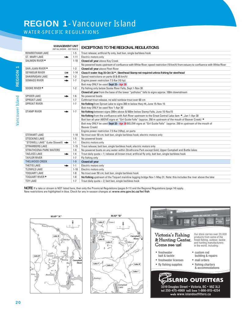
00.51 1 km
Scale
McNair L
Cedar L
Muskeg L
Mud L
Chain L
Blackwater L
Farewell L
Grace L
Roberts Lake
Am
or L
ake
Lake A
Lake B
19
MAP "A"
Roberts
AmorDe
Cosmos
Creek
Creek
Campbell
River
Mary L
Crane L
Men
zies
Men
zies
BayBay
Mai
nlin
e
Mai
nlin
e
Men
zies
Bay
Mai
nlin
e
Morton LMorton LMorton L
Mohun
Creek
Loveland Bay
Gosling L
Campbell Lake
JohnHart
Lake
Moh
un L
19
Lake C
Lake E
Lake G Lake H
Lake I
Lake D
Lake F
00.51 1 km
Scale
MAP "B"
Campbell
River
NOTE: If a lake or stream is NOT listed here, then only the Provincial Regulations (pages 9-11) and the Regional Regulations (page 14) apply. New restrictions are highlighted in blue. Check for any in-season changes at: www.env.gov.bc.ca/fw/fish
freshwater bait & tackle
freshwater licenses fly fishing supplies
custom rod building & repairs
mail orders fishing charters & accommodations
Our store carries over 20,000 products from some of the finest fishing, outdoor, tackle and hunting manufacturers in the world, including:
3319 Douglas Street Victoria, BC V8Z 3L2 250-475-4969 1-866-915-4254
www.islandoutfitters.ca
REGION 1- Vancouver IslandWATER-SPECIFIC REGULATIONS
20
Vanc
ouve
r Is
land
RE
GIO
N 1
MANAGEMENT UNIT (NOT ALL SHOWN - SEE PAGE 5) EXCEPTIONS TO THE REGIONAL REGULATIONS
TRENT RIVER∑ 1-6 No fishing Dec 1-May 31TSABLE RIVER∑ 1-6 No fishing Dec 1-May 31TSABLE LAKE 1-6 Trout release; bait ban, single barbless hookTSITIKA RIVER 1-10 No fishing above Catherine Creek, Nov 1-Apr 30
Fly fishing only below Catherine CreekTSOLUM RIVER∑ 1-6 Closed all yearUNNAMED LAKE “A” - MAP A, below 1-10 Trout release; bait ban, single barbless hookUNNAMED LAKE “B” - MAP A, below 1-10 Trout release; bait ban, single barbless hookUNNAMED LAKE “C” - MAP B, below 1-10 Trout daily quota = 2; bait ban, single barbless hookUNNAMED LAKE “D” - MAP B, below 1-10 Trout daily quota = 2; bait ban, single barbless hookUNNAMED LAKE “E” - MAP B, below 1-10 Trout release; bait ban, single barbless hookUNNAMED LAKE “F” - MAP B, below 1-10 Trout daily quota = 2; bait ban, single barbless hookUNNAMED LAKE “G” - MAP B, below 1-10 Trout daily quota = 2; bait ban, single barbless hookUNNAMED LAKE “H” - MAP B, below 1-10 Trout release; bait ban, single barbless hookUNNAMED LAKE “I” - MAP B, below 1-10 Trout daily quota = 2; bait ban, single barbless hookVILLAGE BAY LAKE 1-15 Bait ban and single barbless hook, Nov 1-Apr 30
Engine power restriction - 7.5 Kw (10 hp)WAHPEETO CREEK 1-14 Closed all year within 100 m below falls 4.5 km upstream of Wakeman RiverWAKEMAN RIVER∑ ∏ 1-14 Class II water Apr 1 - Oct 31; Steelhead Stamp mandatory Apr 1-June 30“WESTON LAKE” 1-1 See Lake WestonWEST WALBRAN RIVER∑ 1-3 Trout and kokanee releaseWESTWOOD LAKE π 1-5 ∞ wheelchair accessible fishing platform is located in Westwood Lake ParkWHITE RIVER∑ 1-10 Closed all year between signs at salmon viewing poolWILLEMAR LAKE 1-6 No trout over 50 cm; bait ban, single barbless hookWILLOW CREEK 1-6 ∂ Age restriction (see page 5)WOWO LAKE π 1-6 Trout daily quota = 2; artificial fly only, bait ban,
single barbless hook; electric motors onlyZEBALLOS LAKE 1-12 Closed all yearZEBALLOS RIVER∑ 1-12 No fishing Nov 1-Apr 30
Family Fishing Waters
Catch up with your kids!
Check out the Family Fishing Waters at
www.env.gov.bc.ca/fw/fish/regulations/family-fishing
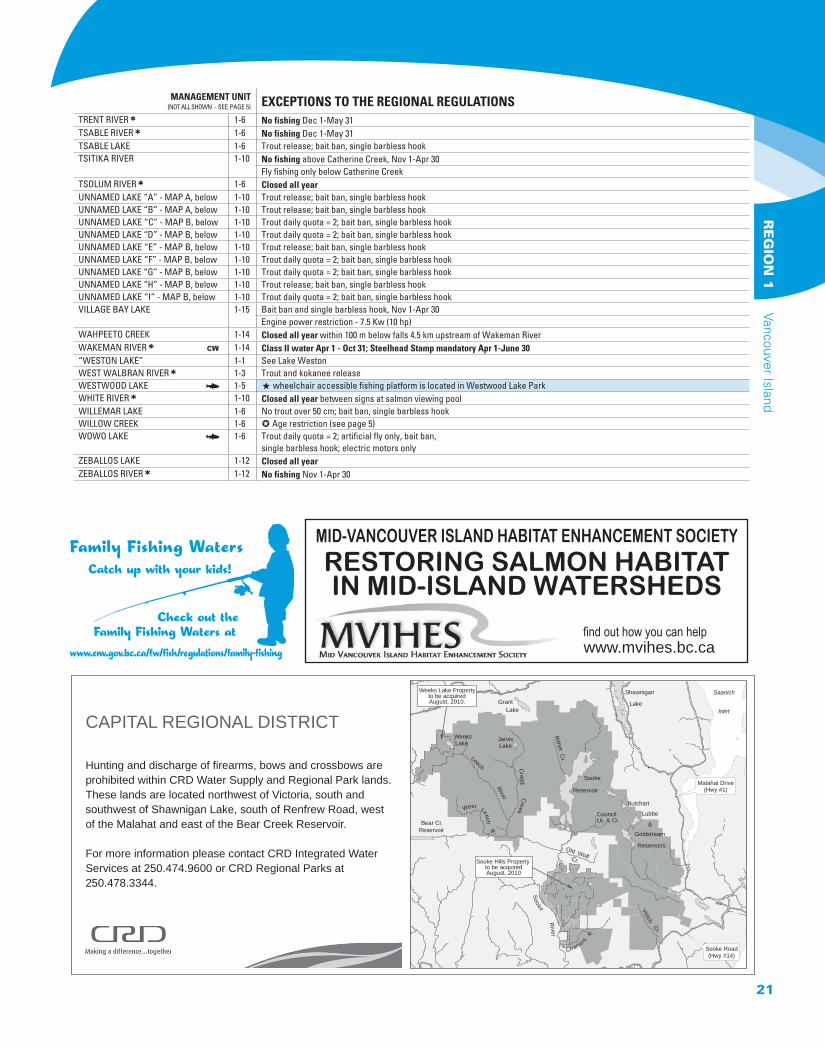
Saanich
Inlet
Malahat Drive(Hwy #1)
Cragg C
reek
Leech River
West Leech R.
Sooke
Reservoir
Butchart
Lubbe
&Goldstream
Reservoirs
Sooke R
iver
Bear Cr.Reservoir
Shawnigan
Lake
Old WolfCr.
GrantLake
LakeWeeks R
ithet Cr.
Sooke Road(Hwy #14)
Chart er s
R.
Veitch Cr.
CouncilLk. & Cr.
Weeks Lake Propertyto be acquiredAugust, 2010.
LakeJarvis
Sooke Hills Property to be acquiredAugust, 2010
CAPITAL REGIONAL DISTRICT
Hunting and discharge of firearms, bows and crossbows are prohibited within CRD Water Supply and Regional Park lands.These lands are located northwest of Victoria, south andsouthwest of Shawnigan Lake, south of Renfrew Road, westof the Malahat and east of the Bear Creek Reservoir.
For more information please contact CRD Integrated WaterServices at 250.474.9600 or CRD Regional Parks at250.478.3344.
MID-VANCOUVER ISLAND HABITAT ENHANCEMENT SOCIETY
RESTORING SALMON HABITAT IN MID-ISLAND WATERSHEDS
www.mvihes.bc.ca
21
Vancouver Island R
EG
ION
1