Embed Size (px)
Citation preview

Les îles de ciels (« Sky islands »)
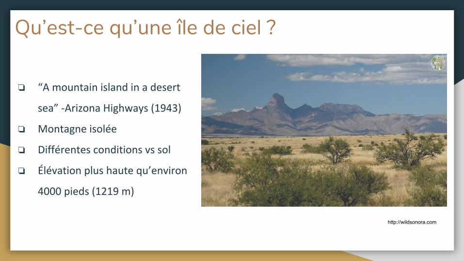
Qu’est-ce qu’une île de ciel ?
❏
❏
❏
❏
http://wildsonora.com
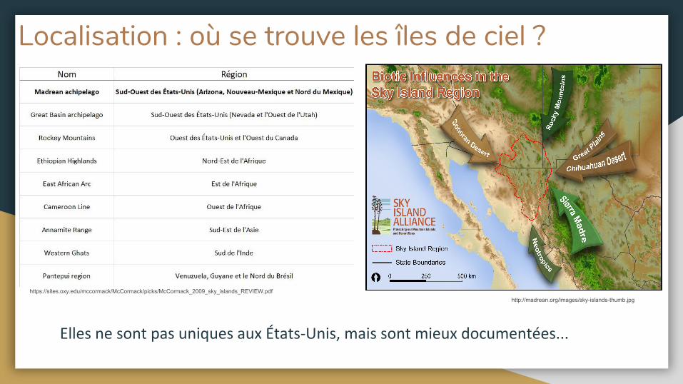
Localisation : où se trouve les îles de ciel ?
https://sites.oxy.edu/mccormack/McCormack/picks/McCormack_2009_sky_islands_REVIEW.pdfhttp://madrean.org/images/sky-islands-thumb.jpg
→
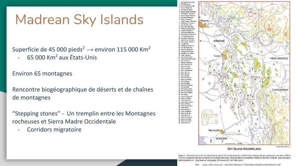
Madrean Sky Islands
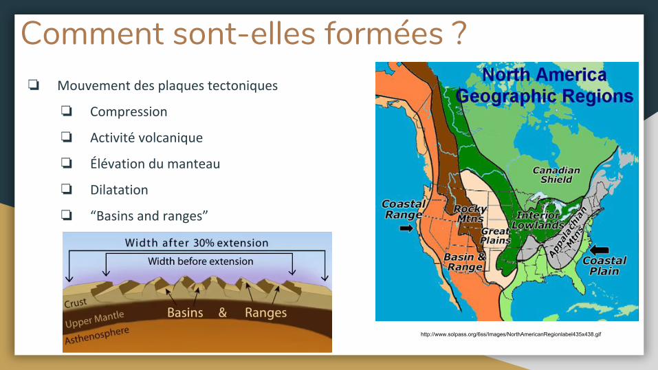
Comment sont-elles formées ?❏
❏
❏
❏
❏
❏
http://www.solpass.org/6ss/Images/NorthAmericanRegionlabel435x438.gif
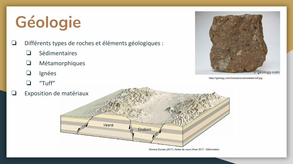
Géologie❏
❏
❏
❏
❏
❏
Simone Dumas (2017), Notes de cours HIver 2017 - Déformation.
https://geology.com/rocks/pictures/welded-tuff.jpg
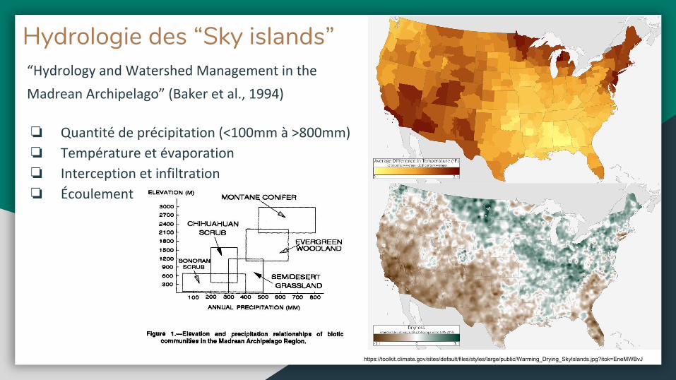
Hydrologie des “Sky islands”
❏
❏
❏
❏
https://toolkit.climate.gov/sites/default/files/styles/large/public/Warming_Drying_SkyIslands.jpg?itok=EneMWBvJ
❏
❏
❏
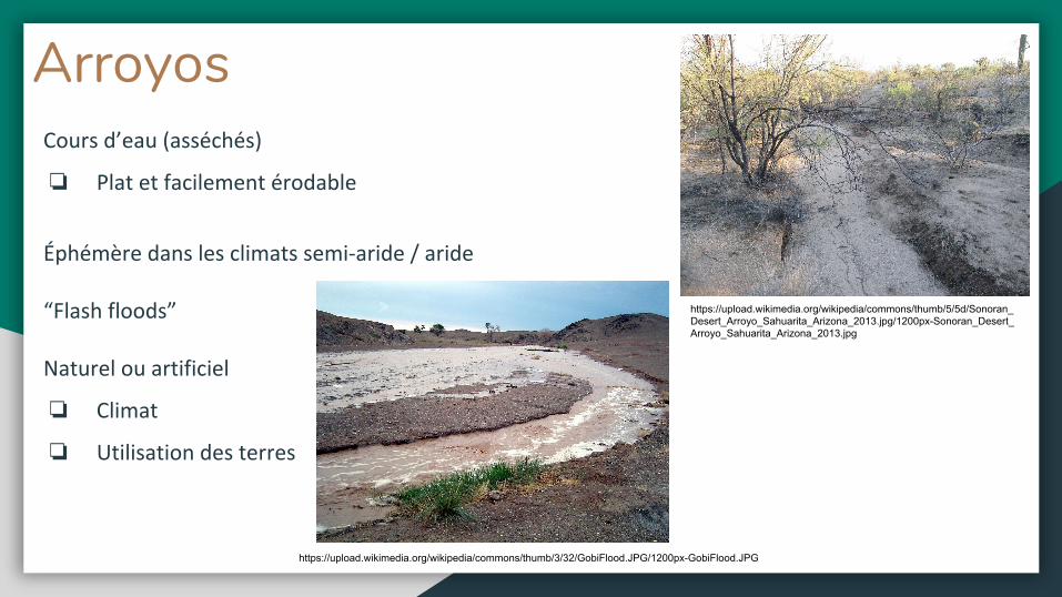
Arroyos
https://upload.wikimedia.org/wikipedia/commons/thumb/5/5d/Sonoran_Desert_Arroyo_Sahuarita_Arizona_2013.jpg/1200px-Sonoran_Desert_Arroyo_Sahuarita_Arizona_2013.jpg
https://upload.wikimedia.org/wikipedia/commons/thumb/3/32/GobiFlood.JPG/1200px-GobiFlood.JPG
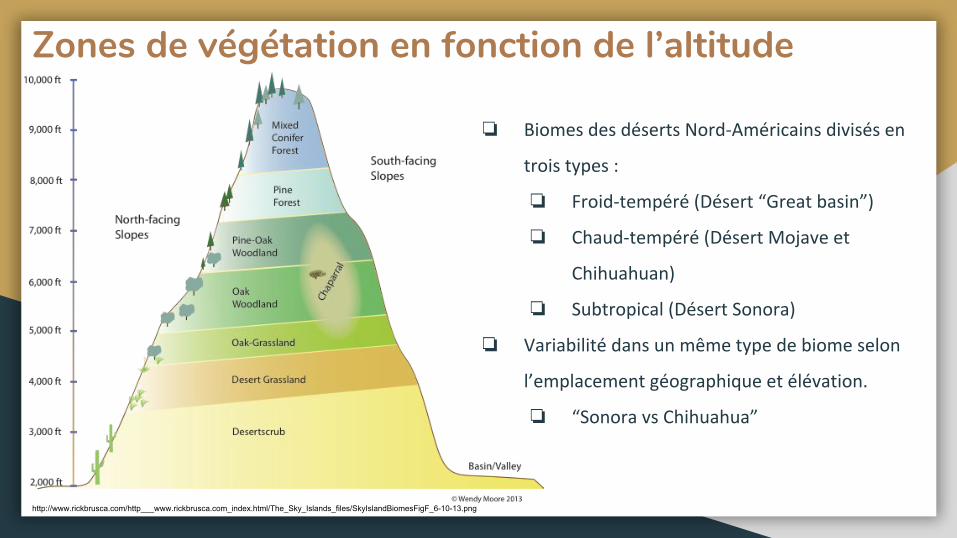
Zones de végétation en fonction de l’altitude
❏
❏
❏
❏
❏
❏
http://www.rickbrusca.com/http___www.rickbrusca.com_index.html/The_Sky_Islands_files/SkyIslandBiomesFigF_6-10-13.png
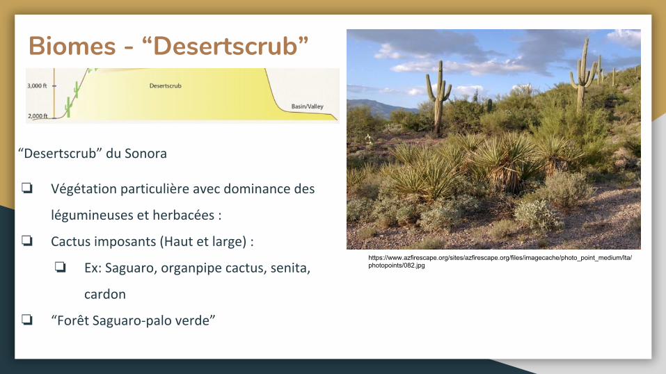
Biomes - “Desertscrub”
❏
❏
❏
❏
https://www.azfirescape.org/sites/azfirescape.org/files/imagecache/photo_point_medium/lta/photopoints/082.jpg
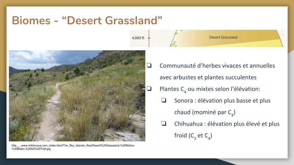
Biomes - “Desert Grassland”
❏
❏
❏
❏
http___www.rickbrusca.com_index.html/The_Sky_Islands_files/Desert%20Grassland,%20Molino%20Basin,%20AZ%20Trail.jpg
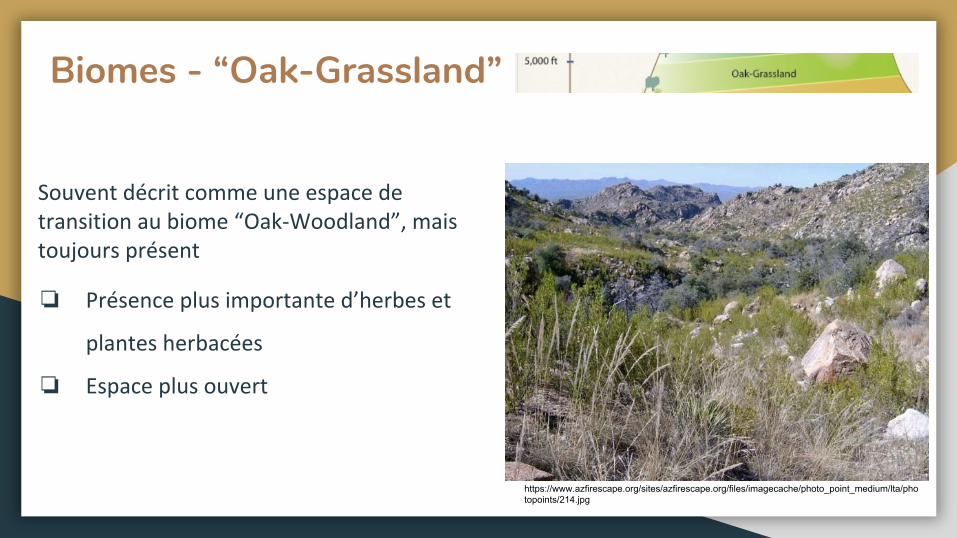
Biomes - “Oak-Grassland”
❏
❏
https://www.azfirescape.org/sites/azfirescape.org/files/imagecache/photo_point_medium/lta/photopoints/214.jpg
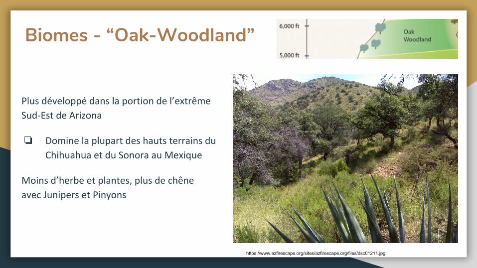
Biomes - “Oak-Woodland”
❏
https://www.azfirescape.org/sites/azfirescape.org/files/dsc01211.jpg
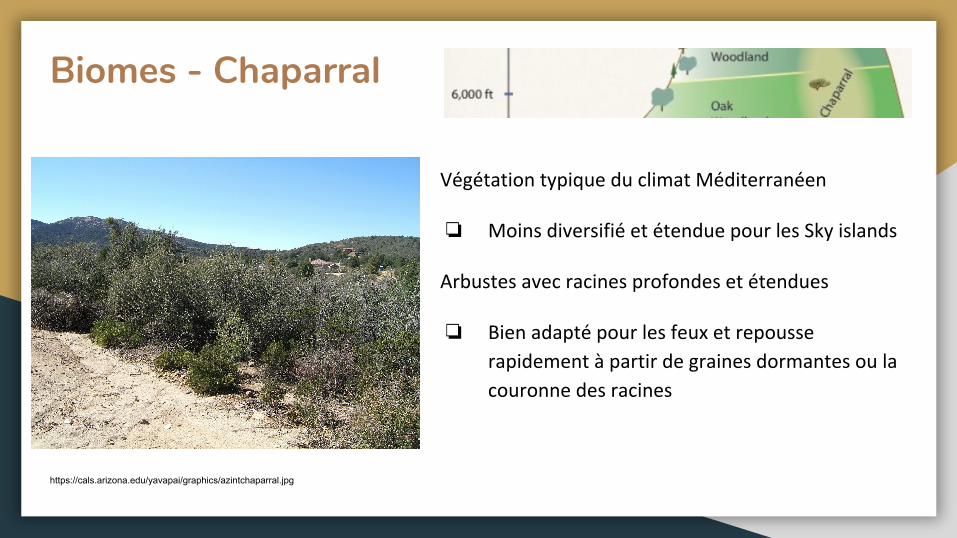
Biomes - Chaparral
❏
❏
https://cals.arizona.edu/yavapai/graphics/azintchaparral.jpg
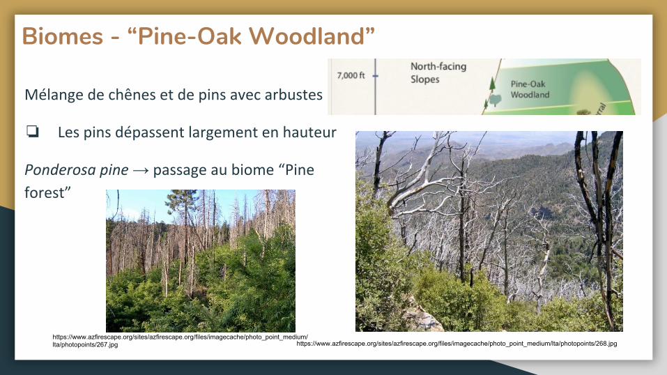
Biomes - “Pine-Oak Woodland”
❏
→
https://www.azfirescape.org/sites/azfirescape.org/files/imagecache/photo_point_medium/lta/photopoints/268.jpghttps://www.azfirescape.org/sites/azfirescape.org/files/imagecache/photo_point_medium/lta/photopoints/267.jpg
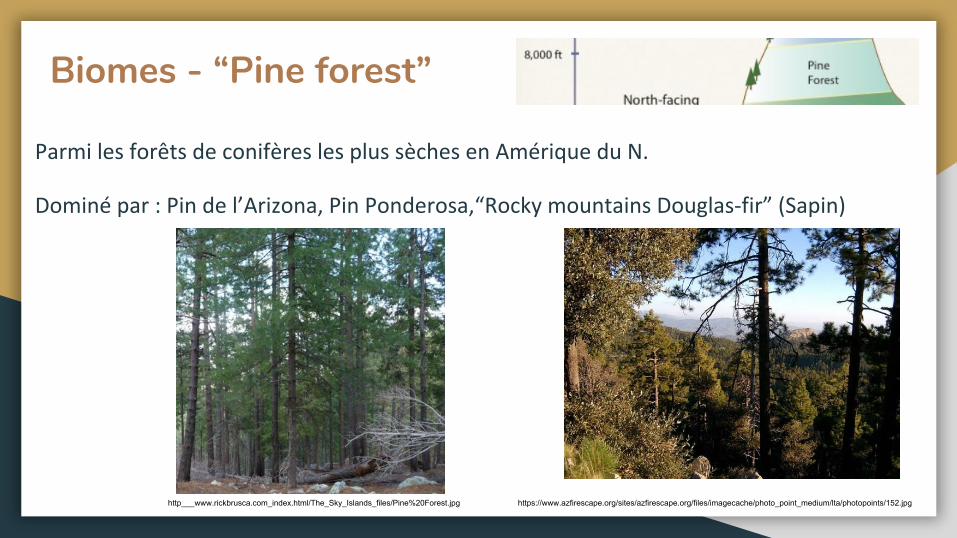
Biomes - “Pine forest”
https://www.azfirescape.org/sites/azfirescape.org/files/imagecache/photo_point_medium/lta/photopoints/152.jpghttp___www.rickbrusca.com_index.html/The_Sky_Islands_files/Pine%20Forest.jpg
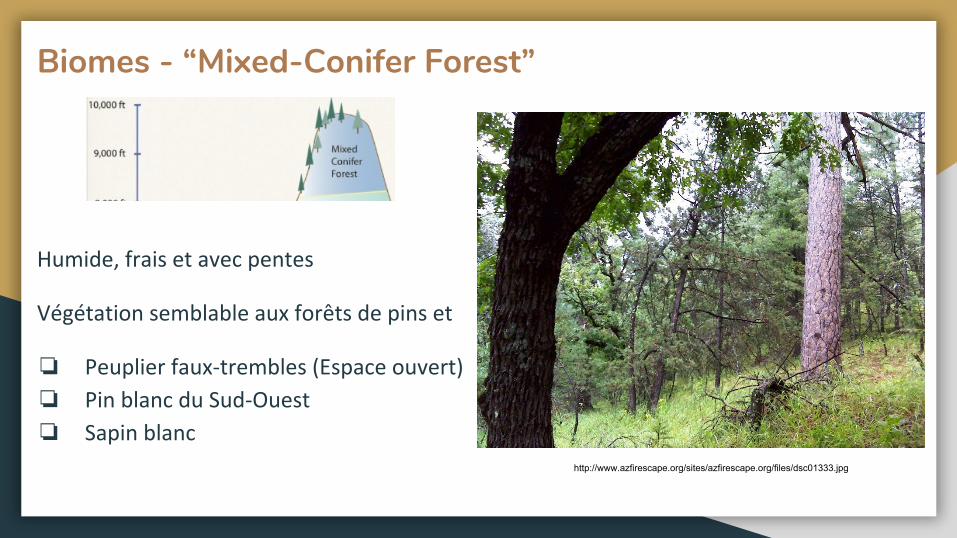
Biomes - “Mixed-Conifer Forest”
❏
❏
❏
http://www.azfirescape.org/sites/azfirescape.org/files/dsc01333.jpg
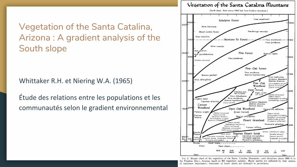
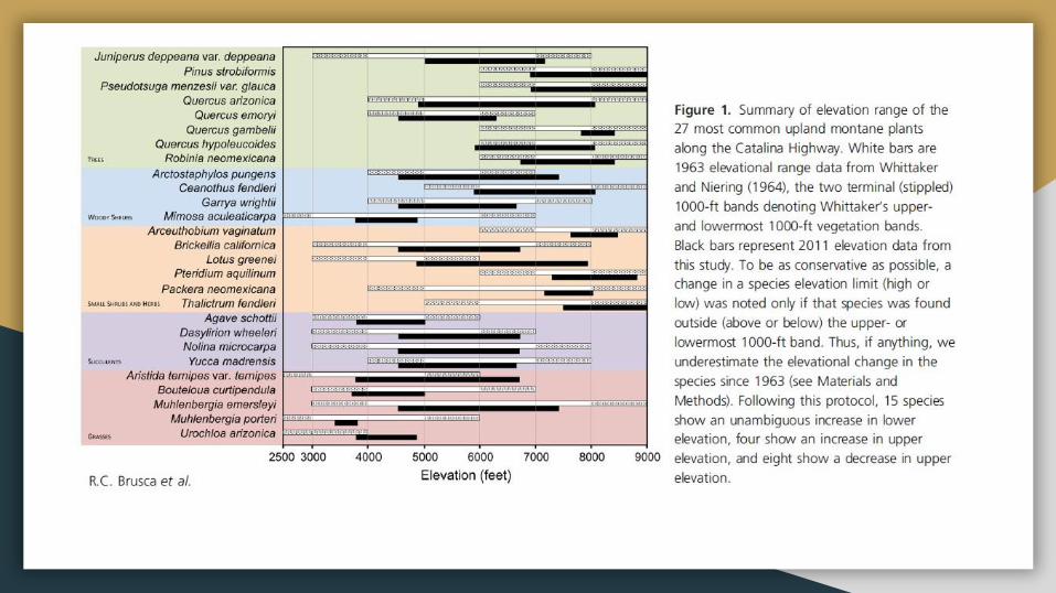
Vegetation of the Santa Catalina, Arizona : A gradient analysis of the South slope
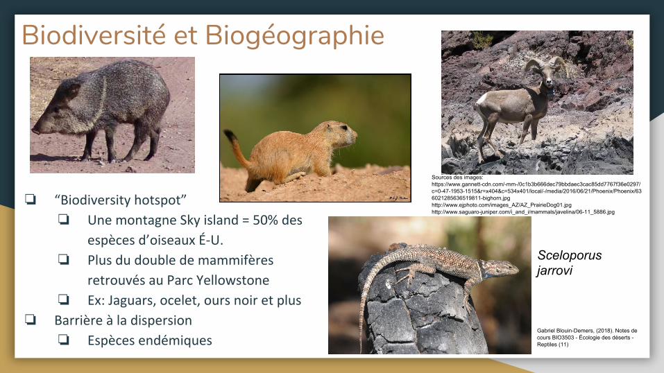
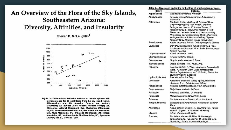
Biodiversité et Biogéographie
❏
❏
❏
❏
❏
❏
Sources des images: https://www.gannett-cdn.com/-mm-/0c1b3b666dec79bbdaec3cac85dd7767f36e0297/c=0-47-1953-1515&r=x404&c=534x401/local/-/media/2016/06/21/Phoenix/Phoenix/636021285636519811-bighorn.jpghttp://www.ejphoto.com/images_AZ/AZ_PrairieDog01.jpghttp://www.saguaro-juniper.com/i_and_i/mammals/javelina/06-11_5886.jpg
Gabriel Blouin-Demers, (2018). Notes de cours BIO3503 - Écologie des déserts - Reptiles (11)
Sceloporus jarrovi
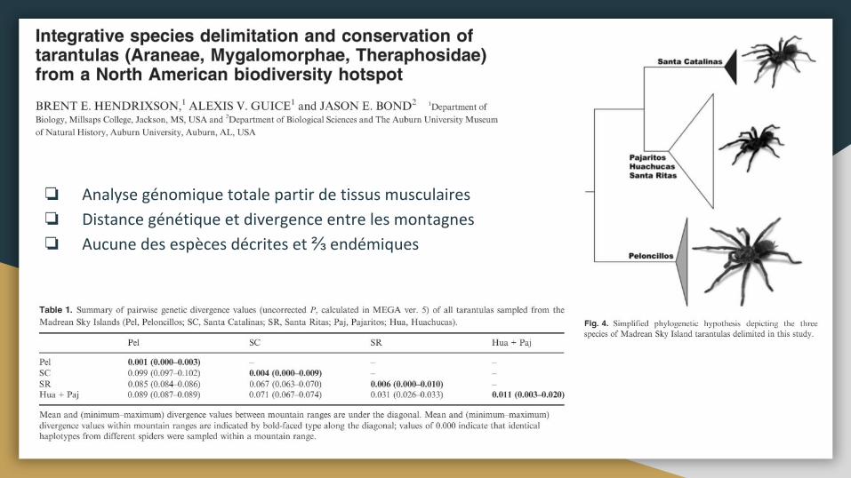
❏
❏
❏ ⅔
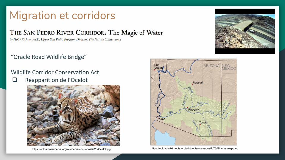
Migration et corridors
❏
https://upload.wikimedia.org/wikipedia/commons/7/76/Gilarivermap.pnghttps://upload.wikimedia.org/wikipedia/commons/2/28/Ocelot.jpg
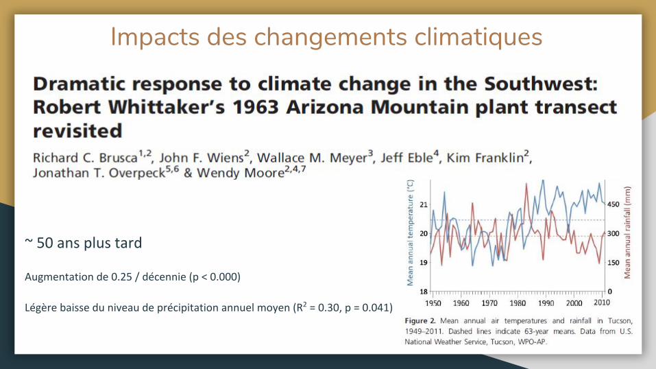
Impacts des changements climatiques
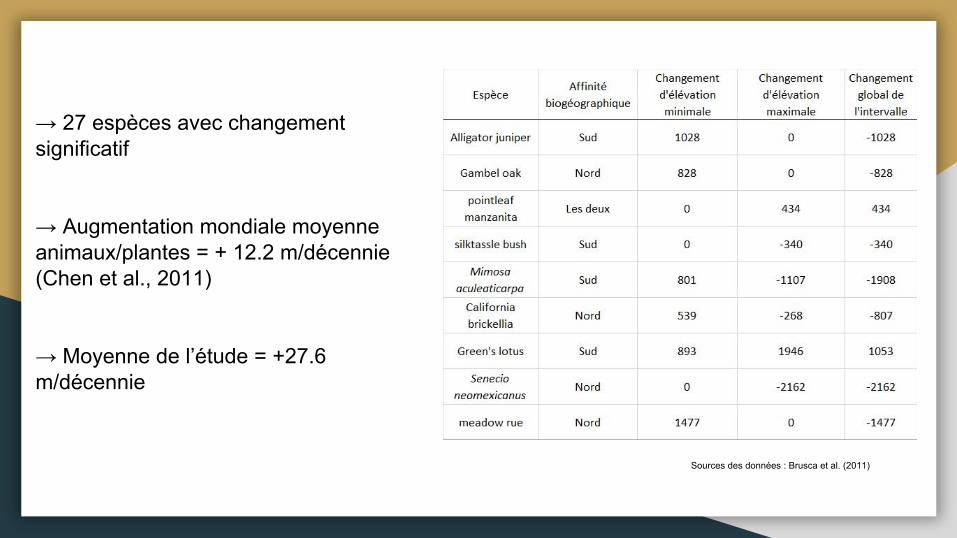
→ 27 espèces avec changement significatif
→ Augmentation mondiale moyenne animaux/plantes = + 12.2 m/décennie (Chen et al., 2011)
→ Moyenne de l’étude = +27.6 m/décennie
Sources des données : Brusca et al. (2011)
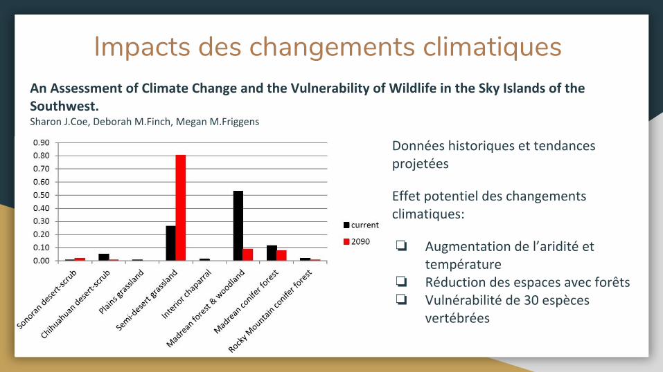
Impacts des changements climatiques
❏
❏❏
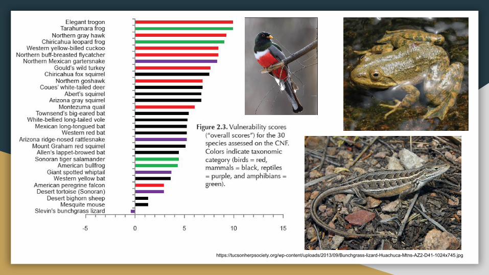
https://tucsonherpsociety.org/wp-content/uploads/2013/09/Bunchgrass-lizard-Huachuca-Mtns-AZ2-D41-1024x745.jpg
Références:
Baker M.B. Jr., DeBano L.F., Ffolliott F., (1994). Hydrology and Watershed Management in the Madrean Archipelago. Biodiversity and Management of the Madrean Archipelago: The Sky Islands of Southwestern United States and Northwestern Mexico. USDA Forest service. pp: 329-337
Brusca R.C., Wiens J., Meyer W.M., Eble J., Franklin K., Overpeck J.T., Moore W. (2013). Dramatic response to climate change in the Southwest: Robert Whittaker’s 1963 Arizona Mountain plant transect revisited. Ecology and Evolution. Vol. 3(10), pp: 3307-3319.
Coe S.J., Finch D.M., Friggens M.M., (2012). An assessment of climate change and the vulnerability of wildlife in the Sky Islands of the Southwest. Gen. Tech. Rep. RMRS-GTR-273. Fort Collins, CO: U.S. Department of Agriculture, Forest Service, Rocky Mountain Research Station. 208p.
Hendrixson B.E., Guice A.V., Bond J.E. (2015). Integrative species delimitation and conservation of tarantulas (Araneae, Mygalomorphae, Theraphosidae) from a North American Biodiversity hotspot. Insect conservation and Diversity. Vol. 8, pp: 120-131
P. McLaughlin, Steven. (1994). An Overview of the Flora of the Sky Islands, Southeastern Arizona: Diversity, Affinities, and Insularity. Ldv Forum - LDV.
Ober K.A., Connolly C.T. (2015). Geometric morphometric and phylogenetic analyses of Arizona Sky Island populations of Scaphinotus peteris Roeschke (Coleoptera: Carabidae). Zoological Journal of the Linnean Society. Vol.175, pp: 107-118.
Whittaker R.H., Niering W.A. (1965). Vegation of the Santa Catalina Mountains, Arizona: A gradient analysis of South slope. Ecology. Vol. 46, No. 4, pp: 429-452.
Sitographie:
https://www.fs.fed.us/wildflowers/beauty/Sky_Islands/index.shtml
https://www.terrain.org/articles/21/skroch.htm
https://en.wikipedia.org/wiki/Arroyo_(creek)
https://serc.carleton.edu/vignettes/collection/36633.html
https://geochange.er.usgs.gov/sw/impacts/geology/arroyos/
https://www.sonorandesert.org/learning-more/wildlife-linkages-2/oracle-road-wildlife-crossings-2/
https://www.skyislandalliance.org/wp-content/uploads/2014/11/10-Fall-Corridors.pdf
http://www.rickbrusca.com/
http://www.madrean.org/symbfauna/
https://www.azfirescape.org/catalina/landscape_types