Embed Size (px)
Citation preview
To improve the traffic routes
into the Rhône mouth :
the evaluation of a planning
policy (17th.-early 19th c.)
Anne Conchon(Université Paris 1 – IDHE.S)

The Rhône delta nowadays

G. Pichard, M. Provansal et F. Sabatier, « Les embouchures du Rhône. L’apport de la cartographie à l’étude deleur évolution géomorphologique au cours du petit âge glaciaire », Méditerranée, 2014, 122, p. 43

G. Arnaud-Fasseta et J.-P. Suc, Cahiers de Vallesia, 29, Sion, 2015, p. 83
The limit between the saltwater and the fresh water(early 18th c.)
M. Provansal, C. Vella, G. Arnaud-Fasseta, F. sabatier et G. Maillet, Participation des apports sédimentaires fluviaux à la mobilité du littoral du delta du Rhône, Géomorphologie : relief, processis, environnement, 2003, vol. 9 (4), p. 271-282

Chronology of the main infrastructure projects intothe mouth of the Rhône river
dates Names ofthepromoters
• M. Mille de Valbrun (from Tarascon)• P. Chalamont (from Tarascon)• Benard (from Arles)• Noël Avizard (from Arles)• M. Silvy• M. Silvy• M. Millet de Monville• M. Beaumond• Jean Guimet
• 1661• 1668• 1707• 1709• 1732• 1737• 1749-1750• 1768• An IX
1. Traffic difficulties in the Rhône delta
2. Numerous waterways projects
3. From the evaluation to the decision : thecomplexity of issues
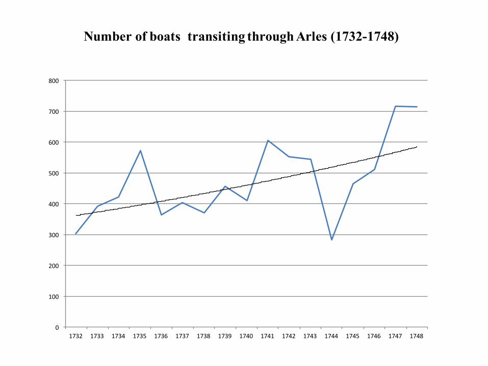
Number of boats transiting through Arles (1732-1748)
0
100
200
300
400
500
600
700
800
1732 1733 1734 1735 1736 1737 1738 1739 1740 1741 1742 1743 1744 1745 1746 1747 1748
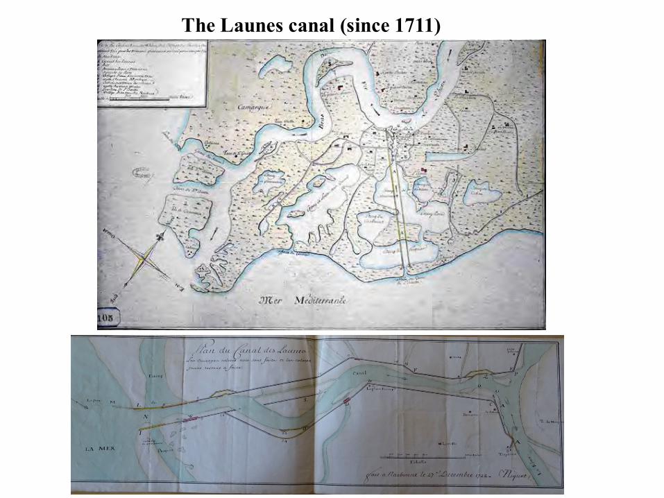
The Launes canal (since 1711)
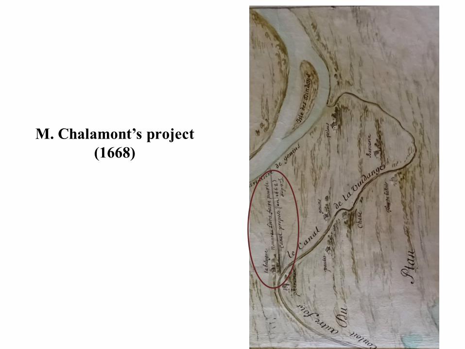
M. Chalamont’s project(1668)
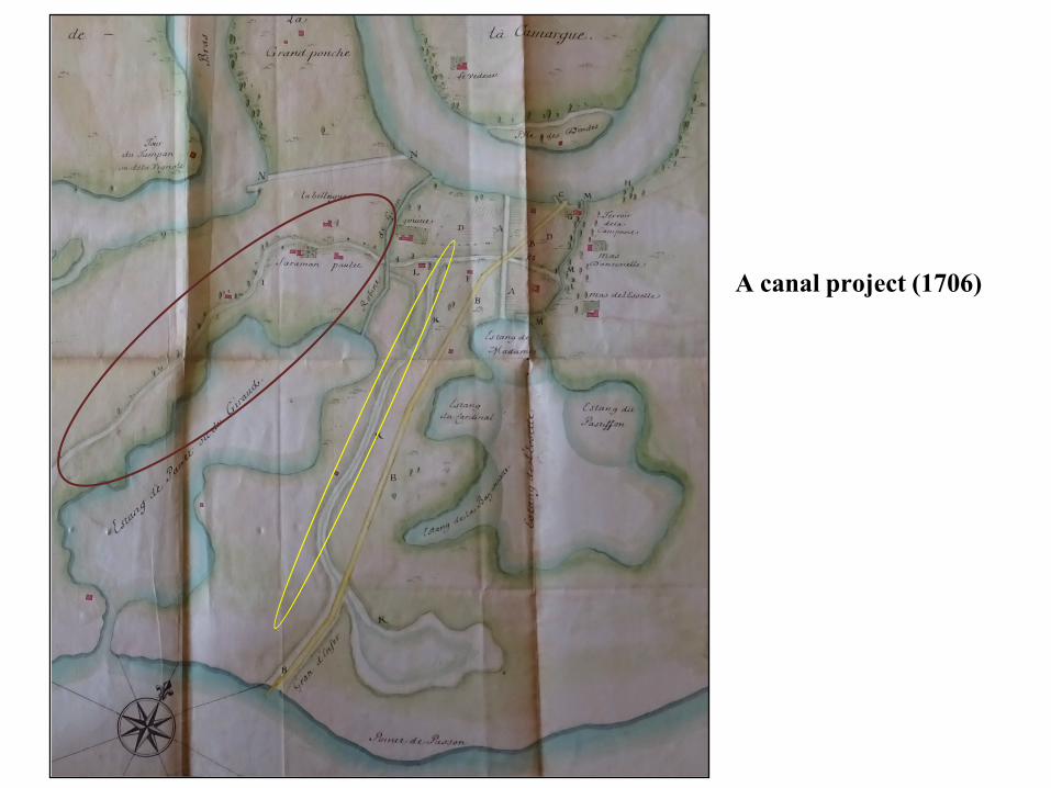
A canal project (1706)

BNF. Carte d'une partie de la Provence, qui représente le plan et projet d'un canal d'Arles au golfe de Fos et à la tour de Bouc, pour communiquer de cette ville à Marseille (1726)

BNF, Carte du golfe de Fos et des étangs voisins, avec tracé du projet de canal d'Arles à Bouc