Embed Size (px)
Citation preview
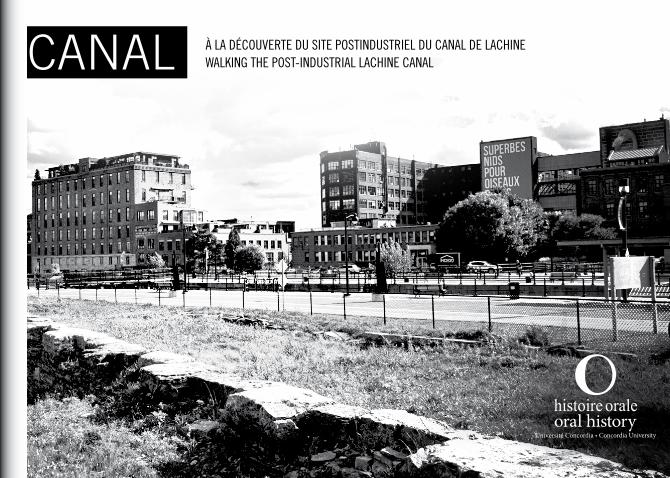
À la découverte du site postindustriel du canal de lachineWalking the post-industrial lachine canal
À la
déc
ouve
rte
du s
ite p
ostin
dust
riel
du
cana
l de
lach
ine
/
Walk
ing
the
post
-indu
stri
al la
chin
e ca
nal

ISBN 978-2-9813949-0-3
Dépôt légal - Bibliothèque et Archives nationales du Québec, 2013
Dépôt légal - Bibliothèque et Archives Canada, 2013
© Centre d’histoire orale et de récits numérisés, 2013.
© Centre for Oral History and Digital Storytelling, 2013.

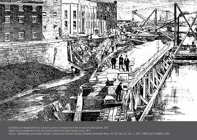
Illustration de l’élargissement du canal de Lachine à l’emplacement des écluses de Saint-Gabriel, 1877. Sketch of the enlargement of the the Lachine Canal at the Saint Gabriel Locks, 1877. Source : Bibliothèque et Archives Canada / Library and Archives Canada, Canadian Illustrated News, Vol. XVI, No. 22, Dec. 1, 1877 / AMICUS27101889, p.340.
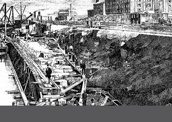
Illustration de l’élargissement du canal de Lachine à l’emplacement des écluses de Saint-Gabriel, 1877. Sketch of the enlargement of the the Lachine Canal at the Saint Gabriel Locks, 1877. Source : Bibliothèque et Archives Canada / Library and Archives Canada, Canadian Illustrated News, Vol. XVI, No. 22, Dec. 1, 1877 / AMICUS27101889, p.340.
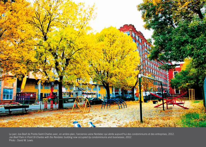
Le parc Joe-Beef de Pointe-Saint-Charles avec, en arrière-plan, l’ancienne usine Nordelec qui abrite aujourd’hui des condominiums et des entreprises, 2012. Joe Beef Park in Point St-Charles with the Nordelec building now occupied by condominiums and businesses, 2012. Photo : David W. Lewis
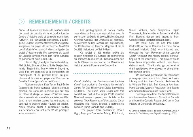
REMERCIEMENTS CREDITS
CONSIGNES INSTRUCTIONS
FINS ET RECOMMENCEMENTS ENDINGS AND BEGINNINGS
PATRIMOINE INDUSTRIEL INDUSTRIAL HERITAGE
I
II
III
IV
LES ENJEUX DU CHANGEMENT URBAIN THE POLITICS OF URBAN CHANGE
QUELQUES LIENS SOME LINKS
LECTURES COMPLéMENTAIRES COMPLEMENTARy READINGS
V
VI
VII
MARCHé ATwATER ATwATER MARKET
1
PONT ATwATER / IROQUOIS ATwATER / IROqUOIS BRIDGE
3
VOIES FERRéES RAILwAy TRACKS
4
COURS à BOIS LUMBER yARDS
5
TOURS DE PONT6
RESTAURANT ET TAVERNE MAGNAN MAGNAN RESTAURANT AND TAvERN7
DOMINION TExTILE2
STELCO8
ROBIN HOOD10
LA PETITE-BOURGOGNE LITTLE BURGUNDy
11
VESTIGES ARCHéOLOGIQUES ARCHEOLOGICAL vESTIGES
12
USINE DE PAPIER GAIR GAIR PAPER
13
RESTAURANT BLUE BLUE RESTAURANT 14
TOUR à BALLES DE LA STELCO STELCO SHOT TOwER
9
PISTE CyCLABLE BIKE PATH
15
NORDELEC17
RAFFINERIE DE SUCRE REDPATH REDPATH SUGAR REFINERy18
éCLUSES LOCKS
19
BELDING-CORTICELLI16
TABLES DES MATIÈRES / TABLE OF CONTENTS
/ I
Canal : À la découverte du site postindustriel du canal de Lachine est une production du Centre d’histoire orale et de récits numérisés (CHORN) de l’Université Concordia. L’audio-guide Canal et le présent livret sont une partie intégrante du projet de recherche Montréal post/industriel et s’inscrit dans la lignée du projet d’histoire orale Vos souvenirs du canal de Lachine révélés mené par Parcs Canada en partenariat avec le CHORN.
Steven High, Eve-Lyne Cayouette Ashby, Phil Lichti, Simon Vickers, Sofie Desjardins, Ingrid Theuninck, Marie-Hélène Sauvé et Viola Fini ont participé à la conception de l’audioguide et du présent livret. Le gra-phisme et la mise en page sont l’œuvre de Camille Rioux ( portefoliocreatif.com ).
Nous remercions Katy Tari et Paul-Émile Cadorette de Parcs Canada ( Lieu historique national du Canal-de-Lachine ) qui ont mis en place et dirigé le projet d’histoire orale Vos souvenirs du canal de Lachine révélés, dont ils ont réalisé toutes les entrevues, et sans qui le présent projet n’aurait pu exister. Nous tenons aussi à remercier toutes les personnes qui ont accepté de partager leurs souvenirs.
Les photographies et cartes conte-nues dans ce livret sont reproduites avec la permission de David W. Lewis, Bibliothèque et Archives Canada, des Archives de Montréal, des archives de Bell Canada, de Parcs Canada, du Restaurant et Taverne Magnan et de la Société historique de Saint-Henri.
Ce projet a été réalisé grâce au soutien financier du Conseil de recherches en sciences humaines du Canada ainsi que de la Chaire de recherche du Canada en histoire orale à l’Université Concordia.
Canal: Walking the Post-Industrial Lachine Canal is a product of Concordia University’s Centre for Oral History and Digital Storytelling (COHDS). The audio walk Canal and this booklet are part of the larger Post/Industrial Montreal research project, and builds on the previous Your Memories of the Lachine Canal Revealed oral history project, a partnership between Parks Canada and COHDS.
The project team consists of Steven High, Eve-Lyne Cayouette Ashby, Phil Lichti,
Simon Vickers, Sofie Desjardins, Ingrid Theuninck, Marie-Hélène Sauvé, and Viola Fini. Booklet design and layout is from Camille Rioux (portefoliocreatif.com).
We thank Katy Tari and Paul-Émile Cadorette of Parks Canada (Lachine Canal National Historic Site) who initiated and directed the Your Memories of the Lachine Canal Revealed oral history project, conduc-ting all of the interviews. This project would have been impossible without their foun-dational work. Thanks also go out to all of the interviewees who agreed to share their stories with others.
We received permission to reproduce photographs and maps from David W. Lewis, Library and Archives Canada, Archives de la Ville de Montréal, Bell Canada Archives, Parks Canada, Magnan Restaurant and Tavern, and Société historique de Saint-Henri.
Funding came from the Social Sciences and Humanities Research Council of Canada and from the Canada Research Chair in Oral History at Concordia University.
© Centre d’histoire orale et de récits numérisés, 2013. / Centre for Oral History and Digital Storytelling, 2013.
REMERCIEMENTS / CREDITS
/ II
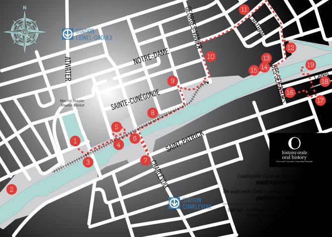
Point d’arrêt Listening stop
Parcours Route
Élément en vedette Featured element
NOTRE-DAME
SAINTE-CUNÉGONDE
ATWATER
GEORGES-VANIER
CHATHAM
CANAL
DES SEIGNEURS
SAINT-PATRICK
CHARLEVOIX
3
2
4
5
6
7
8
9
10
16
15
17
18
1914
1213
11
Marché Atwater Atwater Market
1
STATION CHARLEVOIX
STATION LIONEL-GROULX
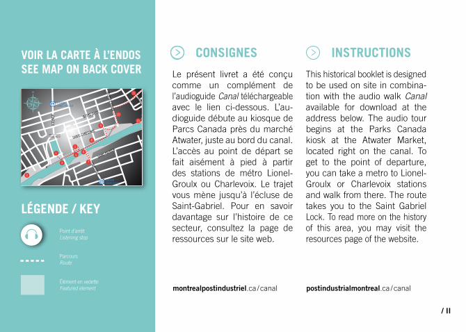
VOIR LA CARTE À L’ENDOS SEE MAP ON BACK COVER
LÉGENDE / KEY
Le présent livret a été conçu comme un complément de l’audioguide Canal téléchargeable avec le lien ci-dessous. L’au-dioguide débute au kiosque de Parcs Canada près du marché Atwater, juste au bord du canal. L’accès au point de départ se fait aisément à pied à partir des stations de métro Lionel-Groulx ou Charlevoix. Le trajet vous mène jusqu’à l’écluse de Saint-Gabriel. Pour en savoir davantage sur l’histoire de ce secteur, consultez la page de ressources sur le site web.
This historical booklet is designed to be used on site in combina-tion with the audio walk Canal available for download at the address below. The audio tour begins at the Parks Canada kiosk at the Atwater Market, located right on the canal. To get to the point of departure, you can take a metro to Lionel-Groulx or Charlevoix stations and walk from there. The route takes you to the Saint Gabriel Lock. To read more on the history of this area, you may visit the resources page of the website.
CONSIGNES INSTRUCTIONS
montrealpostindustriel.ca / canal postindustrialmontreal.ca / canal
Au cours de son histoire, Montréal a connu plusieurs périodes de transformations profondes. Chacun de ces changements sociaux représente à la fois une fin et un recommencement.
À la fin du XIXe siècle, les réformateurs urbains surnom-maient le Sud-Ouest de Montréal « la ville à l’ombre de la mon-tagne » pour décrire la pauvreté crasse, la surpopulation et les maladies qui y sévissaient alors que la révolution industrielle battait son plein. À l’époque, boucan et boucane s’élevaient sans cesse de l’enchevêtre-ment d’usines, de cours de triage et de bassins de radoub concentrés autour du canal de
Lachine. Un observateur notait en 1868 : « Une promenade le long du canal près de l’écluse de Saint-Gabriel rendra évidente toute l’étendue et l’importance des intérêts industriels pour la Ville ». Jusqu’en 1959, le canal servait aussi de voie d’accès aux Grands Lacs, les navires devant l’emprunter pour se rendre à Toronto, Cleveland, Détroit, Chicago et Thunder Bay et en revenir. C’est la construction de la Voie maritime du Saint-Laurent, conjuguée à l’amélioration du transport routier qui conduisit au déplacement des usines vers la banlieue, qui a contribué au déclin de ce corridor industriel.
VOIR DISPARAîTRE TOUT CE qU’ON
A CONNU – la destructIon de son
enVIronnement – PEUT REPRÉSENTER
UNE PERTE DE REPèRES, UN EXIL,
LOIN DES SOUVENIRS qUE CES LIEUX
ÉVOqUAIENT.
ROBERT BEVAN, HISTORIEN
/ III
FINS ET RECOMMENCEMENTS
Une promenade le long du canal de Lachine aujourd’hui laisse à peine deviner ce passé. Presque toutes les usines et manufactures qui s’y trouvaient ont été détruites ou transformées en condominiums de luxe. Le canal lui-même est devenu une zone récréative, les bateaux de plaisance et les cyclistes ayant remplacé les navires et les trains de marchandises de l’époque industrielle. Aujourd’hui administré par Parcs Canada, le canal de l’ère postindustrielle est, pour plusieurs, un refuge à l’abri de la frénésie de la grande ville.
Les quartiers ouvriers de la Petite-Bourgogne, de Saint-Henri, de Pointe-Saint-Charles et de
Côte-Saint-Paul ont toutefois dû payer le fort prix humain de ces transformations. Entre 1959 et 1973, 38 % des emplois manufacturiers dans le Sud-Ouest ont été éliminés ; le reste suivrait plus tard. Les géants manufacturiers ont cessé leurs activités un à un : Dominion Textile (1966), Northern Electric (1974), Redpath Sugar (1976), Belding-Corticelli (1982) et Stelco (1985). Le chômage était à son plus fort en 1986 (19,8 %) et le revenu moyen par ménage dans le secteur se situe encore de nos jours bien en-deçà de la moyenne montréalaise.
La population du Sud-Ouest a diminué de près de la moitié entre 1961 et 1991, passant
de 120 000 à seulement 66 000 personnes. Toutefois, avec de nouveaux règlements de zonage et la construction massive de condominiums, un certain repeu-plement s’opère depuis quelques années. Ce processus de gentri-fication a été accueilli au cours des trente dernières années par de forts mouvements de protestation. Pointe-Saint-Charles est ainsi devenu au québec un symbole de la lutte pour l’obtention de services de santé communautaires et de logements sociaux, de campagnes contre la pauvreté et d’une prise en charge du quartier au niveau local.
Montreal has undergone many periods of transformative change in its history. Each social trans-formation is both an end and a beginning.
In the late 19th century, Montreal’s South-West was known to urban reformers as the “city below the hill” due to its crushing poverty, overcrowding and sickness at the height of industrialization. At the time, the Lachine Canal was a mass of factories, railway yards, and docks that filled the air with smoke and noise. One observer wrote in 1868 that “a walk along the banks of the Lachine Canal and the Saint Gabriel Locks will
convey to the observer a forcible impression of the extent and im-portance of the factory interests of the City.” The canal was also the gateway to the Great Lakes until 1959, as vessels had to pass through it on their way to or back from Toronto, Cleveland, Detroit, Chicago, and Thunder Bay. The building of the Seaway, and the suburbanization of industry with the rise of trucking, contributed to the decline of the industrial corridor.
A walk alongside the La-chine Canal today reveals a very different place. Almost all of the mills and factories that once stood alongside have been
TO LOSE ALL THAT IS FAMILIAR – the destructIon of
one’s enVIronment – CAN MEAN A
DISORIENTING EXILE FROM THE MEMORIES
THEy HAVE INVOKED.
ROBERT BEVAN, HISTORIEN
ENDINGS AND BEGINNINGS
demolished or converted into high-end condominiums. The canal itself has been converted into a recreational zone, with pleasure craft and cyclists repla-cing the cargo ships and freight trains of the industrial age. Now administered by Parks Canada, the post-industrial canal has become a refuge from the noise and bustle of the commercial city.
These sweeping changes have come at a devastating human price for the adjoi-ning working-class districts of Little Burgundy, Saint Henri, Point Saint Charles and Côte Saint Paul. Between 1959 and 1973, the South-West lost 38% of its manufacturing jobs with much more to follow. One giant
factory after another closed, including Dominion Textile (1966), Northern Electric (1974), Redpath Sugar (1976), Belding-Corticelli (1982), and Stelco (1985). Unemployment peaked at 19.8% in 1986, with average household incomes still far below the Montreal average.
The district lost almost half of its population between 1961 and 1991, dropping from 120,000 to just 66,000. In recent years, however, the area’s population has begun to rise again as a result of widespread condo-building and re-zoning, but this trend has sparked three decades of fierce anti-gentrification struggles. Today, Point Saint Charles, in particular, has become synony-
mous in quebec with the fight for community health, social housing, anti-poverty activism, and neigh-bourhood control.
Désigné lieu historique national en 1929, le canal de Lachine constituait autrefois un élément- clé de la révolution des transports au Canada. Toutefois, avec la désindustrialisation, de vastes pans du patrimoine industriel de Montréal sont tombés sous les grues de la modernisation, si bien que dans les années 1990, l’histoire du Montréal industriel semblait perdue à jamais. C’est pourquoi la Commission des lieux et monuments historiques a reconnu le « complexe manu-facturier du canal de Lachine » comme site d’importance en 1996. Si Parcs Canada est devenu responsable du site dès
1978, ce n’est qu’à la fin des années 1990 que les impor-tantes subventions nécessaires à la revitalisation du canal ont été rendues disponibles. Malheureusement, ces investis-sements n’ont pas réussi à freiner la disparition progressive de ce paysage industriel.
En 2010, Parcs Canada et le Centre d’histoire orale et de récits numérisés (CHORN) ont entrepris d’enregistrer les souvenirs qu’avaient du canal ceux et celles qui ont vécu tout près. Une quarantaine d’entre-vues ont été réalisées dans le cadre du projet Vos souvenirs du canal de Lachine révélés.
Le présent livret et la visite audioguidée ont par la suite été produits par le CHORN pour contribuer aux efforts d’interpré-tation du secteur du canal de Lachine. Nous espérons qu’ils vous dévoileront ce site sous un nouveau jour. Admirer le paysage actuel tout en écoutant son passé soulève d’importantes questions sur notre passé, notre présent et notre avenir.
PATRIMOINE INDUSTRIEL
/ IV
INDUSTRIAL HERITAGEDesignated a National Historic Site in 1929, the Lachine Canal has been celebrated as a harbinger of the Canadian transportation revolution. With deindustrialization, however, large swathes of Montreal’s industrial heritage has fallen victim to the wrecking crew. By the 1990s, there was a sense that the city’s industrial history was fading away. In response, the Historic Sites and Monuments Board also designated the “Lachine Canal Manufacturing Complex” in 1996 as historically significant. Parks Canada took over the administration of the canal in
1978, but it was not until the late 1990s that large public investments were made to revitalize the waterway. Unfortu-nately, this has done little to stop the continued erasure of the area’s industrial landscape.
In 2010, Parks Canada and the Centre for Oral History and Digital Storytelling (COHDS) set out to record people’s memories of the Canal. The Your Memories of the Lachine Canal Revealed project resulted in the collection of almost forty interviews. This booklet and audio walk were then produced by COHDS to augment the existing interpretation of the
Lachine Canal area. We hope that they allow you to engage with the canal in a new kind of way. Seeing what is and hearing what once was, raises important questions about our past, present and future.

Vue de l’usine Nordelec pendant la conversion, 2012.Scene outside of Nordelec building during conversion, 2012. Photo : David W. Lewis
Vue de l’usine Nordelec pendant la conversion, 2012.Scene outside of Nordelec building during conversion, 2012. Photo : David W. Lewis
MARCHÉ ATwATER
ATwATER MARKET
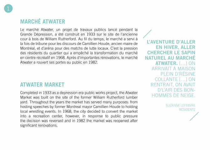
Le marché Atwater, un projet de travaux publics lancé pendant la Grande Dépression, a été construit en 1933 sur le site de l’ancienne cour à bois de William Rutherford. Au fil du temps, le marché a servi à la fois de tribune pour les discours de Camillien Houde, ancien maire de Montréal, et d’aréna pour des matchs de lutte locaux. C’est la pression des résidents du quartier qui a empêché la transformation du marché en centre récréatif en 1968. Après d’importantes rénovations, le marché Atwater a rouvert ses portes au public en 1982.
Completed in 1933 as a depression era public works project, the Atwater Market was built on the site of the former William Rutherford lumber yard. Throughout the years the market has served many purposes: from hosting speeches by former Montreal mayor Camillien Houde to holding local wrestling events. In 1968, the city decided to convert the market into a recreation center, however, in response to public pressure the decision was reversed and in 1982 the market was reopened after significant renovations.
l’aVenture d’aller en hIVer, aller
chercher le sapIn naturel au marché
atwater. […] ON ARRIVAIT À MAISON
PLEIN D’RÉSINE COLLANTE […] ON
RENTRAIT, ON AVAIT D’L’AIR DES BON-
HOMMES DE NEIGE.
SUzANNE LEFEBVRE RÉSIDENTE
1
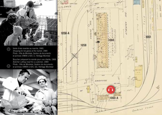
Vente d’oies vivantes au marché, 1969. Shopping for live geese at the market, 1969.Photo : Ville de Montréal, Gestion de documents et archives (VM94-U-641-1), Héritage Montréal
Boucher préparant la viande pour une cliente, 1969.Butcher cutting meat for a customer, 1969.Photo : Ville de Montréal, Gestion de documents et archives (VM94-U-641-16), Héritage Montréal
DOMINION TExTILE
DOMINION TExTILE
La Merchants Textile Company, fondée en 1880, produisait à son apogée près de 43% de tout le textile de coton manufacturé au Canada. Les faibles salaires et la discrimination de la direction envers les employés francophones sont à l’origine de la première grève de l’industrie textile de l’histoire de Montréal. D’autres grèves ont suivi, dont celle qui a lancé la carrière de Madeleine Parent, activiste, syndicaliste et féministe. En 1966, l’usine de la Dominion Textile sur le canal de Lachine a fermé ses portes. Par la suite, une usine de jouets sous la bannière Coleco y a tenu ses activités pendant 22 ans, jusqu’en 1989. Aujourd’hui baptisée Château Saint-Ambroise, la structure sert à un usage mixte.
The Merchants Textile Company was founded in 1880 and at its peak accounted for 43% of Canadian cotton textile production. Low wages and discrimination by management toward francophone employees eventually led to the first, but not the last, textile workers strike in Montreal’s history. Later strikes would follow, one of which would launch the activist career of union organizer and feminist Madeleine Parent. The plant closed its doors in 1966, and after a twenty-two year stint as Coleco Toys it became inactive in 1989. The structure has since been re-named Château Saint-Ambroise and is now a mixed use building.
l’Immense majorIté étaIt faIte de femmes
canadIennes-françaIses quI ne parlaIent pas d’autre langue. […]
MALHEUREUSEMENT LES PRêTRES LEUR DISAIENT DE NE PAS SE FIER AUX JUIVES
PARCE qU’ILS AVAIENT CRU-CIFIÉ JÉSUS-CHRIST. ALORS
ILS NE POUVAIENT JAMAIS FAIRE L’UNITÉ ENTRE CES IMMIGRANTES JUIVES qUI AVAIENT UNE EXPÉRIENCE
SyNDICALE ET LA MASSE DES CANADIENNES FRANçAISES.
MADELEINE PARENT SyNDICALISTE
2
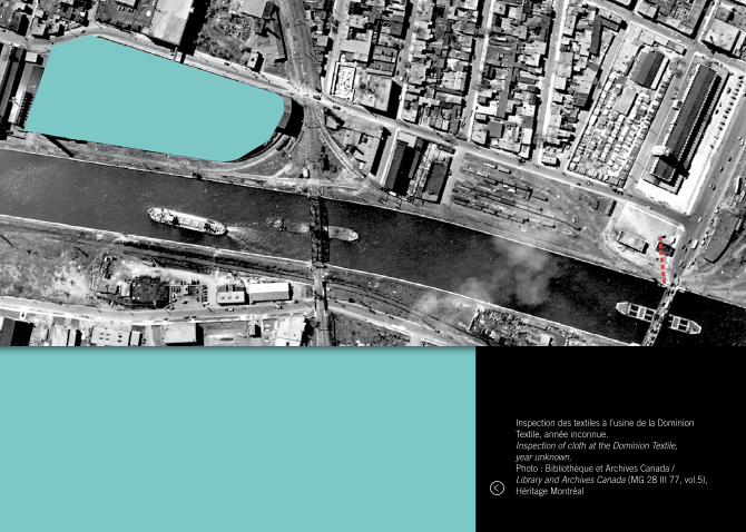
Inspection des textiles à l’usine de la Dominion Textile, année inconnue. Inspection of cloth at the Dominion Textile, year unknown.Photo : Bibliothèque et Archives Canada / Library and Archives Canada (MG 28 III 77, vol.5), Héritage Montréal
PONT ATwATER / IROqUOIS
ATwATER / IROqUOIS BRIDGE
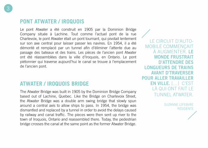
Le pont Atwater a été construit en 1905 par la Dominion Bridge Company située à Lachine. Tout comme l’actuel pont de la rue Charlevoix, le pont Atwater était un pont tournant, qui pivotait lentement sur son axe central pour laisser passer les navires. En 1954, il a été démonté et remplacé par un tunnel afin d’éliminer l’attente due au passage des bateaux et des trains. Les pièces de l’ancien pont Atwater ont été réassemblées dans la ville d’Iroquois, en Ontario. Le pont piétonnier qui traverse aujourd’hui le canal se trouve à l’emplacement de l’ancien pont.
The Atwater Bridge was built in 1905 by the Dominion Bridge Company based out of Lachine, quebec. Like the Bridge on Charlevoix Street, the Atwater Bridge was a double arm swing bridge that slowly spun around a central axis to allow ships to pass. In 1954, the bridge was dismantled and replaced by a tunnel in order to avoid the delays caused by railway and canal traffic. The pieces were then sent up river to the town of Iroquois, Ontario and reassembled there. Today, the pedestrian bridge crosses the canal at the same point as the former Atwater Bridge.
LE CIRCUIT D’AUTO-MOBILE COMMENçAIT
À AUGMENTER. le monde frustraIt
d’attendre des longueurs de traIns
aVant d’traVerser pour aller traVaIller
en VIlle. […] C’EST LÀ qUI ONT FAIT LE TUNNEL ATWATER.
SUzANNE LEFEBVRE RÉSIDENTE
3
Ancien pont Atwater vu du ciel, 1949. Former Atwater Bridge as seen from an airplane, 1949.
Photo : Société historique de Saint-Henri, Fonds Adrien Dubuc (23.1-1492.4.1)
VOIES FERRÉES
RAILwAY TRACKS
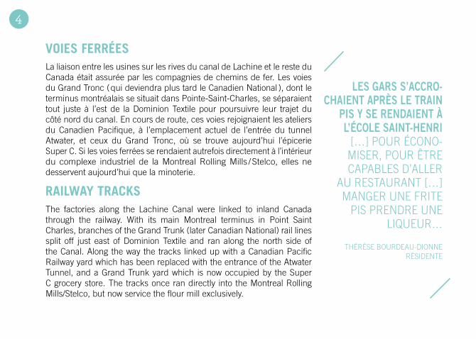
La liaison entre les usines sur les rives du canal de Lachine et le reste du Canada était assurée par les compagnies de chemins de fer. Les voies du Grand Tronc ( qui deviendra plus tard le Canadien National ), dont le terminus montréalais se situait dans Pointe-Saint-Charles, se séparaient tout juste à l’est de la Dominion Textile pour poursuivre leur trajet du côté nord du canal. En cours de route, ces voies rejoignaient les ateliers du Canadien Pacifique, à l’emplacement actuel de l’entrée du tunnel Atwater, et ceux du Grand Tronc, où se trouve aujourd’hui l’épicerie Super C. Si les voies ferrées se rendaient autrefois directement à l’intérieur du complexe industriel de la Montreal Rolling Mills / Stelco, elles ne desservent aujourd’hui que la minoterie.
The factories along the Lachine Canal were linked to inland Canada through the railway. With its main Montreal terminus in Point Saint Charles, branches of the Grand Trunk (later Canadian National) rail lines split off just east of Dominion Textile and ran along the north side of the Canal. Along the way the tracks linked up with a Canadian Pacific Railway yard which has been replaced with the entrance of the Atwater Tunnel, and a Grand Trunk yard which is now occupied by the Super C grocery store. The tracks once ran directly into the Montreal Rolling Mills/Stelco, but now service the flour mill exclusively.
les gars s’accro-chaIent après le traIn
pIs y se rendaIent à l’école saInt-henrI
[…] POUR ÉCONO-MISER, POUR êTRE CAPABLES D’ALLER
AU RESTAURANT […] MANGER UNE FRITE
PIS PRENDRE UNE LIqUEUR…
THÉRèSE BOURDEAU-DIONNE RÉSIDENTE
4
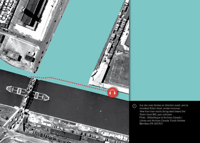
Vue des voies ferrées en direction ouest, vers la minoterie Robin Hood, année inconnue. View from train tracks facing west toward the Robin Hood Mill, year unknown.Photo : Bibliothèque et Archives Canada / Library and Archives Canada, Fonds Andrew Merrilees (PA-202767)
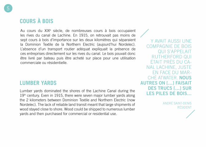
COURS À BOIS
LUMBER YARDS
Au cours du XIXe siècle, de nombreuses cours à bois occupaient les rives du canal de Lachine. En 1915, on retrouvait pas moins de sept cours à bois d’importance sur les deux kilomètres qui séparaient la Dominion Textile de la Northern Electric (aujourd’hui Nordelec). L’absence d’un transport routier adéquat expliquait la présence de ces entreprises directement sur les rives du canal. Le bois pouvait donc être livré par bateau puis être acheté sur place pour une utilisation commerciale ou résidentielle.
Lumber yards dominated the shores of the Lachine Canal during the 19th century. Even in 1915, there were seven major lumber yards along the 2 kilometers between Dominion Textile and Northern Electric (now Nordelec). The lack of reliable land transit meant that large shipments of wood stayed close to shore. Wood could be shipped to numerous lumber yards and then purchased for commercial or residential use.
y AVAIT AUSSI UNE COMPAGNIE DE BOIS
qUI S’APPELAIT RUTHERFORD qUI ÉTAIT PRèS DU CA-
NAL LACHINE, JUSTE EN FACE DU MAR-
CHÉ ATWATER. nous autres on […] faIsaIt
des trucs […] sur les pIles de boIs…
ANDRÉ SAINT-DENIS RÉSIDENT
5
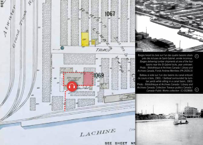
Barges livrant du bois sur l’un des quatre bassins situés près des écluses de Saint-Gabriel, année inconnue.
Barges delivering lumber shipments at one of the four basins near the St Gabriel locks, year unknown.
Photo : Bibliothèque et Archives Canada / Library and Archives Canada, Fonds Andrew Merrilees (PA-202613)
Bateau à voile sur l’un des basins du canal entouré de cours à bois, 1903. / Sailboat surrounded by lum-
ber yards while sitting in a canal basin, 1903.Photo : Bibliothèque et Archives Canada / Library and Archives Canada, Collection Travaux publics Canada /
Canada Public Works collection (C-002868)
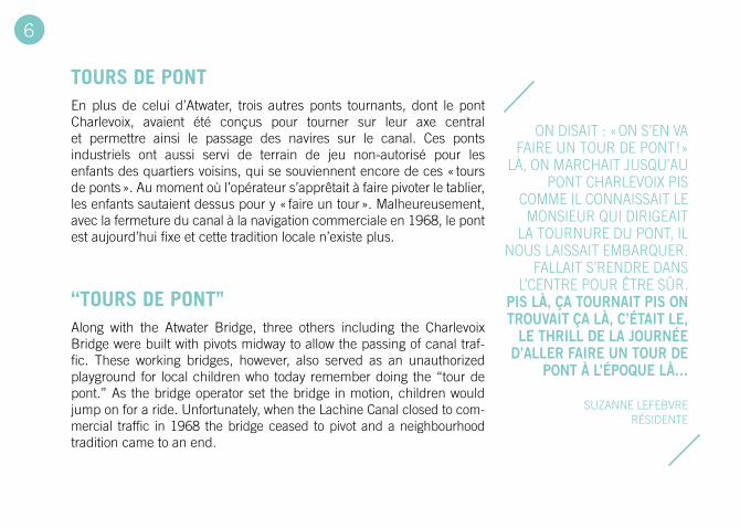
TOURS DE PONT
‘‘TOURS DE PONT’’
En plus de celui d’Atwater, trois autres ponts tournants, dont le pont Charlevoix, avaient été conçus pour tourner sur leur axe central et permettre ainsi le passage des navires sur le canal. Ces ponts industriels ont aussi servi de terrain de jeu non-autorisé pour les enfants des quartiers voisins, qui se souviennent encore de ces « tours de ponts ». Au moment où l’opérateur s’apprêtait à faire pivoter le tablier, les enfants sautaient dessus pour y « faire un tour ». Malheureusement, avec la fermeture du canal à la navigation commerciale en 1968, le pont est aujourd’hui fixe et cette tradition locale n’existe plus.
Along with the Atwater Bridge, three others including the Charlevoix Bridge were built with pivots midway to allow the passing of canal traf-fic. These working bridges, however, also served as an unauthorized playground for local children who today remember doing the “tour de pont.” As the bridge operator set the bridge in motion, children would jump on for a ride. Unfortunately, when the Lachine Canal closed to com-mercial traffic in 1968 the bridge ceased to pivot and a neighbourhood tradition came to an end.
ON DISAIT : « ON S’EN VA FAIRE UN TOUR DE PONT ! »
LÀ, ON MARCHAIT JUSqU’AU PONT CHARLEVOIX PIS
COMME IL CONNAISSAIT LE MONSIEUR qUI DIRIGEAIT
LA TOURNURE DU PONT, IL NOUS LAISSAIT EMBARqUER.
FALLAIT S’RENDRE DANS L’CENTRE POUR êTRE SûR.
pIs là, ça tournaIt pIs on trouVaIt ça là, c’étaIt le,
le thrIll de la journée d’aller faIre un tour de
pont à l’époque là…
SUzANNE LEFEBVRE RÉSIDENTE
6
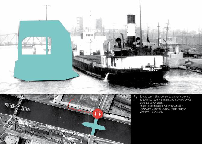
Bateau passant l’un des ponts tournants du canal de Lachine, 1925. / Boat passing a pivoted bridge along the canal, 1925.Photo : Bibliothèque et Archives Canada / Library and Archives Canada, Fonds Andrew Merrilees (PA-202366)
RESTAURANT ET TAVERNE MAGNAN
MAGNAN RESTAURANT AND TAVERN
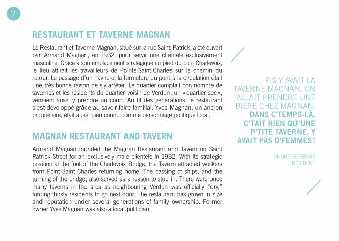
Le Restaurant et Taverne Magnan, situé sur la rue Saint-Patrick, a été ouvert par Armand Magnan, en 1932, pour servir une clientèle exclusivement masculine. Grâce à son emplacement stratégique au pied du pont Charlevoix, le lieu attirait les travailleurs de Pointe-Saint-Charles sur le chemin du retour. Le passage d’un navire et la fermeture du pont à la circulation était une très bonne raison de s’y arrêter. Le quartier comptait bon nombre de tavernes et les résidents du quartier voisin de Verdun, un « quartier sec », venaient aussi y prendre un coup. Au fil des générations, le restaurant s’est développé grâce au savoir-faire familial. yves Magnan, un ancien propriétaire, était aussi bien connu comme personnage politique local.
Armand Magnan founded the Magnan Restaurant and Tavern on Saint Patrick Street for an exclusively male clientele in 1932. With its strategic position at the foot of the Charlevoix Bridge, the Tavern attracted workers from Point Saint Charles returning home. The passing of ships, and the turning of the bridge, also served as a reason to stop in. There were once many taverns in the area as neighbouring Verdun was officially “dry,” forcing thirsty residents to go next door. The restaurant has grown in size and reputation under several generations of family ownership. Former owner yves Magnan was also a local politician.
PIS y AVAIT LA TAVERNE MAGNAN, ON ALLAIT PRENDRE UNE BIèRE CHEz MAGNAN.
dans c’temps-là, c’taIt rIen qu’une
p’tIte taVerne, y aVaIt pas d’femmes !
ANDRÉ LEFEBVRE RÉSIDENT
7
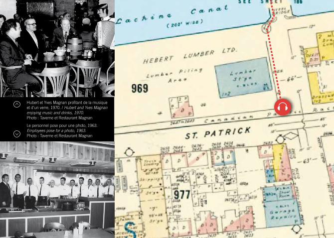
Hubert et yves Magnan profitant de la musique et d’un verre, 1970. / Hubert and Yves Magnan enjoying music and drinks, 1970. Photo : Taverne et Restaurant Magnan
Le personnel pose pour une photo, 1963. Employees pose for a photo, 1963.Photo : Taverne et Restaurant Magnan

STELCO
STELCO
Fondée en 1868, la Montreal Rolling Mills produisait entre autres des fers à cheval et des clous. La fusion de cette compagnie avec plusieurs autres clouteries et aciéries du secteur en 1907 est à l’origine de la Steel Company of Canada, familièrement appelée la Stelco. En 1915, l’entreprise, qui occupait alors sept pâtés de maisons, a contribué à l’effort de guerre en mettant sa production au service des troupes postées en Europe. Toutefois, dans la deuxième moitié du XXe siècle, la Stelco, tout comme d’autres entreprises du secteur, a dû progressivement réduire ses activités. En 1985, l’usine a fermé pour de bon et, trois ans plus tard, elle a été transformée en condos.
The Montreal Rolling Mills was founded in 1868 and originally produced iron products such as horseshoes and nails. In 1907 the Rolling Mills, along with several other surrounding foundries, became the Steel Company of Canada (later Stelco). By 1915, Stelco covered most of seven city blocks and began manufacturing materials for the war in Europe. Like many of the factories along the Lachine Canal, however, the Montreal Stelco plant began to downsize in the second half of the 20th century. In 1985 the factory closed its doors for good, and three years later the former Rolling Mills building was converted to condos.
notre-dame was a Very noIsy facIlIty. WE WERE OPERATING I GUESS AROUND 50
TO 60 NAIL MACHINES THAT ARE CLACKING
ALL THE TIME...
TED MOREMAN FORMER STEELWORKER
8
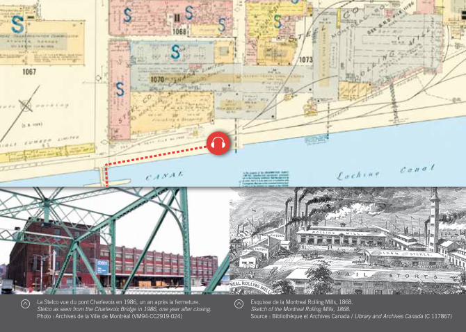
La Stelco vue du pont Charlevoix en 1986, un an après la fermeture. Stelco as seen from the Charlevoix Bridge in 1986, one year after closing.Photo : Archives de la Ville de Montréal (VM94-CC2919-024)
Esquisse de la Montreal Rolling Mills, 1868. Sketch of the Montreal Rolling Mills, 1868.Source : Bibliothèque et Archives Canada / Library and Archives Canada (C 117867)
TOUR À BALLES DE LA STELCO
STELCO SHOT TOwER
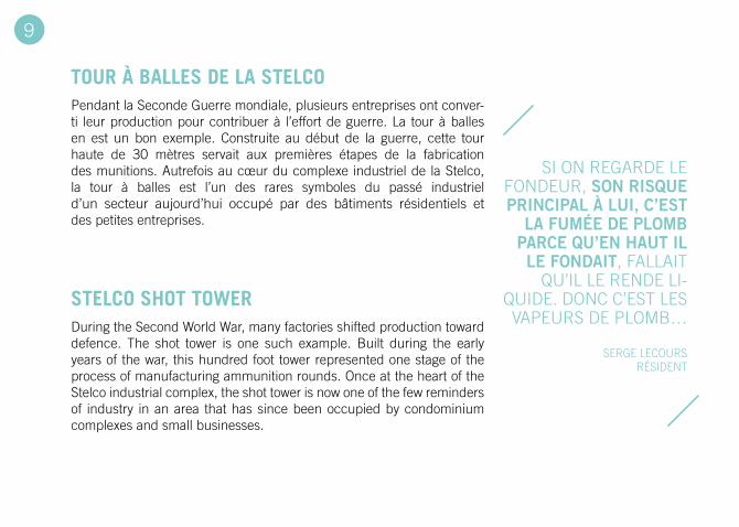
Pendant la Seconde Guerre mondiale, plusieurs entreprises ont conver-ti leur production pour contribuer à l’effort de guerre. La tour à balles en est un bon exemple. Construite au début de la guerre, cette tour haute de 30 mètres servait aux premières étapes de la fabrication des munitions. Autrefois au cœur du complexe industriel de la Stelco, la tour à balles est l’un des rares symboles du passé industriel d’un secteur aujourd’hui occupé par des bâtiments résidentiels et des petites entreprises.
During the Second World War, many factories shifted production toward defence. The shot tower is one such example. Built during the early years of the war, this hundred foot tower represented one stage of the process of manufacturing ammunition rounds. Once at the heart of the Stelco industrial complex, the shot tower is now one of the few reminders of industry in an area that has since been occupied by condominium complexes and small businesses.
SI ON REGARDE LE FONDEUR, son rIsque prIncIpal à luI, c’est
la fumée de plomb parce qu’en haut Il le fondaIt, FALLAIT
qU’IL LE RENDE LI-qUIDE. DONC C’EST LES VAPEURS DE PLOMB…
SERGE LECOURS RÉSIDENT
9
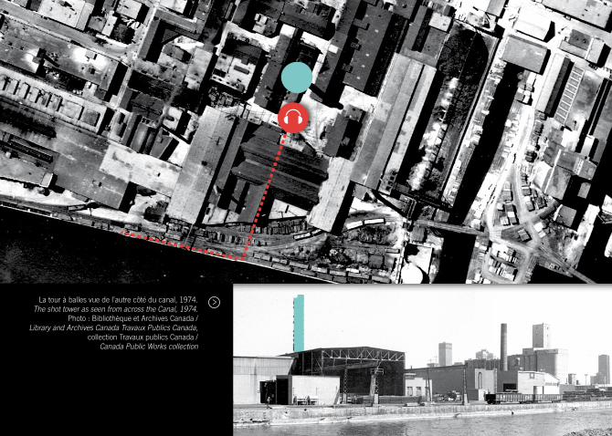
La tour à balles vue de l’autre côté du canal, 1974.The shot tower as seen from across the Canal, 1974.
Photo : Bibliothèque et Archives Canada / Library and Archives Canada Travaux Publics Canada,
collection Travaux publics Canada / Canada Public Works collection
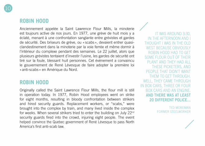
ROBIN HOOD
ROBIN HOOD
Anciennement appelée la Saint Lawrence Flour Mills, la minoterie est toujours active de nos jours. En 1977, une grève de huit mois y a éclaté, menant à une confrontation sanglante entre grévistes et gardes de sécurité. Des briseurs de grève, ou « scabs », devaient entrer quasi-clandestinement dans la minoterie par la voie ferrée et même dormir à l’intérieur du complexe pendant des semaines. Le 22 juillet, alors que plusieurs grévistes tentaient d’investir l’usine, les gardes de sécurité ont tiré sur la foule, blessant huit personnes. Cet événement a convaincu le gouvernement de René Lévesque de faire adopter la première loi « anti-scabs » en Amérique du Nord.
Originally called the Saint Lawrence Flour Mills, the flour mill is still in operation today. In 1977, Robin Hood employees went on strike for eight months, resulting in bloody confrontation between strikers and hired security guards. Replacement workers, or “scabs,” were brought into the complex by train, and many lived inside the complex for weeks. When several strikers tried to enter the building on July 22nd security guards fired into the crowd, injuring eight people. The event helped convince the quebec government of René Lévesque to pass North America’s first anti-scab law.
IT WAS AROUND 3:30, IN THE AFTERNOON AND I
THOUGHT I WAS IN THE OLD WEST BECAUSE OBVIOUSLy
ROBIN HOOD HAD TO GET SOME FLOUR OUT OF THEIR
PLANT AND THEy HAD ALL THESE PICKETERS, AND
PEOPLE THAT DIDN’T WANT THEM TO GET THROUGH.
WELL, THEy CAME THROUGH IN BOX CARS, THREE OR FOUR
BOX CARS AND AN ENGINE. and there was at least
20 dIfferent polIce…
TED MOREMAN FORMER STEELWORKER
10
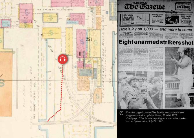
Première page du journal The Gazette montrant un briseur de grève armé et un gréviste blessé, 23 juillet 1977. Front page of The Gazette depicting an armed strike breaker and an injured striker, July 23, 1977.
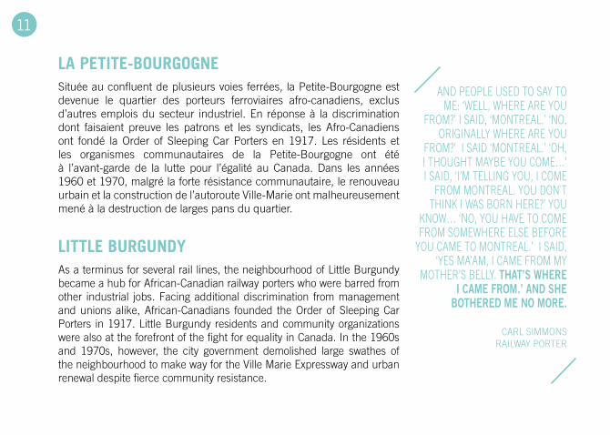
LA PETITE-BOURGOGNE
LITTLE BURGUNDY
Située au confluent de plusieurs voies ferrées, la Petite-Bourgogne est devenue le quartier des porteurs ferroviaires afro-canadiens, exclus d’autres emplois du secteur industriel. En réponse à la discrimination dont faisaient preuve les patrons et les syndicats, les Afro-Canadiens ont fondé la Order of Sleeping Car Porters en 1917. Les résidents et les organismes communautaires de la Petite-Bourgogne ont été à l’avant-garde de la lutte pour l’égalité au Canada. Dans les années 1960 et 1970, malgré la forte résistance communautaire, le renouveau urbain et la construction de l’autoroute Ville-Marie ont malheureusement mené à la destruction de larges pans du quartier.
As a terminus for several rail lines, the neighbourhood of Little Burgundy became a hub for African-Canadian railway porters who were barred from other industrial jobs. Facing additional discrimination from management and unions alike, African-Canadians founded the Order of Sleeping Car Porters in 1917. Little Burgundy residents and community organizations were also at the forefront of the fight for equality in Canada. In the 1960s and 1970s, however, the city government demolished large swathes of the neighbourhood to make way for the Ville Marie Expressway and urban renewal despite fierce community resistance.
AND PEOPLE USED TO SAy TO ME: ‘WELL, WHERE ARE yOU
FROM?’ I SAID, ‘MONTREAL.’ ‘NO, ORIGINALLy WHERE ARE yOU
FROM?’ I SAID ‘MONTREAL.’ ‘OH, I THOUGHT MAyBE yOU COME…’ I SAID, ‘I’M TELLING yOU, I COME
FROM MONTREAL. yOU DON`T THINK I WAS BORN HERE?’ yOU
KNOW… ‘NO, yOU HAVE TO COME FROM SOMEWHERE ELSE BEFORE
yOU CAME TO MONTREAL.’ I SAID, ‘yES MA’AM, I CAME FROM My
MOTHER’S BELLy. that’s where I came from.’ and she
bothered me no more.
CARL SIMMONS RAILWAy PORTER
11
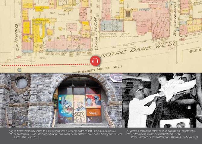
Le Negro Community Centre de la Petite-Bourgogne a fermé ses portes en 1989 à la suite de coupures de financement. / The Little Burgundy Negro Community Centre closed its doors due to funding cuts in 1989.Photo : Phil Lichti, 2013.
Porteur bordant un enfant dans un train de nuit, années 1930.Porter tucking in child on overnight train, 1930’s.Photo : Archives Canadien Pacifique / Canadian Pacific Archives
VESTIGES ARCHÉOLOGIqUES
ARCHEOLOGICAL VESTIGES
En l’an 2000, la Ville de Montréal a ouvert aux fouilles archéologiques un terrain situé du côté nord du canal de Lachine et à l’est de la rue des Seigneurs: la Pointe-des-Seigneurs. Au cours des trois années suivantes, les archéologues ont mis au jour les fondations d’un édifice ayant appartenu à la Ogilvie Flour Company, les vestiges d’un ancien atelier d’ingénierie ainsi que des turbines autrefois reliées aux écluses de Saint-Gabriel. En 2009, la Ville de Montréal a amorcé des démarches pour faire de ce site un parc archéologique ouvert au public.
In the year 2000 the City of Montreal opened the Pointe-des-Seigneurs site located north of the Lachine Canal and east of Des Seigneurs Street to archaeologists. Over the next three years, the archaeological team uncovered the remaining foundations of a building owned by the Ogilvie Flour Company, as well as the remains of a former engineering workshop, and turbines that had once been linked to the Saint Gabriel Locks. In 2009, the City of Montreal initiated plans to open this archeological site to the public.
montréal connaît son premIer boom IndustrIel
à compter de 1848, aVec le premIer élargIssement
du canal de lachIne quI rend dIsponIble une nou-
Velle source d’énergIe. DES INVESTISSEURS AVISÉS
SAISISSENT L’OCCASION POUR DÉMARRER DE NOUVELLES
ENTREPRISES OU POUR AUGMENTER L’ÉCHELLE DE
PRODUCTION DE LEURS ÉTA-BLISSEMENTS, COMME DANS
LE CAS DES MEUNERIES ET DES FONDERIES.
PARCS CANADA LE BERCEAU DE L’INDUSTRIALISATION
12
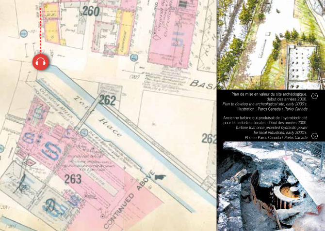
Plan de mise en valeur du site archéologique, début des années 2000.
Plan to develop the archeological site, early 2000’s.Illustration : Parcs Canada / Parks Canada
Ancienne turbine qui produisait de l’hydroélectricité pour les industries locales, début des années 2000.
Turbine that once provided hydraulic power for local industries, early 2000’s.
Photo : Parcs Canada / Parks Canada
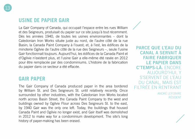
USINE DE PAPIER GAIR
GAIR PAPER
La Gair Company of Canada, qui occupait l’espace entre les rues William et des Seigneurs, produisait du papier sur ce site jusqu’à tout récemment. Dès les années 1940, de toutes les usines environnantes – dont la Caledonian Iron Works située juste au nord, de l’autre côté de la rue Basin; la Canada Paint Company à l’ouest; et, à l’est, les édifices de la minoterie Ogilvie de l’autre côté de la rue des Seigneurs –, seule l’usine Gair fonctionnait toujours. Aujourd’hui, les édifices de la Canada Paint et d’Ogilvie n’existent plus, et l’usine Gair a elle-même été rasée en 2012 pour être remplacée par des condominiums. L’histoire de la fabrication du papier dans ce secteur a été effacée.
The Gair Company of Canada produced paper in the area bordered by William St. and Des Seigneurs St. until relatively recently. Once surrounded by other industries, with the Caledonian Iron Works located north across Basin Street, the Canada Paint Company to the west and buildings owned by Ogilvie Flour across Des Seigneurs St. to the east, by 1940 Gair was the only one left. Today, the buildings that housed Canada Paint and Ogilvie no longer exist, and Gair itself was demolished in 2012 to make way for a condominium development. The site’s long history of paper-making has been erased.
parce que l’eau du canal a serVaIt à
faIre fabrIquer le papIer dans
c’temps-là. ENCORE AUJOURD’HUI, y
S’SERVENT DE L’EAU DU CANAL, MAIS EST
FILTRÉE EN RENTRANT ANDRÉ LEFEBVRE
RÉSIDENT
13
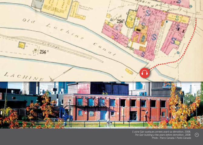
L’usine Gair quelques années avant sa démolition, 2008. The Gair building a few years before demolition, 2008.
Photo : Parcs Canada / Parks Canada
RESTAURANT BLUE
BLUE RESTAURANT
Le Restaurant Blue se trouvait autrefois tout près de la rue des Sei-gneurs, là où la piste cyclable passe sous le pont du côté nord du canal de Lachine. Cette entreprise familiale bénéficiait de sa proximité avec le canal, servant même les marins de passage. Les membres de la famille se souviennent toujours des bateaux qui accostaient le temps d’un repas sur le pouce. Au début des années 1960, le restaurant a été la proie des flammes et, voyant les fermetures d’usine et le déclin du canal de Lachine, les propriétaires ont choisi de ne pas le reconstruire. Les fondations du restaurant nous rappellent que le canal de l’ère industrielle n’était pas qu’un lieu de travail ; il était aussi un lieu de vie.
The Blue Restaurant once sat on the north side of the Lachine Canal alongside Des Seigneurs St., right where the bike path turns between the bridge and the underpass. The family owned business thrived next to the canal, even serving those on passing boats. In the early sixties, the restaurant was lost in a fire and the owners decided not to rebuild. Factories were closing and the canal was in decline. Today, the surviving foundation of the small restaurant serves as a reminder that the industrial canal was not just a place of work; it was also a site of daily life.
THERE WAS NO RAILING, NO NOTHING, THERE WASN’T
THE SECURITy THAT THERE IS TODAy. THE BOAT WOULD JUST PARK RIGHT THERE, IN FRONT
OF US AND I ALMOST FELL IN AT ONE POINT ‘CAUSE I WAS TINy, THE WIND WAS STRONG
AND My GRANDFATHER SAVED ME. so from that tIme
on they tIed me lIke a lIttle dog to the
door and later, my father buIlt a chIcken-type fence on the sIde…
LUISA LONGO FAMILy MEMBER
14
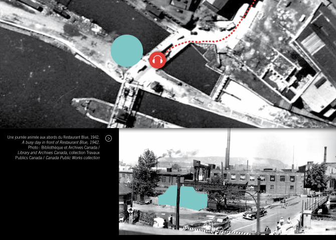
Une journée animée aux abords du Restaurant Blue, 1942. A busy day in front of Restaurant Blue, 1942.
Photo : Bibliothèque et Archives Canada / Library and Archives Canada, collection Travaux
Publics Canada / Canada Public Works collection
PISTE CYCLABLE
BIKE PATH
La Voie maritime du Saint-Laurent, qui permet de nos jours aux navires océaniques de poursuivre leur route jusqu’aux Grands Lacs, a été inaugurée en 1959, déclassant le canal de Lachine. Celui-ci a néanmoins continué à desservir les usines sur ses rives jusqu’en 1970. Après plus de 30 ans d’inactivité, il a enfin été rouvert à la navigation de plaisance en 2002. C’est ainsi que l’ancien site industriel s’est transformé en parc récréatif, avec l’ajout en 1977 d’une piste cyclable sur toute la longueur de la voie navigable. Le canal de Lachine, autrefois un corridor industriel de calibre international, est devenu en 2009 une piste cyclable de renommée mondiale, se classant au troisième rang du palmarès des plus belles pistes cyclables selon le magazine Time.
When the Saint Lawrence Seaway opened in 1959, allowing ocean-going vessels to access the Great Lakes, the Lachine Canal was made largely redundant. It continued to serve adjoining industries until 1970 when it was closed to traffic only to reopen in 2002 to pleasure craft. With this transition, the Lachine Canal shifted from a site of work to a site of leisure, and in 1977 a bike path was completed running the entire length of the Canal. By 2009, the once world famous Lachine Canal industrial corridor had become a world famous bike path, earning the rank of third most beautiful urban bike path by Time Magazine.
MOI J’AI TOUJOURS ADORÉ L’VÉLO
FAIT qU’LA PISTE CyCLABLE…C’TAIT
MERVEILLEUX POUR MOI L’CANAL LACHINE MêME qUAND J’ÉTAIS
TOUT P’TIT LÀ. […]. j’aI découVert […]
tout le sud-ouest, à partIr du canal
de lachIne...
MARCEL COMEAU RÉSIDENT
15
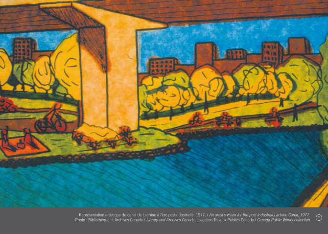
Représentation artistique du canal de Lachine à l’ère postindustrielle, 1977. / An artist’s vision for the post-industrial Lachine Canal, 1977. Photo : Bibliothèque et Archives Canada / Library and Archives Canada, collection Travaux Publics Canada / Canada Public Works collection
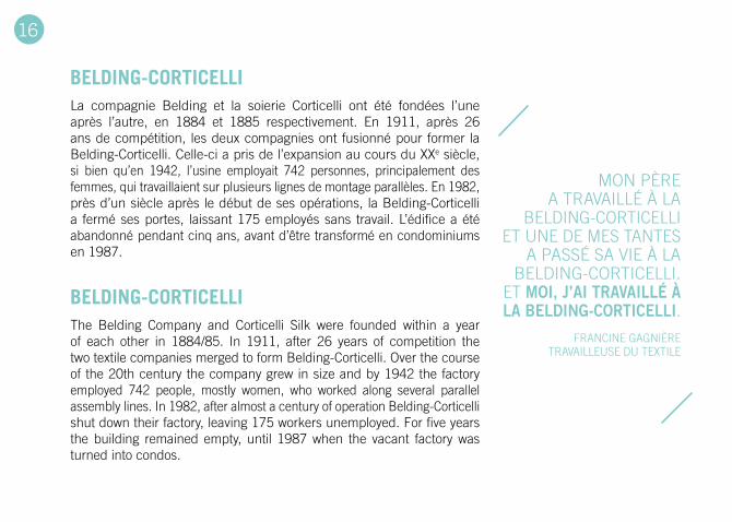
BELDING-CORTICELLI
BELDING-CORTICELLI
La compagnie Belding et la soierie Corticelli ont été fondées l’une après l’autre, en 1884 et 1885 respectivement. En 1911, après 26 ans de compétition, les deux compagnies ont fusionné pour former la Belding-Corticelli. Celle-ci a pris de l’expansion au cours du XXe siècle, si bien qu’en 1942, l’usine employait 742 personnes, principalement des femmes, qui travaillaient sur plusieurs lignes de montage parallèles. En 1982, près d’un siècle après le début de ses opérations, la Belding-Corticelli a fermé ses portes, laissant 175 employés sans travail. L’édifice a été abandonné pendant cinq ans, avant d’être transformé en condominiums en 1987.
The Belding Company and Corticelli Silk were founded within a year of each other in 1884/85. In 1911, after 26 years of competition the two textile companies merged to form Belding-Corticelli. Over the course of the 20th century the company grew in size and by 1942 the factory employed 742 people, mostly women, who worked along several parallel assembly lines. In 1982, after almost a century of operation Belding-Corticelli shut down their factory, leaving 175 workers unemployed. For five years the building remained empty, until 1987 when the vacant factory was turned into condos.
MON PèRE A TRAVAILLÉ À LA
BELDING-CORTICELLI ET UNE DE MES TANTES
A PASSÉ SA VIE À LA BELDING-CORTICELLI.
ET moI, j’aI traVaIllé à la beldIng-cortIcellI.
FRANCINE GAGNIèRE TRAVAILLEUSE DU TEXTILE
16
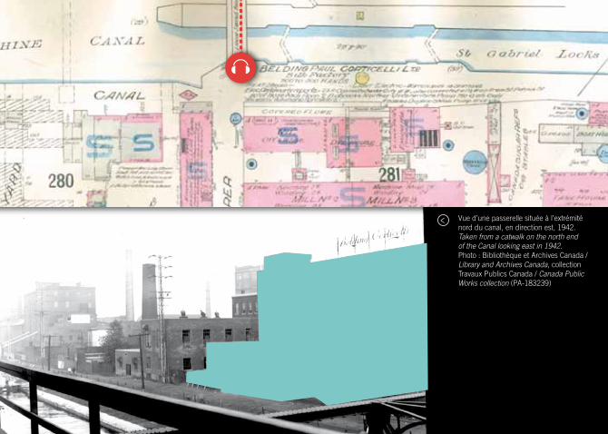
Vue d’une passerelle située à l’extrémité nord du canal, en direction est, 1942.Taken from a catwalk on the north end of the Canal looking east in 1942.Photo : Bibliothèque et Archives Canada /Library and Archives Canada, collection Travaux Publics Canada / Canada Public Works collection (PA-183239)
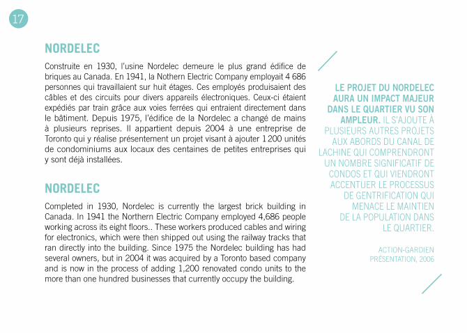
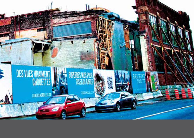
NORDELEC
NORDELEC
Construite en 1930, l’usine Nordelec demeure le plus grand édifice de briques au Canada. En 1941, la Nothern Electric Company employait 4 686 personnes qui travaillaient sur huit étages. Ces employés produisaient des câbles et des circuits pour divers appareils électroniques. Ceux-ci étaient expédiés par train grâce aux voies ferrées qui entraient directement dans le bâtiment. Depuis 1975, l’édifice de la Nordelec a changé de mains à plusieurs reprises. Il appartient depuis 2004 à une entreprise de Toronto qui y réalise présentement un projet visant à ajouter 1 200 unités de condominiums aux locaux des centaines de petites entreprises qui y sont déjà installées.
Completed in 1930, Nordelec is currently the largest brick building in Canada. In 1941 the Northern Electric Company employed 4,686 people working across its eight floors.. These workers produced cables and wiring for electronics, which were then shipped out using the railway tracks that ran directly into the building. Since 1975 the Nordelec building has had several owners, but in 2004 it was acquired by a Toronto based company and is now in the process of adding 1,200 renovated condo units to the more than one hundred businesses that currently occupy the building.
le projet du nordelec aura un Impact majeur
dans le quartIer Vu son ampleur. IL S’AJOUTE À
PLUSIEURS AUTRES PROJETS AUX ABORDS DU CANAL DE
LACHINE qUI COMPRENDRONT UN NOMBRE SIGNIFICATIF DE
CONDOS ET qUI VIENDRONT ACCENTUER LE PROCESSUS
DE GENTRIFICATION qUI MENACE LE MAINTIEN
DE LA POPULATION DANS LE qUARTIER.
ACTION-GARDIEN PRÉSENTATION, 2006
17
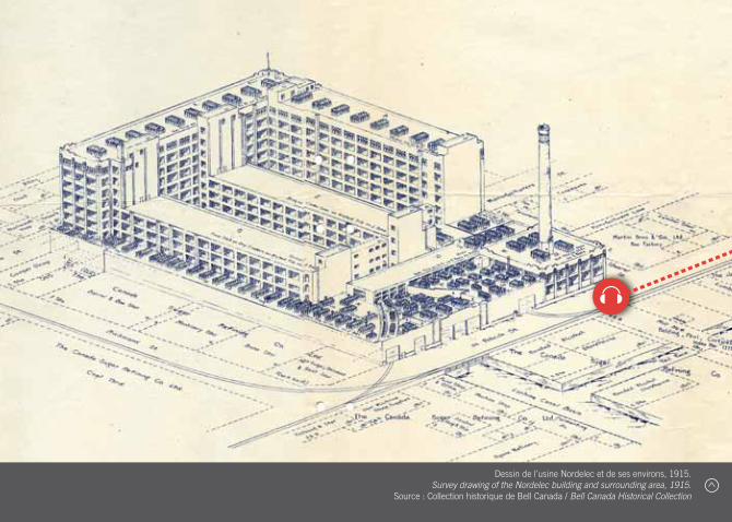
Dessin de l’usine Nordelec et de ses environs, 1915. Survey drawing of the Nordelec building and surrounding area, 1915.
Source : Collection historique de Bell Canada / Bell Canada Historical Collection
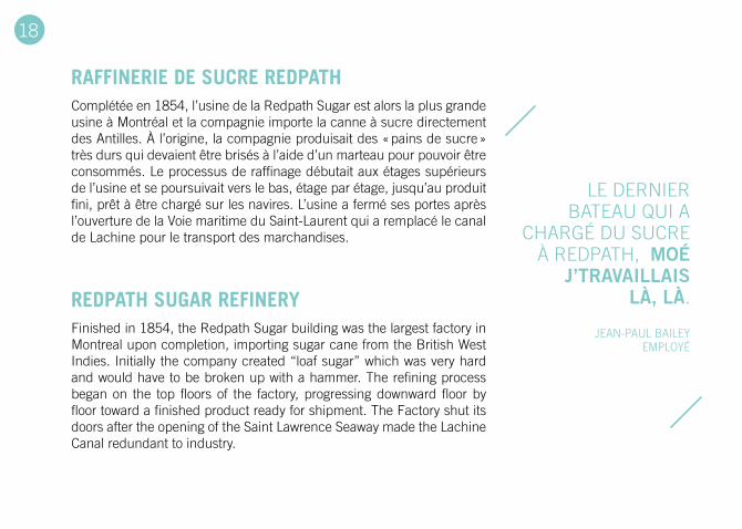
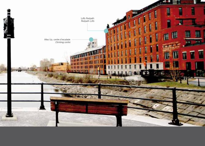
RAFFINERIE DE SUCRE REDPATH
REDPATH SUGAR REFINERY
Complétée en 1854, l’usine de la Redpath Sugar est alors la plus grande usine à Montréal et la compagnie importe la canne à sucre directement des Antilles. À l’origine, la compagnie produisait des « pains de sucre » très durs qui devaient être brisés à l’aide d’un marteau pour pouvoir être consommés. Le processus de raffinage débutait aux étages supérieurs de l’usine et se poursuivait vers le bas, étage par étage, jusqu’au produit fini, prêt à être chargé sur les navires. L’usine a fermé ses portes après l’ouverture de la Voie maritime du Saint-Laurent qui a remplacé le canal de Lachine pour le transport des marchandises.
Finished in 1854, the Redpath Sugar building was the largest factory in Montreal upon completion, importing sugar cane from the British West Indies. Initially the company created “loaf sugar” which was very hard and would have to be broken up with a hammer. The refining process began on the top floors of the factory, progressing downward floor by floor toward a finished product ready for shipment. The Factory shut its doors after the opening of the Saint Lawrence Seaway made the Lachine Canal redundant to industry.
LE DERNIER BATEAU qUI A
CHARGÉ DU SUCRE À REDPATH, moé
j’traVaIllaIs là, là.
JEAN-PAUL BAILEy EMPLOyÉ
18
Entrepôt de sucre non raffiné près de la rue De Condé, 1904.
Raw sugar shed near De Condé St, 1904.Photo : Redpath Sugar Museum
ÉCLUSES
LOCKS
La première des trois écluses de Saint-Gabriel, complétée en 1825, servait de déversoir. La seconde écluse, construite en 1848, servait en plus à générer de l’énergie hydraulique. Rapidement, des usines comme la Redpath et la Belding-Corticelli se sont installées dans le secteur Saint-Gabriel pour profiter de cette ressource. Aujourd’hui, ces écluses qui ont contribué à l’histoire industrielle de Montréal permettent aux plaisanciers de circuler sur toute l’étendue du canal.
The first of the three Saint Gabriel Locks was completed in 1825 as a spillway. In 1848, a second lock was completed which also served as a hydraulic power generator. Soon, factories such as Ogilvie Mills and Belding-Corticelli clustered around Saint Gabriel to take advantage of the available power. Today, the locks that were integral to the industrial history of Montreal and Canada open and close to allow pleasure craft to move up and down the canal.
là, ben des foIs le lockmaster
crIaIt : « where you go ? where you’re
from ? » ET PUIS « qU’EST C’EST qUE
T’AS DANS TON TON CHARGEMENT, DU MINERAI D’FER ?
DU BLÉ ? ETC. » « LÀ ON S’EN VA À
PITTSBURGH », « DÉTROIT ! »,
« CHICAGO ! » LÀ.
yVON LEMIEUX RÉSIDENT
19
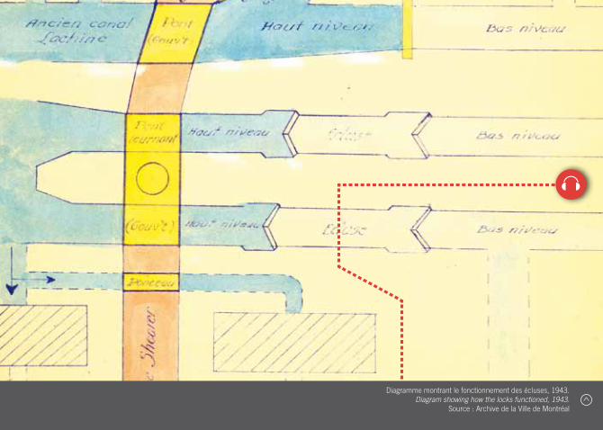
Diagramme montrant le fonctionnement des écluses, 1943. Diagram showing how the locks functioned, 1943.
Source : Archive de la Ville de Montréal
Au cours des années 1970 et 1980, il devenait impératif de se pencher sur l’avenir de toutes ces usines inactives le long du canal de Lachine. Est-ce que ces friches industrielles devaient être réindustrialisées, démolies, converties à d’autres usages ou simplement laissées à l’abandon ? Les coûts de décon-tamination environnementale sont souvent astronomiques. Pour la plupart des anciens sites industriels, l’abandon est une solution rapide qui dure de quelques années à quelques décennies.
La question de l’occupation de ces lieux a été et est toujours
l’objet de débats politiques intenses. Les planificateurs urbains, promoteurs immobiliers, environnementalistes, défenseurs du patrimoine et résidents des quartiers avoisinants ont exprimé des visions parfois contradictoires. Aujourd’hui, le canal postindustriel est une zone récréative accessible au public. Il est aussi devenu une zone d’affluence qui contraste avec les quartiers autour. Les publicités des agences immobilières font la promotion de « la vie sur le canal » plutôt que de risquer de s’associer aux anciens quartiers ouvriers. Les divisions de classe, comme
autrefois, existent toujours sur les rives du canal de Lachine.
Notre audioguide et notre livret visent à rendre visibles certaines de ces absences et de ces divisons et, ainsi, à contri-buer aux discussions entourant les enjeux des transformations urbaines.
LES ENJEUx DU CHANGEMENT URBAIN
/ V
THE POLITICS OF URBAN CHANGE What to do with the closed factories along the Lachine Canal became a pressing concern in the 1970s and 1980s. Should these brownfield sites be re-industrialized, demolished, converted to other uses, or simply left to ruin? The financial cost of the environmental cleanup is often massive. For most former industrial sites, abandonment is fleeting: lasting a few years, or perhaps a decade or two.
The question of who would occupy these redundant lands and buildings was and is a point of intense political debate.
Urban planners, developers, environmentalists, heritage advocates, and long-time neighbourhood residents have expressed competing visions. Today, the post-industrial canal has been transformed into an idyllic recreation zone that is accessible to the public. But it has also become a zone of affluence that stands apart from the adjacent neighbourhoods. Real estate ads speak in terms of “canal properties” rather than risk associating these properties with the historic working-class neighbourhoods.Social class thus continues to
define the Lachine Canal, as it always has.
Our audio walk and booklet aim to make visible some of these absences and divides, contributing to the wider ongoing discussion about the politics of urban change.

Canal : À la découverte du site postindustriel du canal de Lachine, audioguide ......................................montrealpostindustriel.ca/canal Canal: Walking the Post-Industrial Lachine Canal, Audio Walk................................................................postindustrialmontreal.ca/canal
Site web Montréal post / industriel ...................................................................................................................montrealpostindustriel.ca Post / Industrial Montreal website ....................................................................................................................postindustrialmontreal.ca
Centre d’histoire orale et de récits numérisés Centre for Oral History and Digital Storytelling ...................................................................................................storytelling.concordia.ca
Parcs Canada (canal de Lachine) Parks Canada (Lachine Canal) .....................................................................................pc.gc.ca/fra/lhn-nhs/qc/canallachine/index.aspx
Centre d’histoire de Montréal Centre d’histoire de Montréal (French only) ..................................................................................................... ville.montreal.qc.ca/chm
Action-Gardien Action-Gardien (French only) ..................................................................................................................................... actiongardien.org
Société d’histoire de Pointe-Saint-Charles ................................................................................................................shpsc.org/fr/accueil
Société historique de Saint-Henri Société historique de Saint-Henri (French only) .............................................................................................................saint-henri.com
Office de consultation publique de Montréal Office de consultation publique de Montréal (French only) .................................................................................................. ocpm.qc.ca
Association québécoise pour le patrimoine industriel Association québécoise pour le patrimoine industriel (French only) ....................................................................................... aqpi.qc.ca
The International Committee for the Conservation of Industrial Heritage [en anglais seulement The International Committee for the Conservation of Industrial Heritage .................................................................................. ticcih.org
qUELqUES LIENS / SOME LINKS
/ VI

LECTURES COMPLÉMENTAIRES / COMPLEMENTARY READINGSAmes, Herbert. The City Below the Hill, Toronto: University of Toronto Press (reprint), 1927 [1897].
Blick, Desmond & Pierre Gauthier, « Understanding the Built Form of Industrialization Along the Lachine Canal in Montreal, » Urban History Review 35, 1 (2006), 3-17.
Bradbury, Bettina. Working Families: Age, Gender, and Daily Survival in Industrializing Montreal, Toronto: McClelland and Stewart, 1993.
Desloges, yvon et Alain Gelly, Le canal de Lachine: Du tumultedes flots à l’essor industriel et urbain, 1850-1959. Montréal : Septentrion, 2002.
DeVerteuil, G. (2004), The changing landscapes of Southwest Montréal: a visual account. The Canadian Geographer / Le Géographe canadien, 48: 76–82.
Fennario, David. Balconville, Alexander Street Press, 2007.
High, Steven. Corporate Wasteland: The Landscape and Memory of Deindustrialization, Ithaca: Cornell University Press, 2007.
High, Steven. Industrial Sunset: The Making of North America’s Rust Belt, Toronto: University of Toronto Press, 2003.
Horner, Dan. « Solemn Processions and Terrifying Violence: Spectacle, Authority, and Citizenship during the Lachine Canal Strike of 1843, » Urban History Review, 38, 2 (2010), 36-47.
Collectif et Anna Kruzynski, Pointe Saint-Charles : un quartier, des femmes, une histoire communautaire. Montréal : Remue-ménage, 2006.
Linteau, Paul-André. Histoire de Montréal depuis la Confédération. Montréal : Éditions du Boréal, 2000.
Rose, Damaris. « Un aperçu féminin sur la restructuration de l’emploi et sur la gentrification: le cas de Montréal », Cahiers de géographie du Québec, vol. 31, no. 83 (1987), 205-224.
Rose, Damaris « Les atouts des quartiers en voie de gentrification : du discours municipal à celui des acheteurs. », Sociétés contemporaines, 3/2006 ( no 63 ), p. 39-61.
/ VII
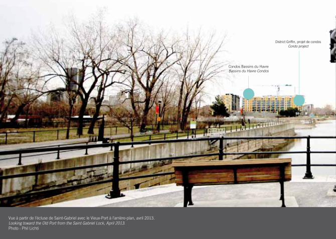
Vue à partir de l’écluse de Saint-Gabriel avec le Vieux-Port à l’arrière-plan, avril 2013.Looking toward the Old Port from the Saint Gabriel Lock, April 2013. Photo : Phil Lichti
Condos Bassins du Havre Bassins du Havre Condos
District Griffin, projet de condos Condo project
Vue à partir de l’écluse de Saint-Gabriel avec le Vieux-Port à l’arrière-plan, avril 2013.Looking toward the Old Port from the Saint Gabriel Lock, April 2013. Photo : Phil Lichti
Allez Up, centre d’escalade Climbing centre
Lofts Redpath Redpath Lofts


NOTRE-DAME
SAINTE-CUNÉGONDE
ATWATER
GEORGES-VANIER
CHATHAMCANAL
DES SEIGNEURS
SAINT-PATRICK
CHARLEVOIX3
2
4
5
6
7
8
9
10
16
15
17
18
1914
1213
11
Marché Atwater Atwater Market
1
STATION CHARLEVOIX
STATION LIONEL-GROULX
dépôt légal - Bibliothèque et archives nationales du Québec, 2013 dépôt légal - Bibliothèque et archives canada, 2013
isBn 978-2-9813949-0-3
l’audioguide Canal est téléchargeable au : montrealpostindustriel.ca
the audio walk Canal is available for download at: postindustrialmontreal.ca
À la
déc
ouve
rte
du s
ite p
ostin
dust
riel
du
cana
l de
lach
ine
/
Walk
ing
the
post
-indu
stri
al la
chin
e ca
nal